1960s Maps of El Paso County, Colorado
Explore 21 historic maps of El Paso County from the 1960s. These maps offer a rare glimpse into what life looked like during the 1960s — showing old roads, neighborhoods, homes, and landmarks that have changed or disappeared over time.
Whether you're researching your family's past, planning a metal detecting trip, or studying how El Paso County's landscape evolved across the 1960s, these high-resolution maps are a powerful tool for exploring the history of this region.
- Focus on a specific era: All maps on this page are from the 1960s, giving you a focused view of this time period.
- See what’s changed: Compare century-old streets, trails, and buildings to today's modern landscape using overlays and satellite layers.
- Research with precision: Use these maps for genealogy, historical research, land use analysis, or educational projects.
- View, download, or print: Maps are fully viewable online in high resolution, and can be downloaded or printed for your own records.
Start exploring El Paso County's history through authentic maps from the 1960s. This is your window into the past.
El Paso County, CO maps
(21)- 1960 Map of Denver
 1960 Denver1960 Print · USGSDenver and the Colorado Front Range are seen here at a pivotal moment of postwar expansion into the plains and foothills. Researchers can trace the mid-century rail network of the Denver & Rio Grande Western RR and locate historic institutional landmarks like Buckley Field and the Colorado School of Mines.
 - 1961 Map of Fountain NE, 1962 Print
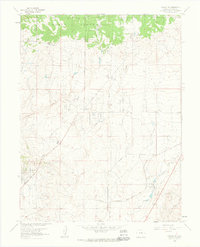
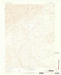
 1961 Fountain NE1962 Print · USGSEl Paso County ranch lands are captured here in the early sixties, showing the intersection of traditional cattle operations and modern utility corridors. Researchers can trace land use through Kane Ranch, the Bailey Windmill, and the prominent Pipeline.2 unique versions available
 - 1961 Map of Cheyenne Mountain, 1963 Print
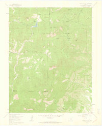
 1961 Cheyenne Mountain1963 Print · USGSEl Paso County in the early sixties showcases the intersection of military expansion and Front Range wilderness. Trace the boundaries of the Fort Carson Military Reservation alongside landmarks like Hitch Rack Ranch and the Louisiana State University Camp.9 unique versions available
 - 1961 Map of Buttes, 1963 Print
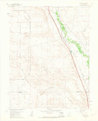 1961 Buttes1963 Print · USGSEl Paso County ranch land and military infrastructure meet along the Fountain Creek corridor in the early sixties. Genealogists and rail historians can trace the twin paths of the Atchison Topeka and Santa Fe Railway and the Denver and Rio Grande Western Railroad past the Wigwam Sch and Midway Ranch.8 unique versions available
 - 1961 Map of Manitou Springs, 1963 Print
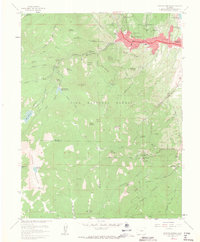 1961 Manitou Springs1963 Print · USGSManitou Springs and the surrounding peaks of the Pike National Forest are captured here in the early sixties. Researchers can trace the path of the Cog RR, locate landmarks like the Cave of the Winds, and find old mountain sites like Minnehaha.11 unique versions available
 - 1961 Map of Falcon NW, 1963 Print
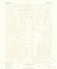
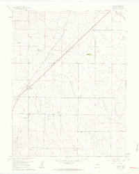
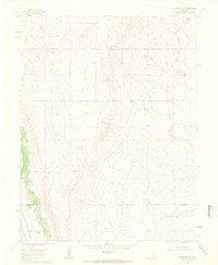
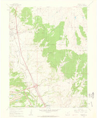
 1961 Falcon NW1963 Print · USGSEl Paso County ranching and early rail lines are shown in detail just as the 1960s began. Genealogists and local historians can trace large landholdings like Banning Lewis Ranch and the tracks of the Chicago Rock Island and Pacific Railroad.6 unique versions available
 - 1961 Map of Palmer Lake, 1963 Print
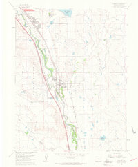
 1961 Palmer Lake1963 Print · USGSPalmer Lake and the northern El Paso County foothills are captured here in the early sixties as the modern military presence began to reshape the landscape. Genealogists and historians can trace family sites like McShane Home (Site) Old Stone Fort or the burgeoning Air Force Academy grounds.7 unique versions available
 - 1961 Map of Colorado Springs, 1963 Print
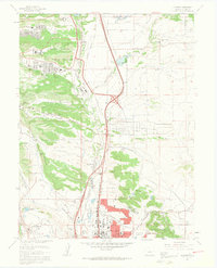
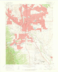 1961 Colorado Springs1963 Print · USGSColorado Springs was undergoing significant growth in the early sixties, as suburban developments expanded toward the surrounding military installations. Researchers can trace the layout of Ent Air Force Base, find family sites in Evergreen Cemetery, or locate vanished schoolhouses like Wasson High Sch.7 unique versions available
 - 1961 Map of Falcon, 1963 Print
 1961 Falcon1963 Print · USGSEl Paso County ranching and rail infrastructure are captured here in the early sixties. Genealogists and local historians can trace family properties like the Gieck Ranch and Solberg Ranch along the Chicago Rock Island and Pacific railroad.4 unique versions available
 - 1961 Map of Fountain, 1963 Print
 1961 Fountain1963 Print · USGSEl Paso County at the start of the sixties shows a landscape of rapid suburban growth and military presence. Genealogists and historians can trace the early developments of Security and Widefield or locate rail sites like Crews and Holmes.9 unique versions available
 - 1961 Map of Pikeview, 1963 Print
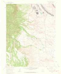
 1961 Pikeview1963 Print · USGSNorth of Colorado Springs in the early sixties, the landscape was being reshaped by the massive new United States Air Force Academy. Researchers can trace the transition from ranching at Wilsons Ranch to suburban growth near Pulpit Rock and the industrial hub of Pikeview.5 unique versions available
 - 1961 Map of Elsmere, 1963 Print
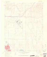 1961 Elsmere1963 Print · USGSThe high plains of El Paso County are captured here in the early sixties as military aviation and suburban growth begin to transform the landscape. Researchers can trace the development of Security, locate early schools like Sproul Sch, and explore features like Peterson Field and the Pikes Peak Speedway.9 unique versions available
 - 1961 Map of Fountain SE, 1963 Print
 1961 Fountain SE1963 Print · USGSThe ranching plains of El Paso and Pueblo counties are captured here in the early sixties, showing a landscape defined by water and rail. Genealogists can locate family holdings like Totten Ranch and Hammer Ranch along the path of the Denver and Rio Grande Western railroad.4 unique versions available
 - 1961 Map of Monument, 1963 Print
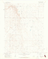
 1961 Monument1963 Print · USGSNorthern El Paso County was defined by its busy rail corridor and emerging military presence in the early sixties. Researchers can trace ranching heritage at Flying Horse Ranch and locate the historic Mt Herman Grange and the Cem near Palmer Lake.7 unique versions available
 - 1961 Map of Mount Big Chief, 1963 Print
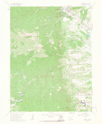
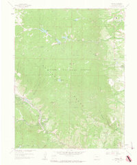
 1961 Mount Big Chief1963 Print · USGSEl Paso and Teller counties in the early 1960s reveal a landscape of high-altitude ranching and forest recreation. Trace the historic Gold Camp Road past Rosemont or locate the site of the Emerald Valley Boys Camp and Broadmoor Lodge.6 unique versions available
 - 1961 Map of Timber Mountain, 1963 Print
 1961 Timber Mountain1963 Print · USGSThe foothills south of Colorado Springs appear in the early sixties as a mix of military training grounds and isolated ranching outposts. Genealogists and historians can trace family locations like Earley Ranch, Avery Ranch, and the rural Lytle Sch.6 unique versions available
 - 1961 Map of Cascade, 1963 Print
 1961 Cascade1963 Print · USGSThe Rampart Range and the western edge of the Air Force Academy are shown in the early sixties as Colorado Springs expanded. Trace mountain landmarks like the Glen Eyrie estate, the Schubarth Trail, and the high waters of Manitou Reservoir.6 unique versions available
 - 1961 Map of Corral Bluffs, 1963 Print
 1961 Corral Bluffs1963 Print · USGSEl Paso County, Colorado, in the early sixties was a landscape of high-plains ranching and remnant mining activity. Genealogists and local historians can trace family properties like Dentan Ranch or Hammer Ranch and locate the historic Franceville Mine or the Old Railroad Grade.3 unique versions available
 - 1961 Map of Mount Pittsburg, 1963 Print
 1961 Mount Pittsburg1963 Print · USGSThe high ranch lands of Fremont and El Paso counties are captured here in the early sixties, showing a landscape of remote mountain holdings and steep canyons. Genealogists and local historians can trace legacy properties like Foote Mountaindale Ranch or locate the old Quarries and the Landing Strip near Turkey Creek.8 unique versions available
 - 1962 Map of Pueblo
 1962 Pueblo1962 Print · USGSThe Front Range and high plains meet in the early sixties as military installations and industrial mining shape the corridor from Colorado Springs to Pueblo. Genealogists can trace family names through rural landmarks like the Columbine School, Hanover Church, and Fairview Cem.
 - 1966 Map of Pueblo
 1966 Pueblo1966 Print · USGSThe Front Range and Arkansas River Valley are captured here in the mid-1960s, showing a landscape shaped by mining, military expansion, and rail. Researchers can locate numerous country schools and mines, such as the Lytle School, Pioneer Cem, and Empire Zinc Mine.
End of results
Showing maps 1-21 of 21
Top cities of El Paso County
- Colorado Springs historical maps
- Fountain historical maps
- Manitou Springs historical maps
- Monument historical maps
- Palmer Lake historical maps
- Calhan historical maps
See more
Frequently asked questions
- What are the different types of historical maps available for El Paso County?
- What is the oldest map of El Paso County?
- Where can I purchase historical maps of El Paso County for my home or office?
- Where can I download high-res historical maps of El Paso County?
- Are there historical topographic maps available for El Paso County?
- Is there historical aerial imagery available for El Paso County?
- Where are historical maps of El Paso County sourced from?