1990s Maps of El Paso County, Colorado
Explore 9 historic maps of El Paso County from the 1990s. These maps offer a rare glimpse into what life looked like during the 1990s — showing old roads, neighborhoods, homes, and landmarks that have changed or disappeared over time.
Whether you're researching your family's past, planning a metal detecting trip, or studying how El Paso County's landscape evolved across the 1990s, these high-resolution maps are a powerful tool for exploring the history of this region.
- Focus on a specific era: All maps on this page are from the 1990s, giving you a focused view of this time period.
- See what’s changed: Compare century-old streets, trails, and buildings to today's modern landscape using overlays and satellite layers.
- Research with precision: Use these maps for genealogy, historical research, land use analysis, or educational projects.
- View, download, or print: Maps are fully viewable online in high resolution, and can be downloaded or printed for your own records.
Start exploring El Paso County's history through authentic maps from the 1990s. This is your window into the past.
El Paso County, CO maps
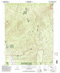
(9)- 1994 Map of Mount Big Chief, 1998 Print
 1994 Mount Big Chief1998 Print · USGSThe high ridges of the Colorado Front Range are captured here during the 1990s, where El Paso, Teller, and Fremont counties meet. Researchers can trace old transportation routes like Gold Camp Road and locate remote outposts such as Broadmoor Lodge and Emerald Valley Ranch.
 - 1994 Map of Palmer Lake, 1998 Print
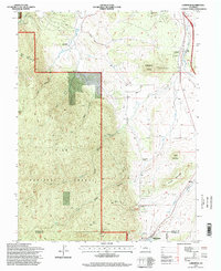
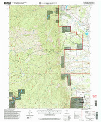 1994 Palmer Lake1998 Print · USGSThe Front Range foothills in the mid-1990s showcase the developed grounds of the U. S. Air Force Academy alongside the Pike National Forest. Researchers can trace local landmarks like Elephant Rock, find the alpine waters of Sapphire Lake, and explore the early layouts of Palmer Lake and Monument.2 unique versions available
 - 1994 Map of Cascade, 1998 Print
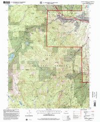
 1994 Cascade1998 Print · USGSThe Rampart Range rises above the Colorado Springs fringe in the 1990s, where high-altitude reservoirs meet military and recreational land. Genealogists and hikers can trace the mountain communities of Cascade and Chipita Park or the iconic terrain of the Garden of the Gods.
 - 1994 Map of Woodland Park, 1998 Print
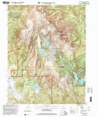
 1994 Woodland Park1998 Print · USGSThe northern slopes of Pikes Peak and the Rampart Range come into focus in the 1990s as this region balanced forest preservation with water engineering. Genealogists and hikers can trace old mountain roads and landmarks like Woodland Park, the Pikes Peak Toll Road, and the air force recreation area at Farish Memorial.
 - 1994 Map of Dakan Mountain, 1998 Print
 1994 Dakan Mountain1998 Print · USGSThe Colorado Front Range comes into focus during the mid-nineties, showing the intersection of federal forestry research and public land management. You can trace the rugged topography around Dakan Mountain and identify industrial sites like the Quarry near Saylor Park.
 - 1994 Map of Mount Deception, 1998 Print
 1994 Mount Deception1998 Print · USGSIn the mid-1990s, the high forests north of Woodland Park were a mix of scientific research sites and rugged mountain terrain. Researchers can locate landmarks like Manitou Park Grange, the Sky High Girl Scout Camp, and the heights of the Rampart Range.
 - 1994 Map of Larkspur, 1998 Print
 1994 Larkspur1998 Print · USGSDouglas County ranching and rail history are preserved here in the mid-nineties, showing the landscape before significant suburban expansion. Genealogists and local historians can trace family-named sites like Crystal Springs Ranch or follow the paths of the AT&SF RR and D&RGW RR.
 - 1994 Map of Manitou Springs, 2001 Print
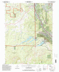
 1994 Manitou Springs2001 Print · USGSManitou Springs sat at a junction of rail and trail in the mid-1990s, serving as a hub for mountain travel and water engineering. Trace the path of the Manitou and Pikes Peak Railway or locate the site of Nelson Camp near Mount Rosa.
 - 1994 Map of Pikes Peak, 2001 Print
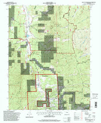
 1994 Pikes Peak2001 Print · USGSThe high country of Teller County is captured here in the mid-1990s, centered on the infrastructure and alpine terrain surrounding the famous summit. Researchers can trace historic mining activity near Gillett or locate landmarks like Barr Camp and the Summit House.
End of results
Showing maps 1-9 of 9
Top cities of El Paso County
- Colorado Springs historical maps
- Fountain historical maps
- Manitou Springs historical maps
- Monument historical maps
- Palmer Lake historical maps
- Calhan historical maps
See more
Frequently asked questions
- What are the different types of historical maps available for El Paso County?
- What is the oldest map of El Paso County?
- Where can I purchase historical maps of El Paso County for my home or office?
- Where can I download high-res historical maps of El Paso County?
- Are there historical topographic maps available for El Paso County?
- Is there historical aerial imagery available for El Paso County?
- Where are historical maps of El Paso County sourced from?