Old Maps of El Paso County, Colorado
Explore 128 old maps of El Paso County, spanning from 1893 to today. These high-resolution historic maps reveal how streets, neighborhoods, landmarks, and natural features evolved over time — perfect for genealogy, metal detecting, research, and local history exploration.
What you can do with these maps:
- See how El Paso County changed over time: Compare historical maps to modern-day views to trace roads, homesites, rail lines & more.
- View detailed metadata: Each map includes creators, publishers, year, scale, and archive source.
- Overlay maps with satellite & LiDAR: Visualize the past alongside modern tools to explore terrain & human change.
- Trusted historical sources: Maps sourced from the USGS, Library of Congress, and other archives.
- Access maps your way: View online, download high-res files, or order prints for personal or research use.
Start exploring old maps of El Paso County to uncover forgotten places, hidden landmarks, and the deep history beneath your feet.
El Paso County, CO maps
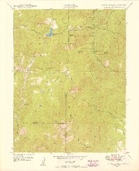
(128)- 1893 Map of Big Springs
 1893 Big Springs1893 Print · USGSCovers El Paso County, including Rush, Truckton, and other nearby areas5 unique versions available
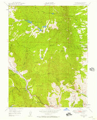
 - 1893 Map of Platte Canyon
 1893 Platte Canyon1893 Print · USGSCovers El Paso County, including Woodland Park, Buffalo Creek, and other nearby areas8 unique versions available
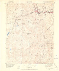
 - 1893 Map of Colorado Springs, 1896 Print
 1893 Colorado Springs1896 Print · USGSCovers El Paso County, including Colorado Springs, Fountain, and other nearby areas2 unique versions available
 - 1894 Map of Pikes Peak
 1894 Pikes Peak1894 Print · USGSCovers El Paso County, including Woodland Park, Cripple Creek, and other nearby areas2 unique versions available
 - 1894 Map of Castle Rock
 1894 Castle Rock1894 Print · USGSCovers El Paso County, including Colorado Springs, Castle Rock, and other nearby areas2 unique versions available
 - 1901 Map of Pikes Peak
 1901 Pikes Peak1901 Print · USGSCovers El Paso County, including Woodland Park, Cripple Creek, and other nearby areas6 unique versions available
 - 1901 Map of Pikes Peak, 1909 Print
 1901 Pikes Peak1909 Print · USGSCovers El Paso County, including Woodland Park, Cripple Creek, and other nearby areas
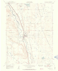
 - 1909 Map of Colorado Springs
 1909 Colorado Springs1909 Print · USGSCovers El Paso County, including Colorado Springs, Fountain, and other nearby areas5 unique versions available
 - 1913 Map of Castle Rock
 1913 Castle Rock1913 Print · USGSCovers El Paso County, including Colorado Springs, Castle Rock, and other nearby areas5 unique versions available
 - 1940 Map of Elbert, 1956 Print
 1940 Elbert1956 Print · USGSCovers El Paso County, including Elbert, Eastonville, and other nearby areas2 unique versions available
 - 1942 Map of Colorado Springs
 1942 Colorado Springs1942 Print · USGSCovers El Paso County, including Colorado Springs, Fountain, and other nearby areas
 - 1944 Map of Elbert
 1944 Elbert1944 Print · USGSCovers El Paso County, including Elbert, Eastonville, and other nearby areas2 unique versions available
 - 1948 Map of Falcon, 1952 Print
 1948 Falcon1952 Print · USGSCovers El Paso County, including Colorado Springs, Falcon, and other nearby areas2 unique versions available
 - 1948 Map of Mount Big Chief, 1953 Print
 1948 Mount Big Chief1953 Print · USGSCovers El Paso County, including Duffield, Rosemont, and other nearby areas2 unique versions available
 - 1948 Map of Mount Pittsburg, 1956 Print
 1948 Mount Pittsburg1956 Print · USGSCovers El Paso County, including Pueblo County, Fremont County, and other nearby areas
 - 1948 Map of Timber Mountain, 1956 Print
 1948 Timber Mountain1956 Print · USGSCovers El Paso County, including Pueblo County, United States, and other nearby areas
 - 1948 Map of Manitou Springs, 1956 Print
 1948 Manitou Springs1956 Print · USGSCovers El Paso County, including Colorado Springs, Manitou Springs, and other nearby areas2 unique versions available
 - 1948 Map of Fountain SE, 1957 Print
 1948 Fountain SE1957 Print · USGSCovers El Paso County, including Pueblo County, United States, and other nearby areas
 - 1948 Map of Colorado Springs, 1957 Print
 1948 Colorado Springs1957 Print · USGSCovers El Paso County, including Colorado Springs, Manitou Springs, and other nearby areas
 - 1948 Map of Pikeview, 1957 Print
 1948 Pikeview1957 Print · USGSCovers El Paso County, including Colorado Springs, Pikeview, and other nearby areas
 - 1948 Map of Cascade, 1958 Print
 1948 Cascade1958 Print · USGSCovers El Paso County, including Colorado Springs, Cascade, and other nearby areas2 unique versions available
 - 1948 Map of Fountain, 1958 Print
 1948 Fountain1958 Print · USGSCovers El Paso County, including Colorado Springs, Fountain, and other nearby areas
 - 1948 Map of Colorado Springs, 1958 Print
 1948 Colorado Springs1958 Print · USGSCovers El Paso County, including Colorado Springs, Security-Widefield, and other nearby areas2 unique versions available
 - 1948 Map of Cheyenne Mountain, 1959 Print
 1948 Cheyenne Mountain1959 Print · USGSCovers El Paso County, including Colorado Springs, Security-Widefield, and other nearby areas
 - 1948 Map of Falcon, 1960 Print
 1948 Falcon1960 Print · USGSCovers El Paso County, including Colorado Springs, Fountain, and other nearby areas
Showing maps 1-25 of 128
Top cities of El Paso County
- Colorado Springs historical maps
- Fountain historical maps
- Manitou Springs historical maps
- Monument historical maps
- Palmer Lake historical maps
- Calhan historical maps
See more
Frequently asked questions
- What are the different types of historical maps available for El Paso County?
- What is the oldest map of El Paso County?
- Where can I purchase historical maps of El Paso County for my home or office?
- Where can I download high-res historical maps of El Paso County?
- Are there historical topographic maps available for El Paso County?
- Is there historical aerial imagery available for El Paso County?
- Where are historical maps of El Paso County sourced from?