1990s Maps of Fremont County, Colorado
Explore 15 historic maps of Fremont County from the 1990s. These maps offer a rare glimpse into what life looked like during the 1990s — showing old roads, neighborhoods, homes, and landmarks that have changed or disappeared over time.
Whether you're researching your family's past, planning a metal detecting trip, or studying how Fremont County's landscape evolved across the 1990s, these high-resolution maps are a powerful tool for exploring the history of this region.
- Focus on a specific era: All maps on this page are from the 1990s, giving you a focused view of this time period.
- See what’s changed: Compare century-old streets, trails, and buildings to today's modern landscape using overlays and satellite layers.
- Research with precision: Use these maps for genealogy, historical research, land use analysis, or educational projects.
- View, download, or print: Maps are fully viewable online in high resolution, and can be downloaded or printed for your own records.
Start exploring Fremont County's history through authentic maps from the 1990s. This is your window into the past.
Fremont County, CO maps
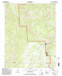
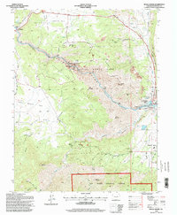
(15)- 1994 Map of Black Mountain, 1997 Print
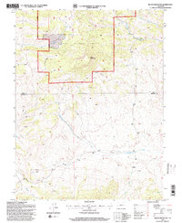 1994 Black Mountain1997 Print · USGSThe high ranchlands and forest boundaries of Fremont and Park counties are detailed here during the mid-nineties. Researchers can locate remote sites like Stirrup Ranch, various mountain prospects, and the drainage of Cottonwood Creek.2 unique versions available
 - 1994 Map of Mount Big Chief, 1998 Print
 1994 Mount Big Chief1998 Print · USGSThe high ridges of the Colorado Front Range are captured here during the 1990s, where El Paso, Teller, and Fremont counties meet. Researchers can trace old transportation routes like Gold Camp Road and locate remote outposts such as Broadmoor Lodge and Emerald Valley Ranch.
 - 1994 Map of Poncha Pass, 1998 Print
 1994 Poncha Pass1998 Print · USGSSaguache County and the high country of the Sangre De Cristo range are captured here in the mid-1990s. Researchers can trace the junction of three counties and locate old resource sites like Mears Junction, Poncha Hot Springs, and the Rainbow Trail.
 - 1994 Map of Jack Hall Mountain, 1998 Print
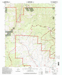
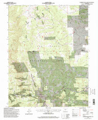
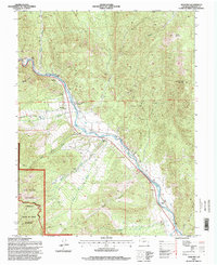
 1994 Jack Hall Mountain1998 Print · USGSFremont County, Colorado, is shown in the mid-1990s as a landscape of high-country mining and forest management. Researchers can trace the drainages of Badger Creek and explore historical extraction sites like the Cooper Mine and Banning Cabin.
 - 1994 Map of Cotopaxi, 1998 Print
 1994 Cotopaxi1998 Print · USGSThe upper Arkansas River valley comes alive in the mid-1990s as it transitions from riverfront settlements to high mountain wilderness. Genealogists and researchers can trace the roads through Cotopaxi and Coaldale, or locate remote camps and trails like the Rainbow Trail and Rainbow Trail Camp.
 - 1994 Map of Curley Peak, 1998 Print
 1994 Curley Peak1998 Print · USGSThe Fremont and Custer County line in the mid-1990s is dominated by the high summits and gulches of the Isabel National Forest. Researchers can trace old mountain routes like the Oak Creek Grade and Tanner Trail as they pass by Yorkville and local prospects.
 - 1994 Map of Cameron Mountain, 1998 Print
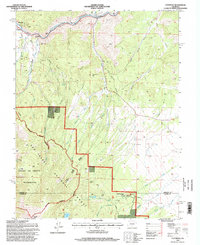
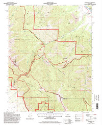
 1994 Cameron Mountain1998 Print · USGSThe high country of Chaffee and Park counties is mapped here during the mid-nineties, showing a landscape shaped by mining and forest management. Researchers can locate the Gold Bug Mine, the settlement of Whitehorn, and the remote Bassam Guard Station.
 - 1994 Map of Salida East, 1998 Print
 1994 Salida East1998 Print · USGSThe Arkansas River valley in the mid-1990s showcases the expansion of Salida and its mountain surroundings. Local historians can trace the streets around Woodlawn Cemetery, the site of Cleora, and the network of gulches like Cottonwood Gulch and Longs Gulch.
 - 1994 Map of Wellsville, 1998 Print
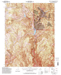
 1994 Wellsville1998 Print · USGSThe Arkansas River valley in the 1990s was a hub of high-altitude mining activity centered on the settlement of Wellsville. Modern researchers can trace dozens of mountain Quarries, remote sites like Salamander Lake, and the path of the Rainbow Trail.
 - 1994 Map of Howard, 1998 Print
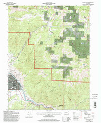
 1994 Howard1998 Print · USGSSettlement along the upper Arkansas River comes into focus during the late twentieth century, showing a landscape defined by ranching and mountain access. Genealogists and hikers can locate the Howard Cem, Stout Cr Sch, and the high-elevation Rainbow Trail.
 - 1994 Map of Coaldale, 1998 Print
 1994 Coaldale1998 Print · USGSThe high country of the Sangre de Cristo Range comes to life in the 1990s as it transitions from the Arkansas River valley into protected wilderness. Researchers can trace historic mining activity at the Strip Mine and Prospects or locate the Cem near Coaldale.
 - 1994 Map of Rockvale, 1998 Print
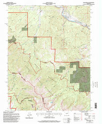
 1994 Rockvale1998 Print · USGSFremont County's mining heart is on full display in the 1990s, where the rugged terrain meets the established communities of Rockvale and Coalcreek. Researchers can trace old operations like the Cedar Canon Mine, Caldrola No 1 Mine, and the historic Radiant Camp site.
 - 1994 Map of Big Bull Mountain, 1998 Print
 1994 Big Bull Mountain1998 Print · USGSThe high peaks and mining districts of southern Teller County are shown here in the mid-nineties, just as modern conservation efforts expanded. Researchers can locate numerous Prospects and trace the waters of Skaguay Reservoir near Goldfield and Clyde.
 - 1994 Map of Royal Gorge, 1998 Print
 1994 Royal Gorge1998 Print · USGSThe Arkansas River cuts a dramatic path through Fremont County in the mid-1990s, revealing a landscape defined by deep canyons and high peaks. Genealogists and historians can trace the sites of Parkdale and Buckskin Joe alongside the Railroad and Eightmile Park.
 - 1994 Map of Gribbles Park, 1998 Print
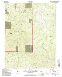
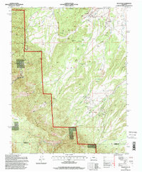
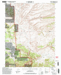 1994 Gribbles Park1998 Print · USGSThe high country of Fremont and Park counties in the 1990s reveals a landscape of ranching and resource extraction. Genealogists and researchers can trace the locations of the Everett Cow Camp, remote mines, and family-named water sources like Suckerville Spring.
End of results
Showing maps 1-15 of 15
Top cities of Fremont County
- Cañon City historical maps
- Lincoln Park historical maps
- Florence historical maps
- Penrose historical maps
- Howard historical maps
- Williamsburg historical maps
See more
Frequently asked questions
- What are the different types of historical maps available for Fremont County?
- What is the oldest map of Fremont County?
- Where can I purchase historical maps of Fremont County for my home or office?
- Where can I download high-res historical maps of Fremont County?
- Are there historical topographic maps available for Fremont County?
- Is there historical aerial imagery available for Fremont County?
- Where are historical maps of Fremont County sourced from?