1970s Maps of Grand County, Colorado
Explore 7 historic maps of Grand County from the 1970s. These maps offer a rare glimpse into what life looked like during the 1970s — showing old roads, neighborhoods, homes, and landmarks that have changed or disappeared over time.
Whether you're researching your family's past, planning a metal detecting trip, or studying how Grand County's landscape evolved across the 1970s, these high-resolution maps are a powerful tool for exploring the history of this region.
- Focus on a specific era: All maps on this page are from the 1970s, giving you a focused view of this time period.
- See what’s changed: Compare century-old streets, trails, and buildings to today's modern landscape using overlays and satellite layers.
- Research with precision: Use these maps for genealogy, historical research, land use analysis, or educational projects.
- View, download, or print: Maps are fully viewable online in high resolution, and can be downloaded or printed for your own records.
Start exploring Grand County's history through authentic maps from the 1970s. This is your window into the past.
Grand County, CO maps
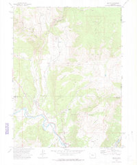
(7)- 1970 Map of Dillon, 1973 Print
 1970 Dillon1973 Print · USGSThe Blue River valley and Williams Fork Mountains are captured here in the early 1970s. Trace the growth of Silverthorne and Dillon near the Dillon Reservoir or follow high-country routes like the Dillon Jeep Trail and Ptarmigan Pass.3 unique versions available
 - 1971 Map of Parshall, 1974 Print
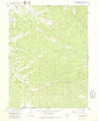
 1971 Parshall1974 Print · USGSSoutheast Colorado in the early seventies is defined here by the winding Purgatoire River and its dramatic canyon walls. Researchers can trace land use through features like the Lewelling Mc Cormick Ditch and the isolated Patterson Crossing.
 - 1972 Map of Mc Coy, 1975 Print
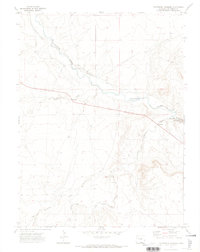
 1972 Mc Coy1975 Print · USGSThe Colorado high country in the early seventies centers on the rail-and-river corridor connecting the small settlements of McCoy and Bond. Genealogists and historians can trace the McCoy Cem, mining Prospects on Yarmony Mountain, and the Denver and Rio Grande Western rail line.3 unique versions available
 - 1972 Map of Radium, 1976 Print
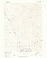
 1972 Radium1976 Print · USGSThe Colorado River corridor near the Grand and Eagle County line comes into focus in the early 1970s. Researchers can trace the path of the Denver and Rio Grande Western Railroad through Azure and Radium, or locate landmarks like Rancho del Rio and Red Gorge.
 - 1974 Map of Montezuma, 1985 Print
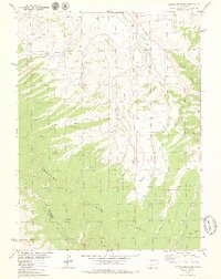
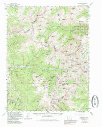 1974 Montezuma1985 Print · USGSThe high peaks of the Continental Divide in the mid-1970s reveal a landscape shaped by a century of silver mining and early ski development. Researchers can trace historic mining claims like Saints John, find remote camps at Swandyke, and locate the Loveland Pass Tunnel.
 - 1979 Map of Sylvan Reservoir
 1979 Sylvan Reservoir1979 Print · USGSGrand County's high forest terrain is captured here in the late seventies, showing a landscape of resource management and wilderness transit. Trace the routes of the Ranger Trail and explore sites like Sylvan Reservoir, the Horseshoe Guard Station, and Ute Park.3 unique versions available
 - 1979 Map of Battle Mountain
 1979 Battle Mountain1979 Print · USGSHigh-altitude wilderness in the late seventies is captured here as the Arapaho National Forest meets the Williams Fork Mountains. Researchers can trace the rugged drainage of Battle Creek, locate a remote Landing Strip, and explore old jeep trails near Jessmer.4 unique versions available
End of results
Showing maps 1-7 of 7
Top cities of Grand County
- Granby historical maps
- Kremmling historical maps
- Fraser historical maps
- Hot Sulphur Springs historical maps
- Grand Lake historical maps
- Tabernash historical maps
Frequently asked questions
- What are the different types of historical maps available for Grand County?
- What is the oldest map of Grand County?
- Where can I purchase historical maps of Grand County for my home or office?
- Where can I download high-res historical maps of Grand County?
- Are there historical topographic maps available for Grand County?
- Is there historical aerial imagery available for Grand County?
- Where are historical maps of Grand County sourced from?