1900s (20th Century) Maps of Grand County, Colorado
Explore 100 historic maps of Grand County from the 1900s (20th Century). These maps offer a rare glimpse into what life looked like during the 1900s — showing old roads, neighborhoods, homes, and landmarks that have changed or disappeared over time.
Whether you're researching your family's past, planning a metal detecting trip, or studying how Grand County's landscape evolved across the 1900s, these high-resolution maps are a powerful tool for exploring the history of this region.
- Focus on a specific era: All maps on this page are from the 1900s, giving you a focused view of this time period.
- See what’s changed: Compare century-old streets, trails, and buildings to today's modern landscape using overlays and satellite layers.
- Research with precision: Use these maps for genealogy, historical research, land use analysis, or educational projects.
- View, download, or print: Maps are fully viewable online in high resolution, and can be downloaded or printed for your own records.
Start exploring Grand County's history through authentic maps from the 1900s. This is your window into the past.
Grand County, CO maps
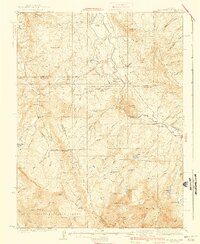
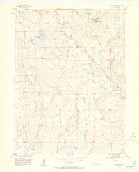
(100)- 1905 Map of Central City
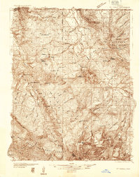
 1905 Central City1905 Print · USGSThe Colorado Front Range is captured here at the peak of its early mining era, showing the dense network of gulches and camps. Trace historic mining operations at Central City, follow the high-mountain route of the Denver Northwestern and Pacific RR, or locate vanished settlements like Baltimore and Perigo.
 - 1910 Map of Central City, 1957 Print
 1910 Central City1957 Print · USGSThe Colorado high country at the start of the century reveals a landscape defined by mining booms and engineering marvels. Trace the intricate rail networks of the Colorado Southern RR or locate family roots in the historic camps of Nevadaville and Central City.2 unique versions available
 - 1912 Map of Central City
 1912 Central City1912 Print · USGSThe Colorado Front Range mining districts were in full operation during this era of deep-shaft extraction and mountain railroading. Researchers can trace the industrial footprint of Central City, locate the Boulder County Mine, and follow the path of the Colorado and Southern RR through the gulches.4 unique versions available
 - 1915 Map of Longs Peak
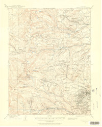
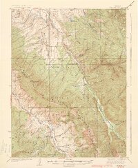
 1915 Longs Peak1915 Print · USGSHigh mountain passes and early alpine settlements define this region just as the National Park system was taking root. Genealogists and hikers can trace the Ute Trail, locate the Sleepy Hollow School, or find the old Monarch PO near Grand Lake.3 unique versions available
 - 1919 Map of Rocky Mountain National Park
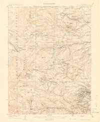
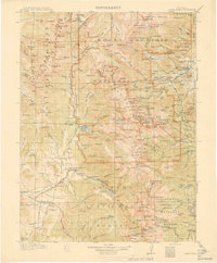
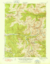
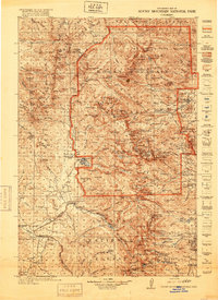 1919 Rocky Mountain National Park1919 Print · USGSThe high alpine basins of Northern Colorado are captured here in the years following the park's creation. Researchers can locate early schools and post offices like Sleepy Hollow School and Monarch PO, or trace the rail lines of the Denver and Salt Lake RR.7 unique versions available
 - 1924 Map of Montezuma
 1924 Montezuma1924 Print · USGSHigh Colorado peaks and mining camps define the landscape during the 1920s and 1930s. Genealogists and historians can trace the foundations of Montezuma and Keystone, and locate historic operations like the Hamill Mine and Waldorf Mine.2 unique versions available
 - 1924 Map of Fraser, 1957 Print
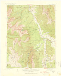
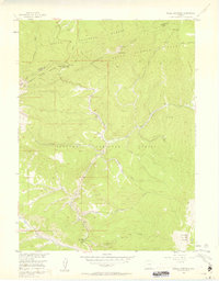
 1924 Fraser1957 Print · USGSGrand County's high-country rail and ranching corridors come alive in this mid-twenties survey of the Fraser Valley. Researchers can trace the original Denver and Salt Lake RR route, locate the Pole Creek School, and study the early layout of West Portal near the Moffat Tunnel.2 unique versions available
 - 1926 Map of Fraser
 1926 Fraser1926 Print · USGSThe high Rockies come alive in the mid-twenties as the Moffat Tunnel and Denver and Salt Lake Railroad reshape the landscape. Researchers can trace early infrastructure like the Lumber Flume and the isolated Pole Creek School.4 unique versions available
 - 1926 Map of Montezuma
 1926 Montezuma1926 Print · USGSThe Continental Divide during the 1920s reveals a high-country landscape defined by its mining heritage and high mountain passes. Researchers can trace the rugged operations at the Waldorf Mine and Stevens Mine or locate the early mountain settlements of Montezuma and Swandyke.3 unique versions available
 - 1929 Map of Dillon, 1955 Print
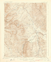
 1929 Dillon1955 Print · USGSIn the late 1920s, the Blue River valley was a high-country network of rail stops and mining camps before the landscape was changed by major dam projects. Genealogists and historians can trace the early footprints of Dillon, Frisco, and the Colorado and Southern railroad line.2 unique versions available
 - 1933 Map of Mt. Powell
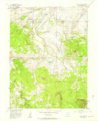
 1933 Mt. Powell1933 Print · USGSThe Colorado high country in the early thirties reveals a landscape of isolated mountain homesteads and remote federal forest lands. Genealogists and local historians can trace family locations like the Noonen Ranch or locate early rural schools including Upper Sheephorn Sch and Lakeside Sch.5 unique versions available
 - 1933 Map of Montezuma, 1956 Print
 1933 Montezuma1956 Print · USGSThe mining districts of the high Rockies are caught in a period of transition in the 1930s. Researchers can locate remote industrial sites like the Waldorf Mine and follow early mountain routes over Loveland Pass and Argentine Pass.3 unique versions available
 - 1933 Map of Ute Peak, 1959 Print
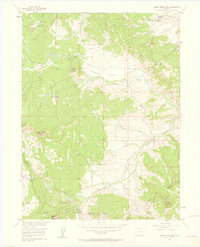
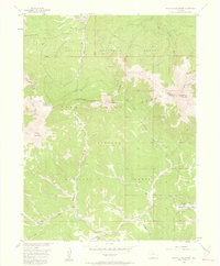
 1933 Ute Peak1959 Print · USGSThe high mountain country of Grand and Summit Counties is captured here in the early 1930s before modern development altered these drainages. Genealogists and historians can trace the locations of the Ute Park School and Hermosa School or find the remote Leal post office and Horseshoe Ranger Station.3 unique versions available
 - 1934 Map of Dillon
 1934 Dillon1934 Print · USGSDillon and the surrounding Blue River Valley are shown here in the mid-1930s before the valley was flooded for reservoir construction. Genealogists and historians can trace the original locations of Dillon, the Dickey Ranger Sta, and mining sites like the Boss Mine.3 unique versions available
 - 1937 Map of Ute Peak
 1937 Ute Peak1937 Print · USGSGrand and Summit counties are captured here in the 1930s, when remote ranger stations and schoolhouses anchored the high timber. Trace the early road and trail networks connecting Ute Park, Leal, and the Slate Creek Ranger Sta.3 unique versions available
 - 1940 Map of Mount Powell
 1940 Mount Powell1940 Print · USGSThe high peaks of the Gore Range and the Blue River valley are shown here during the late 1930s. Researchers can locate remote homesteads and schools such as Abbet Place, Smith Ranch, and the Hillcrest Sch among the alpine lakes.3 unique versions available
 - 1953 Map of Denver, 1964 Print
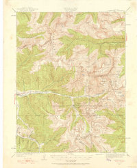
 1953 Denver1964 Print · USGSDenver and the Colorado Front Range are captured here during a decade of post-war growth and military expansion. Researchers can trace the sprawling rail lines of the Union Pacific, locate the State Capitol, and explore historic mountain mining hubs like Central City.6 unique versions available
 - 1954 Map of Greeley, 1966 Print
 1954 Greeley1966 Print · USGSNorthern Colorado transitions from high-alpine peaks to the irrigated South Platte valley during this mid-century period of growth. Genealogists and historians can trace rail-connected hubs like Greeley and Longmont alongside landmarks like Horsetooth Reservoir and Estes Park.3 unique versions available
 - 1954 Map of Craig, 1973 Print
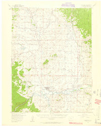
 1954 Craig1973 Print · USGSNorthwest Colorado and the high mountain parks are captured in the mid-fifties, showing the region's ranching, mining, and timber centers. Genealogists and historians can trace rail corridors like the Denver and Rio Grande Western and old towns such as Axial, Milner, and Coalmont.3 unique versions available
 - 1956 Map of Radial Mountain, 1957 Print
 1956 Radial Mountain1957 Print · USGSThe high Colorado Rockies meet at the Continental Divide in the mid-1950s, where national forest boundaries intersect at the Jackson and Grand county lines. Researchers can trace historic alpine infrastructure like the Gilsonite Guard Station, Willow Creek Pass, and a Road Camp.4 unique versions available
 - 1956 Map of Rabbit Ears Peak, 1958 Print
 1956 Rabbit Ears Peak1958 Print · USGSThe Continental Divide serves as the backbone for this mid-century survey of the high country along the Jackson and Grand county line. Researchers can trace early ranching and industry through the McGowan Homestead, a Lumber Camp, and the strategic crossing at Rabbit Ears Pass.4 unique versions available
 - 1956 Map of Lake Agnes, 1958 Print
 1956 Lake Agnes1958 Print · USGSThe high country of the Rabbit Ears Range comes into focus during the mid-fifties, capturing a landscape of alpine ranching and timber work. You can locate family-named sites like Andersons Ranch, the Strole Sawmill, and the remote Rabbit Ears Lodge.6 unique versions available
 - 1956 Map of Kremmling, 1958 Print
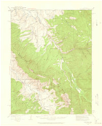
 1956 Kremmling1958 Print · USGSMid-century Colorado ranching and river geography converge at the confluence of the Colorado River and Blue River. Genealogists and local historians can trace family-named sites like Taussig Ranch and Ingram Ranch or locate the old Colorow Sch.3 unique versions available
 - 1956 Map of Spicer Peak, 1958 Print
 1956 Spicer Peak1958 Print · USGSJackson County ranching and water management are captured here in the mid-fifties, showing the high-country network of the Continental Divide. Genealogists and historians can trace family properties like Van Valkenburg Ranch and Chas Murphy Ranch alongside the extensive Arapaho Ditch system.5 unique versions available
 - 1956 Map of Parkview Mountain, 1958 Print
 1956 Parkview Mountain1958 Print · USGSThe Continental Divide winds through the Rabbit Ears Range in the mid-1950s, where high-altitude ranching meets National Forest wilderness. Trace early backcountry routes like the Arapaho Creek Trail or locate the Trails End Ranch and its nearby Beaver Ponds.5 unique versions available
Showing maps 1-25 of 100
Top cities of Grand County
- Granby historical maps
- Kremmling historical maps
- Fraser historical maps
- Hot Sulphur Springs historical maps
- Grand Lake historical maps
- Tabernash historical maps
Frequently asked questions
- What are the different types of historical maps available for Grand County?
- What is the oldest map of Grand County?
- Where can I purchase historical maps of Grand County for my home or office?
- Where can I download high-res historical maps of Grand County?
- Are there historical topographic maps available for Grand County?
- Is there historical aerial imagery available for Grand County?
- Where are historical maps of Grand County sourced from?