1950s Maps of Grand County, Colorado
Explore 46 historic maps of Grand County from the 1950s. These maps offer a rare glimpse into what life looked like during the 1950s — showing old roads, neighborhoods, homes, and landmarks that have changed or disappeared over time.
Whether you're researching your family's past, planning a metal detecting trip, or studying how Grand County's landscape evolved across the 1950s, these high-resolution maps are a powerful tool for exploring the history of this region.
- Focus on a specific era: All maps on this page are from the 1950s, giving you a focused view of this time period.
- See what’s changed: Compare century-old streets, trails, and buildings to today's modern landscape using overlays and satellite layers.
- Research with precision: Use these maps for genealogy, historical research, land use analysis, or educational projects.
- View, download, or print: Maps are fully viewable online in high resolution, and can be downloaded or printed for your own records.
Start exploring Grand County's history through authentic maps from the 1950s. This is your window into the past.
Grand County, CO maps
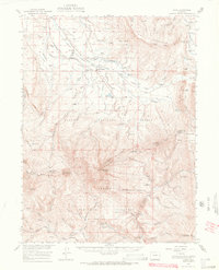
(46)- 1953 Map of Denver, 1964 Print
 1953 Denver1964 Print · USGSDenver and the Colorado Front Range are captured here during a decade of post-war growth and military expansion. Researchers can trace the sprawling rail lines of the Union Pacific, locate the State Capitol, and explore historic mountain mining hubs like Central City.6 unique versions available
 - 1954 Map of Greeley, 1966 Print
 1954 Greeley1966 Print · USGSNorthern Colorado transitions from high-alpine peaks to the irrigated South Platte valley during this mid-century period of growth. Genealogists and historians can trace rail-connected hubs like Greeley and Longmont alongside landmarks like Horsetooth Reservoir and Estes Park.3 unique versions available
 - 1954 Map of Craig, 1973 Print
 1954 Craig1973 Print · USGSNorthwest Colorado and the high mountain parks are captured in the mid-fifties, showing the region's ranching, mining, and timber centers. Genealogists and historians can trace rail corridors like the Denver and Rio Grande Western and old towns such as Axial, Milner, and Coalmont.3 unique versions available
 - 1956 Map of Radial Mountain, 1957 Print
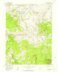
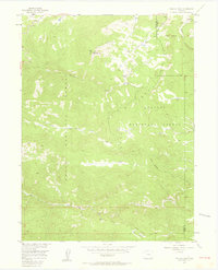
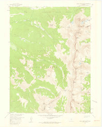
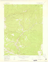 1956 Radial Mountain1957 Print · USGSThe high Colorado Rockies meet at the Continental Divide in the mid-1950s, where national forest boundaries intersect at the Jackson and Grand county lines. Researchers can trace historic alpine infrastructure like the Gilsonite Guard Station, Willow Creek Pass, and a Road Camp.4 unique versions available
 - 1956 Map of Rabbit Ears Peak, 1958 Print
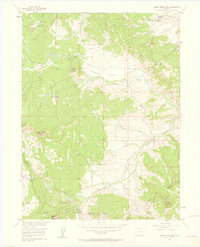 1956 Rabbit Ears Peak1958 Print · USGSThe Continental Divide serves as the backbone for this mid-century survey of the high country along the Jackson and Grand county line. Researchers can trace early ranching and industry through the McGowan Homestead, a Lumber Camp, and the strategic crossing at Rabbit Ears Pass.4 unique versions available
 - 1956 Map of Lake Agnes, 1958 Print
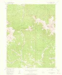
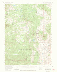
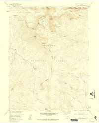
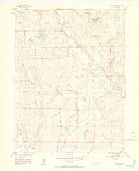 1956 Lake Agnes1958 Print · USGSThe high country of the Rabbit Ears Range comes into focus during the mid-fifties, capturing a landscape of alpine ranching and timber work. You can locate family-named sites like Andersons Ranch, the Strole Sawmill, and the remote Rabbit Ears Lodge.6 unique versions available
 - 1956 Map of Kremmling, 1958 Print
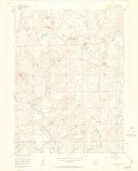
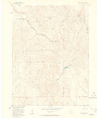
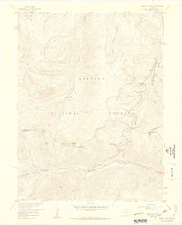
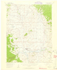 1956 Kremmling1958 Print · USGSMid-century Colorado ranching and river geography converge at the confluence of the Colorado River and Blue River. Genealogists and local historians can trace family-named sites like Taussig Ranch and Ingram Ranch or locate the old Colorow Sch.3 unique versions available
 - 1956 Map of Spicer Peak, 1958 Print
 1956 Spicer Peak1958 Print · USGSJackson County ranching and water management are captured here in the mid-fifties, showing the high-country network of the Continental Divide. Genealogists and historians can trace family properties like Van Valkenburg Ranch and Chas Murphy Ranch alongside the extensive Arapaho Ditch system.5 unique versions available
 - 1956 Map of Parkview Mountain, 1958 Print
 1956 Parkview Mountain1958 Print · USGSThe Continental Divide winds through the Rabbit Ears Range in the mid-1950s, where high-altitude ranching meets National Forest wilderness. Trace early backcountry routes like the Arapaho Creek Trail or locate the Trails End Ranch and its nearby Beaver Ponds.5 unique versions available
 - 1956 Map of Whiteley Peak, 1958 Print
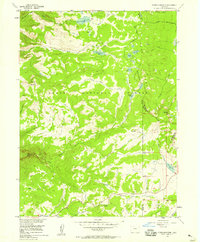
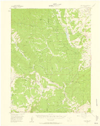
 1956 Whiteley Peak1958 Print · USGSGrand County ranching and high-altitude wilderness meet in the mid-1950s along the Continental Divide. Trace the location of historic family operations like Haworth Ranch and the local Muddy Valley Sch near the Rabbit Ears Range.6 unique versions available
 - 1956 Map of Storm Mountain, 1958 Print
 1956 Storm Mountain1958 Print · USGSThe high alpine country of the Routt National Forest is captured here in the mid-1950s, showing the intersection of three Colorado counties. Trace the paths of early travelers across the Continental Divide and locate remote landmarks like Fishhook Lake or Storm Mountain.4 unique versions available
 - 1956 Map of Walton Peak, 1958 Print
 1956 Walton Peak1958 Print · USGSThe high divide of the Gore Range was a wilderness of forest boundaries and pack trails in the mid-1950s. Trace the path of the Buffalo Park Trail or locate the remote State Highway Radio Relay Station near the headwaters of Service Creek.4 unique versions available
 - 1956 Map of Hyannis Peak, 1958 Print
 1956 Hyannis Peak1958 Print · USGSThe high Continental Divide country of Grand and Jackson Counties is captured here in the mid-fifties, showing a landscape defined by mountain ranges and early forest trails. Trace the remote Hendricks Ranch, search for old Mines near Coal Mountain, and follow the path of the Arapaho Creek Trail.7 unique versions available
 - 1956 Map of Gore Pass, 1958 Print
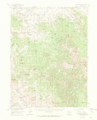
 1956 Gore Pass1958 Print · USGSThe high mountain divide between Grand and Routt Counties comes into focus during the mid-1950s, showing a landscape defined by timber and ranching. Researchers can locate remote sites like Strutsell Sawmill, Snowshoe Ranch, and the Bible Institute Camp.4 unique versions available
 - 1956 Map of Hyannis Peak, 1969 Print
 1956 Hyannis Peak1969 Print · USGSJackson County's high ranching country and the Continental Divide are captured in the mid-1950s as the region's cattle and water networks matured. Researchers can trace historic homesteads like the Van Valkenburg Ranch, locate the Muddy Valley Sch, and find early water works like the Eureka Ditch.2 unique versions available
 - 1956 Map of Rand, 1969 Print
 1956 Rand1969 Print · USGSJackson County ranching and forest lands are captured here in the mid-1950s as the high-country economy centered on the Illinois River. Researchers can trace old family properties like Donelson Ranch, find the Cem at Rand, and locate the Gilsonite Guard Station.3 unique versions available
 - 1956 Map of Rabbit Ears Peak, 1970 Print
 1956 Rabbit Ears Peak1970 Print · USGSNorth-central Colorado at the height of the mid-century demonstrates a rugged alpine economy focused on ranching and forestry. Researchers can trace historic high-altitude homesteads and sites like Anderson Ranch, Rabbit Ears Lodge, and the remote De Berard Ranch.3 unique versions available
 - 1957 Map of Denver
 1957 Denver1957 Print · USGSDenver and the Colorado Front Range are seen here during a mid-century period of intense military and urban expansion. Trace the footprints of the Rocky Mountain Arsenal, the early United States Air Force Academy, and the Lowry AF Base.
 - 1957 Map of Craig
 1957 Craig1957 Print · USGSNorthwest Colorado in the mid-fifties is a landscape of mountain ranching and rail-dependent river towns. Researchers can trace historic coal mining at the Sudduth Mine, follow the Denver and Rio Grande Western tracks, and locate vanished settlements like Pearl.
 - 1957 Map of Greeley
 1957 Greeley1957 Print · USGSNorthern Colorado in the mid-fifties is captured here as the agricultural plains of Weld County meet the high peaks of the Front Range. Genealogists and historians can trace rail-linked towns like Keenesburg and Roggen or locate early water features such as Boyd Lake and Fossil Creek Reservoir.
 - 1957 Map of Mc Henrys Peak, 1959 Print
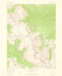 1957 Mc Henrys Peak1959 Print · USGSRocky Mountain National Park in the late 1950s reveals a high-alpine landscape defined by the Continental Divide and its massive glaciers. Trace historic climbing routes and trail networks near Mc Henrys Peak, Andrews Glacier, and Bear Lake.8 unique versions available
 - 1957 Map of Byers Peak, 1959 Print
 1957 Byers Peak1959 Print · USGSThe high alpine terrain of the Arapaho National Forest is captured here in the late fifties as water and mining interests shaped the landscape. Trace the Continental Divide through Jones Pass or locate high-altitude sites like the Bobtail Mine and Butler Lake.7 unique versions available
 - 1957 Map of Mount Richthofen, 1959 Print
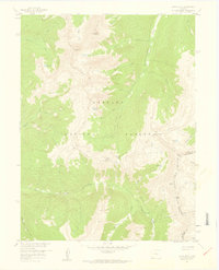
 1957 Mount Richthofen1959 Print · USGSThe high alpine wilderness of Jackson County is captured here in the late fifties, where the Continental Divide splits three major forest and park boundaries. Researchers can trace the source of the Michigan River and locate remote landmarks like the Nokhu Crags, Lake Agnes, and Bearpaws Peaks.9 unique versions available
 - 1957 Map of Bowen Mountain, 1959 Print
 1957 Bowen Mountain1959 Print · USGSThe high peaks of the Never Summer Mountains are captured here in the late fifties, straddling the Continental Divide. Researchers can trace old high-country routes like the Wolverine Trail and locate historical mining activity at the Wolverine Mine.8 unique versions available
 - 1957 Map of Berthoud Pass, 1959 Print
 1957 Berthoud Pass1959 Print · USGSThe high Divide during the late fifties captures a landscape of early ski culture and mountain engineering. Researchers can trace the Jones Pass Tunnel, locate the First Creek Ski Cabin, and explore the terrain around Berthoud Pass and the Urad Mine.7 unique versions available
Showing maps 1-25 of 46
Top cities of Grand County
- Granby historical maps
- Kremmling historical maps
- Fraser historical maps
- Hot Sulphur Springs historical maps
- Grand Lake historical maps
- Tabernash historical maps
Frequently asked questions
- What are the different types of historical maps available for Grand County?
- What is the oldest map of Grand County?
- Where can I purchase historical maps of Grand County for my home or office?
- Where can I download high-res historical maps of Grand County?
- Are there historical topographic maps available for Grand County?
- Is there historical aerial imagery available for Grand County?
- Where are historical maps of Grand County sourced from?