1960s Maps of Hinsdale County, Colorado
Explore 27 historic maps of Hinsdale County from the 1960s. These maps offer a rare glimpse into what life looked like during the 1960s — showing old roads, neighborhoods, homes, and landmarks that have changed or disappeared over time.
Whether you're researching your family's past, planning a metal detecting trip, or studying how Hinsdale County's landscape evolved across the 1960s, these high-resolution maps are a powerful tool for exploring the history of this region.
- Focus on a specific era: All maps on this page are from the 1960s, giving you a focused view of this time period.
- See what’s changed: Compare century-old streets, trails, and buildings to today's modern landscape using overlays and satellite layers.
- Research with precision: Use these maps for genealogy, historical research, land use analysis, or educational projects.
- View, download, or print: Maps are fully viewable online in high resolution, and can be downloaded or printed for your own records.
Start exploring Hinsdale County's history through authentic maps from the 1960s. This is your window into the past.
Hinsdale County, CO maps
(27)- 1960 Map of Montrose
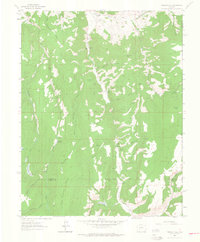
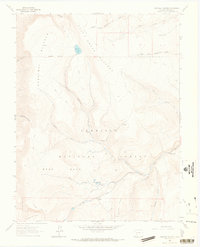
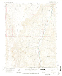
 1960 Montrose1960 Print · USGSThe Colorado high country in the mid-fifties is captured here during a period of steady ranching and persistent mining. Researchers can trace the path of the Denver & Rio Grande Western RR or locate small settlements like Somerset, Maher, and Sargent.2 unique versions available
 - 1961 Map of Durango
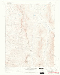
 1961 Durango1961 Print · USGSThe high San Juan country in the early sixties is shown here as a network of historic mining towns and early reservoir projects. Genealogists and researchers can trace the Denver & Rio Grande Western RR as it connects Durango, Silverton, and Arboles.
 - 1962 Map of Rudolph Hill, 1964 Print
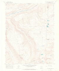
 1962 Rudolph Hill1964 Print · USGSGunnison County ranching and mountain terrain are captured here in the early sixties, showing the remote homesteads and rugged drainages of the region. Researchers can locate family landmarks like Sammons Ranch and Inside Ranch or the Powderhorn Cem.3 unique versions available
 - 1963 Map of Durango
 1963 Durango1963 Print · USGSThe San Juan Mountains and San Luis Valley are captured here in the early 1950s as mining, rail, and tribal lands shaped the region. Researchers can trace the Denver & Rio Grande Western RR through high-country towns like Telluride and Silverton, or locate landmarks such as the Asiatic Mine.
 - 1963 Map of Courthouse Mountain, 1966 Print
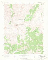
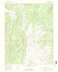
 1963 Courthouse Mountain1966 Print · USGSThe high alpine country of the Uncompahgre National Forest is documented here in the early 1960s. Researchers can locate remote landmarks like the Kennedy Mine, the Jackson Guard Station, and the distinct profile of Chimney Rock.5 unique versions available
 - 1963 Map of Sheep Mountain, 1966 Print
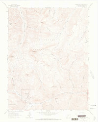
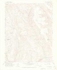
 1963 Sheep Mountain1966 Print · USGSHigh-country ranching and forestry operations are documented in this early 1960s survey of the Gunnison and Hinsdale county border. Researchers can trace historic mountain routes including the Alpine (Pack) Trail, find the Alpine Guard Sta, and locate the seasonal settlement at Johnson Park.4 unique versions available
 - 1963 Map of Lake City, 1966 Print
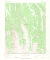
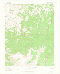
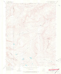
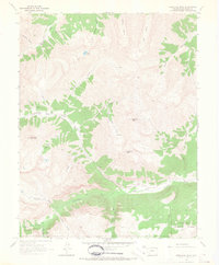
 1963 Lake City1966 Print · USGSLake City was a busy mining and ranching center in the mid-1960s, surrounded by high mountain peaks and national forests. Genealogists and historians can trace local families at Vickers Ranch or search for old claims like the Hidden Treasure Mine and California Mine.3 unique versions available
 - 1963 Map of Cannibal Plateau, 1966 Print
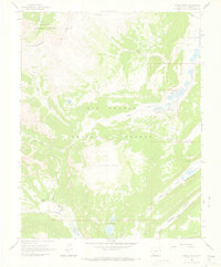
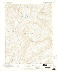
 1963 Cannibal Plateau1966 Print · USGSHinsdale County high country is shown here in the early sixties as a landscape of massive geologic flows and primitive pack routes. Researchers can trace the massive Slumgullion Slide, find old Prospects, and locate high-altitude water at Devils Lake.5 unique versions available
 - 1963 Map of Powderhorn Lakes, 1966 Print
 1963 Powderhorn Lakes1966 Print · USGSThe Gunnison and Hinsdale county borderlands are captured here in the early sixties, showing a high-country landscape of plateaus and remote headwaters. Researchers can trace the path of a jeep trail through the mountains, locate Grey Ranch, and find isolated prospects near Powderhorn Lakes.3 unique versions available
 - 1963 Map of Wetterhorn Peak, 1966 Print
 1963 Wetterhorn Peak1966 Print · USGSThe high San Juan peaks near the Ouray and Hinsdale county lines were still a rugged mining and pack-trail frontier in the early sixties. Researchers can trace historic access routes like the Cow Creek Trail and old workings at Porphyry Basin and Wetterhorn Peak.7 unique versions available
 - 1963 Map of Mineral Mountain, 1966 Print
 1963 Mineral Mountain1966 Print · USGSHigh in the Colorado Rockies during the early sixties, this terrain centers on the wild headwaters of Cebolla Creek. Trace rugged routes like the Bondholder Trail (Jeep) and find remote mountain landmarks like Mineral Mountain and Dry Lake.6 unique versions available
 - 1963 Map of Alpine Plateau, 1966 Print
 1963 Alpine Plateau1966 Print · USGSThe Colorado high country in the early sixties is captured here, centered on the Alpine Plateau and the river valley below. Trace legacy family lands and ranching history at the Wilson Ranch, Thomas Ranch, and the Cem near the river.5 unique versions available
 - 1963 Map of Uncompahgre Peak, 1966 Print
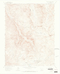
 1963 Uncompahgre Peak1966 Print · USGSHinsdale County’s high alpine peaks were a theater of mining activity in the early sixties, centered around the lofty summit of Uncompahgre Peak. Researchers can trace old operations like the Pride of America Mine and the historic location of Capitol City (Site).5 unique versions available
 - 1964 Map of Uncompahgre Peak, 1966 Print
 1964 Uncompahgre Peak1966 Print · USGSThe mining heritage of the San Juan Mountains is captured here in the mid-1960s, showing the high-altitude landscape of Hinsdale County. Trace the sites of old operations like the Silver Jack Mine or the remnants of Capitol City along Henson Creek.
 - 1964 Map of Rio Grande Pyramid, 1967 Print
 1964 Rio Grande Pyramid1967 Print · USGSHigh in the San Juan Mountains during the mid-1960s, this area centers on the massive Rio Grande Pyramid and the headwaters of the Rio Grande. Trace the path of the Continental Divide and find remote alpine features like The Window and Ute Lake.5 unique versions available
 - 1964 Map of Finger Mesa, 1967 Print
 1964 Finger Mesa1967 Print · USGSHinsdale County high country in the mid-1960s was a landscape of remote pack trails and high-altitude ranching. Genealogists and historians can trace the reach of the Rio Grande headwaters near Lost Trail Ranch, Ski Hi Ranch, and the waters of Hermit Lakes.3 unique versions available
 - 1964 Map of Bear Mountain, 1967 Print
 1964 Bear Mountain1967 Print · USGSHinsdale and Archuleta counties appear here in the mid-1960s as a high-altitude wilderness within the San Juan National Forest. Map collectors and hikers can trace historical routes like the Stock Driveway, pack trails, and the dramatic Second Box Canyon.3 unique versions available
 - 1964 Map of Redcloud Peak, 1967 Print
 1964 Redcloud Peak1967 Print · USGSHigh in the San Juan Mountains during the mid-sixties, this map shows a landscape of soaring summits and isolated mining prospects. Researchers can locate the mountain camp of Sherman and trace high-altitude routes like the Cooper Creek Pack Trail and Grizzly Gulch Pack Trail.2 unique versions available
 - 1964 Map of Oakbrush Ridge, 1967 Print
 1964 Oakbrush Ridge1967 Print · USGSThe high San Juan Forest country near the Hinsdale and Archuleta county line is captured here in the mid-1960s. Researchers can locate remote high-altitude landmarks like Piedra Guard Station, Singing Pines Ranch, and the Debs Community Hall.4 unique versions available
 - 1964 Map of Little Squaw Creek, 1967 Print
 1964 Little Squaw Creek1967 Print · USGSHinsdale and Mineral counties are shown here in the mid-1960s as a high-mountain wilderness split by the Continental Divide. Trace the remote network of a Stock Driveway and Pack Trails connecting Ruby Lake, River Hill, and Trout Lake.5 unique versions available
 - 1964 Map of Pole Creek Mountain, 1967 Print
 1964 Pole Creek Mountain1967 Print · USGSHinsdale and San Juan counties are shown at the height of the mid-sixties wilderness era, centered on the high ridges of the Continental Divide. Researchers can trace the routes of the Garita Stock Driveway and the Cuba Pack Trail past peaks like Carson Peak.4 unique versions available
 - 1964 Map of Weminuche Pass, 1967 Print
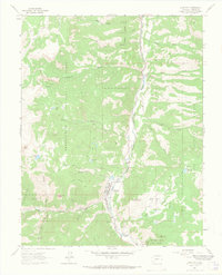
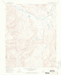
 1964 Weminuche Pass1967 Print · USGSHinsdale County in the mid-1960s was a landscape defined by high-altitude crossings and the early water infrastructure of the Rio Grande Reservoir. Researchers can trace historic transit routes like the Weminuche Pass and the Squaw Stock Driveway, alongside the site of an old Stage Station.4 unique versions available
 - 1964 Map of Lake San Cristobal, 1967 Print
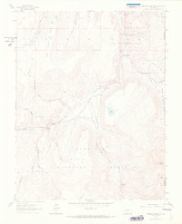
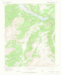
 1964 Lake San Cristobal1967 Print · USGSHinsdale County’s high mountain terrain is captured in the mid-1960s, showing the intersection of the Continental Divide and the Gunnison River. Researchers can trace old mining footprints at Mines, locate a local Cem, and find early aviation marks like the Landing Strip.4 unique versions available
 - 1964 Map of Workman Creek, 1967 Print
 1964 Workman Creek1967 Print · USGSHigh in the San Juan Mountains during the mid-sixties, this survey captures the winding Rio Grande and Antelope Park. Trace backcountry landmarks like Sulphur Tunnel, the Stock Driveway, and alpine waters at Love Lake.3 unique versions available
 - 1964 Map of Granite Peak, 1968 Print
 1964 Granite Peak1968 Print · USGSThe high San Juan Mountains of the mid-sixties are captured here at the intersection of La Plata, Hinsdale, and Archuleta counties. Researchers can trace historic mining activity near Tuckerville, locate remote livestock routes like the Pine-Piedra Stock Driveway, and explore the headwaters of the Los Pinos River.5 unique versions available
Showing maps 1-25 of 27
Top cities of Hinsdale County
Frequently asked questions
- What are the different types of historical maps available for Hinsdale County?
- What is the oldest map of Hinsdale County?
- Where can I purchase historical maps of Hinsdale County for my home or office?
- Where can I download high-res historical maps of Hinsdale County?
- Are there historical topographic maps available for Hinsdale County?
- Is there historical aerial imagery available for Hinsdale County?
- Where are historical maps of Hinsdale County sourced from?