1980s Maps of Hinsdale County, Colorado
Explore 7 historic maps of Hinsdale County from the 1980s. These maps offer a rare glimpse into what life looked like during the 1980s — showing old roads, neighborhoods, homes, and landmarks that have changed or disappeared over time.
Whether you're researching your family's past, planning a metal detecting trip, or studying how Hinsdale County's landscape evolved across the 1980s, these high-resolution maps are a powerful tool for exploring the history of this region.
- Focus on a specific era: All maps on this page are from the 1980s, giving you a focused view of this time period.
- See what’s changed: Compare century-old streets, trails, and buildings to today's modern landscape using overlays and satellite layers.
- Research with precision: Use these maps for genealogy, historical research, land use analysis, or educational projects.
- View, download, or print: Maps are fully viewable online in high resolution, and can be downloaded or printed for your own records.
Start exploring Hinsdale County's history through authentic maps from the 1980s. This is your window into the past.
Hinsdale County, CO maps
(7)- 1982 Map of Silverton, 1983 Print
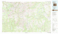 1982 Silverton1983 Print · USGSThe San Juan Mountains were entering a new era in the early eighties as mining heritage met growing wilderness preservation. Researchers can trace historic claims and mountain rail routes through Silverton, Telluride, and the high-altitude Sunnyside Mine.3 unique versions available
 - 1983 Map of Montrose
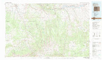 1983 Montrose1983 Print · USGSThe Uncompahgre Valley and high San Juan peaks come together in the early eighties, showing a landscape defined by deep canyons and mountain mining towns. Genealogists and hikers can trace old routes near Ouray, Lake City, and the Pelican Mine.2 unique versions available
 - 1983 Map of Durango
 1983 Durango1983 Print · USGSSouthwestern Colorado at the start of the 1980s shows a landscape where high-mountain wilderness meets the agricultural plateaus of the Southern Ute. Genealogists and historians can trace the Durango & Silverton Narrow Gauge Railroad or locate sites like Southern Ute Agency and Pagosa Junction.
 - 1983 Map of Courthouse Mountain, 1984 Print
 1983 Courthouse Mountain1984 Print · USGSThe high San Juan alpine country is captured here during the 1980s, showcasing the dramatic divide of Cimarron Ridge. Researchers can trace old mountain routes over Owl Creek Pass, locate the Kennedy Mine, or find the Jackson Guard Station near the shores of Silver Jack Reservoir.
 - 1986 Map of Hermit Lakes
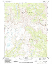
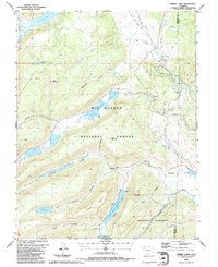 1986 Hermit Lakes1986 Print · USGSHinsdale County high country in the mid-1980s reveals a landscape of alpine ranching and public water management. Trace family-owned landmarks like San Juan Ranch or locate remote outposts like the Bristol View Ranger Sta.
 - 1986 Map of Slumgullion Pass
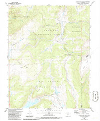 1986 Slumgullion Pass1986 Print · USGSThe high San Juan Mountains are captured here in the mid-1980s, centered on the dramatic geological slump of the Slumgullion Slide. High-country researchers can trace the Continental Divide past Snow Mesa and locate the Skyline Trail.
 - 1986 Map of Baldy Cinco
 1986 Baldy Cinco1986 Print · USGSHigh in the Colorado Rockies during the mid-eighties, this survey captures the intersection of three counties along the Continental Divide. Trace the remote Cebolla Trail across the broad Snow Mesa or locate Prospects near the headwaters of Mineral Creek.
End of results
Showing maps 1-7 of 7
Top cities of Hinsdale County
Frequently asked questions
- What are the different types of historical maps available for Hinsdale County?
- What is the oldest map of Hinsdale County?
- Where can I purchase historical maps of Hinsdale County for my home or office?
- Where can I download high-res historical maps of Hinsdale County?
- Are there historical topographic maps available for Hinsdale County?
- Is there historical aerial imagery available for Hinsdale County?
- Where are historical maps of Hinsdale County sourced from?