1960s Maps of Jackson County, Colorado
Explore 18 historic maps of Jackson County from the 1960s. These maps offer a rare glimpse into what life looked like during the 1960s — showing old roads, neighborhoods, homes, and landmarks that have changed or disappeared over time.
Whether you're researching your family's past, planning a metal detecting trip, or studying how Jackson County's landscape evolved across the 1960s, these high-resolution maps are a powerful tool for exploring the history of this region.
- Focus on a specific era: All maps on this page are from the 1960s, giving you a focused view of this time period.
- See what’s changed: Compare century-old streets, trails, and buildings to today's modern landscape using overlays and satellite layers.
- Research with precision: Use these maps for genealogy, historical research, land use analysis, or educational projects.
- View, download, or print: Maps are fully viewable online in high resolution, and can be downloaded or printed for your own records.
Start exploring Jackson County's history through authentic maps from the 1960s. This is your window into the past.
Jackson County, CO maps
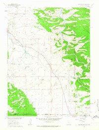
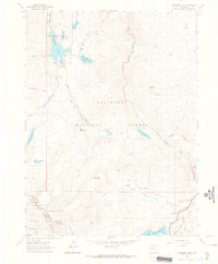
(18)- 1960 Map of Craig
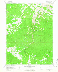
 1960 Craig1960 Print · USGSNorthwest Colorado in the 1950s is a landscape of mountain summits and industrial growth at the headwaters of the West. Genealogists and historians can trace rail-town development along the Denver and Salt Lake line, while locating Uranium Mines and settlements like Craig, Meeker, and Steamboat Springs.
 - 1961 Map of Greeley
 1961 Greeley1961 Print · USGSNorthern Colorado's transition from high mountain peaks to irrigated plains is captured here just as the post-war population boom reached the Front Range. Researchers can trace early water infrastructure and rail lines like the Great Western RR connecting sugar beet hubs from Fort Collins to Greeley.
 - 1961 Map of Elkhorn Point, 1963 Print
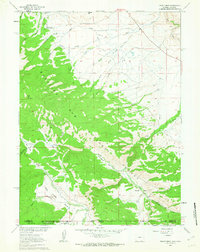
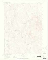
 1961 Elkhorn Point1963 Print · USGSHigh-country ranching and timberlands meet along the Wyoming-Colorado border in the early sixties. Researchers can trace historic water rights via Henry Ditch or locate family landmarks like Big Creek Ranch and Parkview Hill.4 unique versions available
 - 1961 Map of Trent Creek, 1963 Print
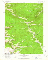
 1961 Trent Creek1963 Print · USGSThe high-country wilderness of the Medicine Bow Range is documented here in the early 1960s, showing the intersection of ranching and forestry. Researchers can find old landmarks like the Big Creek Guard Station, the remote Skyline Ranch, and early mining sites at the Mine and Prospect.3 unique versions available
 - 1961 Map of Horatio Rock, 1963 Print
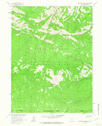
 1961 Horatio Rock1963 Print · USGSThe high timberlands and canyons along the Wyoming-Colorado border are captured here in the early sixties. Researchers can trace the drainage of the North Platte River through Gate Canyon and locate landmarks like Thompson Lodge or Horatio Rock.5 unique versions available
 - 1961 Map of Blackhall Mountain, 1963 Print
 1961 Blackhall Mountain1963 Print · USGSThe high divide between Wyoming and Colorado is captured here in the early sixties, showing the remote borderlands of two national forests. Researchers can trace historic access routes like the Telephone Line and Pack Trail past a high-country Mine.4 unique versions available
 - 1961 Map of Dudley Creek, 1963 Print
 1961 Dudley Creek1963 Print · USGSThe high Sierra Madre range at the Wyoming-Colorado border is captured here in the early sixties, showing the remote wilderness of the Medicine Bow National Forest. Trace the path of the Continental Divide near industrial and seasonal sites like the Broadway Mine and Finch Cow Camp.4 unique versions available
 - 1962 Map of Rawlins
 1962 Rawlins1962 Print · USGSSouthern Wyoming at the dawn of the sixties shows a landscape shaped by the Union Pacific and the high peaks of the Medicine Bow Mountains. Researchers can trace the path of the old stage routes through Overland Stage Station and Fort Fred Steele.
 - 1962 Map of Craig
 1962 Craig1962 Print · USGSNorthwest Colorado in the early sixties is a land of high-elevation ranching and remote river valleys. Genealogists and historians can trace the Denver and Rio Grande Western rail lines and locate early settlements like Hahns Peak, Meeker, and Juniper Springs.
 - 1962 Map of West Fork Lake, 1964 Print
 1962 West Fork Lake1964 Print · USGSThe high alpine terrain along the Continental Divide comes into focus in the early sixties as a region of forest management and seasonal livestock movement. Trace the paths of early travelers along the Stock Driveway or find remote landmarks like West Fork Lake and Silver City Creek.5 unique versions available
 - 1962 Map of Clark Peak, 1964 Print
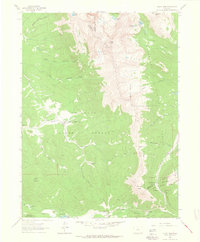 1962 Clark Peak1964 Print · USGSThe rugged divide of the Front Range and the Medicine Bow Mountains comes into focus in the early sixties. Trace historical timber operations at Bockman Lumber Camp or explore alpine features like Clark Peak and the Michigan Ditch.6 unique versions available
 - 1962 Map of Rawah Lakes, 1964 Print
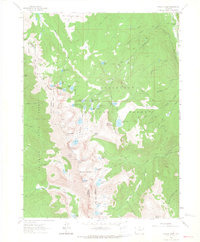 1962 Rawah Lakes1964 Print · USGSThe Medicine Bow Mountains along the Larimer and Jackson county line are captured here in the early sixties as a pristine alpine wilderness. Hikers and historians can trace high-altitude routes like the Rawah Trail and identify remote landmarks including North Rawah Peak and Sugarbowl Lake.3 unique versions available
 - 1962 Map of Chambers Lake, 1965 Print
 1962 Chambers Lake1965 Print · USGSLarimer County's high country is captured here in the early sixties, showing the vital water infrastructure of the Front Range. Researchers can trace historic alpine water diversions like the Skyline Ditch and locate seasonal sites like the Corral Park Cow Camp.9 unique versions available
 - 1964 Map of Craig
 1964 Craig1964 Print · USGSNorthwestern Colorado's high country is captured here during the mid-sixties, from the Yampa River valley to the high peaks of the Park Range. Local researchers can trace the Denver and Rio Grande Western rail line and locate Uranium Mines near Lay.
 - 1964 Map of Greeley
 1964 Greeley1964 Print · USGSThe Front Range corridor and high peaks of the Rockies appear here in the mid-1960s, showing the intersection of mountain wilderness and plains agriculture. Trace the rail routes of the Great Western RR or locate landmarks like Longs Peak and Horsetooth Reservoir.
 - 1965 Map of Greeley
 1965 Greeley1965 Print · USGSNorthern Colorado in the mid-sixties shows a landscape defined by high mountain summits and the growing irrigation networks of the plains. Genealogists and historians can trace rail-side towns like Wellington or follow the early tracks of the Union Pacific Railroad past Longs Peak.
 - 1965 Map of Craig
 1965 Craig1965 Print · USGSNorthwest Colorado in the mid-sixties is defined by its massive river basins and high mountain ranges flanking the Continental Divide. Trace the routes of the Denver and Rio Grande Western through old settlements like McCoy and Kremmling.
 - 1967 Map of Rawlins
 1967 Rawlins1967 Print · USGSCentral Wyoming and northern Colorado in the 1980s are defined here by the Union Pacific corridor and the high peaks of the Sierra Madre. Researchers can trace the legacy of old mining and rail towns like Carbon, Hanna, and Medicine Bow along the Overland Trail.
End of results
Showing maps 1-18 of 18
Top cities of Jackson County
Frequently asked questions
- What are the different types of historical maps available for Jackson County?
- What is the oldest map of Jackson County?
- Where can I purchase historical maps of Jackson County for my home or office?
- Where can I download high-res historical maps of Jackson County?
- Are there historical topographic maps available for Jackson County?
- Is there historical aerial imagery available for Jackson County?
- Where are historical maps of Jackson County sourced from?