Old Maps of Jackson County, Colorado for Academic Research
Study the evolution of Jackson County with 325 high-resolution historic maps. Whether you're teaching, researching, or modeling changes in land use, these maps provide essential visual documentation of urban, environmental, and geographic change.
- Analyze long-term change: Track patterns in development, transportation, and natural features.
- Ideal for environmental or urban studies: Support academic projects with primary historical map data.
- Use in the classroom or lab: Educators and researchers rely on these maps to bring historical context to life.
These maps are a powerful tool for teaching, research, and visualizing how Jackson County has changed over the decades.
Jackson County, CO maps
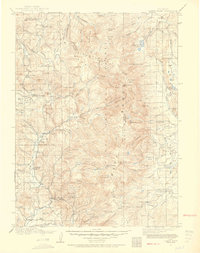
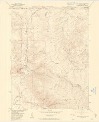
(325)- 1906 Map of Medicine Bow, 1955 Print
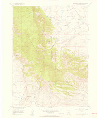
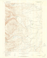
 1906 Medicine Bow1955 Print · USGSThe Medicine Bow Range at the dawn of the twentieth century shows a high-country economy driven by mining, timber, and ranching. Researchers can trace early infrastructure like the Laramie Hahns Peak and Pacific RR or locate family sites such as the Beckwith Ranch and Lenhardys Cabin.
 - 1908 Map of Medicine Bow
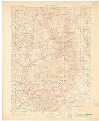
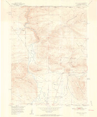
 1908 Medicine Bow1908 Print · USGSThe Medicine Bow Range at the dawn of the twentieth century shows a landscape of mountain ranches and early mining. Trace family-named landmarks like Logan-Grisley Ranch and industrial sites like Webbers Sawmill or the White Swan Mine.3 unique versions available
 - 1911 Map of Hahns Peak, 1954 Print
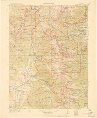
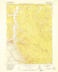
 1911 Hahns Peak1954 Print · USGSThe northern Park Range and the Continental Divide appear in great detail just after the first decade of the twentieth century. Researchers can locate remote schools and ranches like Moon Hill School, the Elkhorn Mine, and the settlement of Pearl.2 unique versions available
 - 1913 Map of Hahns Peak
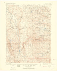
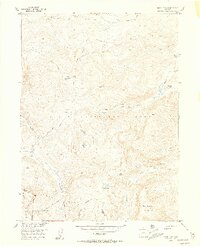
 1913 Hahns Peak1913 Print · USGSRoutt County was a landscape of high-country mining and isolated homesteads in the early 1900s. Researchers can trace the era's rural infrastructure through old schoolhouses like Moon Hill School, the Elkhorn Mine, and settlements such as Columbine.2 unique versions available
 - 1915 Map of Longs Peak
 1915 Longs Peak1915 Print · USGSHigh mountain passes and early alpine settlements define this region just as the National Park system was taking root. Genealogists and hikers can trace the Ute Trail, locate the Sleepy Hollow School, or find the old Monarch PO near Grand Lake.3 unique versions available
 - 1916 Map of Home, 1954 Print
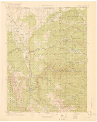
 1916 Home1954 Print · USGSHigh mountain ranching and early forestry are captured in this 1916 survey of northern Colorado as the modern park system took root. Researchers can trace historic homesteads like Williams Ranch, find the Black Mtn School, and locate the mining-era settlement of Manhattan.2 unique versions available
 - 1919 Map of Rocky Mountain National Park
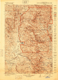 1919 Rocky Mountain National Park1919 Print · USGSThe high alpine basins of Northern Colorado are captured here in the years following the park's creation. Researchers can locate early schools and post offices like Sleepy Hollow School and Monarch PO, or trace the rail lines of the Denver and Salt Lake RR.7 unique versions available
 - 1920 Map of Home
 1920 Home1920 Print · USGSLarimer County at the end of the Great War was a landscape of high-country ranches and forest outposts. Genealogists and historians can locate family homesteads like Derby Ranch and Bennett Ranch or trace the early operations of the Black Mtn School and Manhattan.4 unique versions available
 - 1939 Map of Saratoga
 1939 Saratoga1939 Print · USGSThe North Platte valley comes alive in the late 1930s as a vital corridor for ranching and transport. Researchers can trace the Saratoga and Encampment Railroad or locate early rural schools like Benton Creek Sch and the Big Cr Mine.3 unique versions available
 - 1950 Map of Northgate, 1957 Print
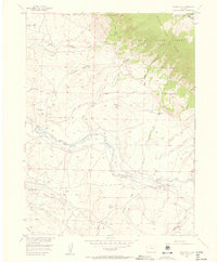
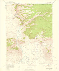 1950 Northgate1957 Print · USGSJackson County ranching and mining operations are captured in detail at the turn of the 1950s. Genealogists and historians can trace family-named sites like the Quaintance Ranch alongside industrial landmarks including the Fluorspar Mine and Gero Tunnel.6 unique versions available
 - 1950 Map of Kings Canyon, 1959 Print
 1950 Kings Canyon1959 Print · USGSThe Colorado-Wyoming border region in the 1950s was a hub for high-country mining and specialized irrigation. Researchers can trace historic industrial sites like the Kings Canyon Mine and water infrastructure such as the Hardwork Ditch and Government Ditch.4 unique versions available
 - 1952 Map of Northgate
 1952 Northgate1952 Print · USGSHigh-altitude ranching and mining operations meet along the North Platte River in northern Colorado during the early fifties. Genealogists and historians can trace industrial sites like the Fluorspar Mine, local landmarks like Quaintance Ranch, and the Union Pacific rail corridor.2 unique versions available
 - 1952 Map of Kings Canyon
 1952 Kings Canyon1952 Print · USGSThe Colorado-Wyoming borderlands appear here in the early fifties as a rugged high-altitude frontier shaped by mining and rail. Genealogists and historians can trace the sites of Roach and Camp Nelson along the Union Pacific line.2 unique versions available
 - 1954 Map of Greeley, 1966 Print
 1954 Greeley1966 Print · USGSNorthern Colorado transitions from high-alpine peaks to the irrigated South Platte valley during this mid-century period of growth. Genealogists and historians can trace rail-connected hubs like Greeley and Longmont alongside landmarks like Horsetooth Reservoir and Estes Park.3 unique versions available
 - 1954 Map of Rawlins, 1968 Print
 1954 Rawlins1968 Print · USGSThe high plains and mountain ranges of southern Wyoming are shown here in the mid-1950s as the Union Pacific railroad and early highways fueled local industry. Genealogists and historians can trace old homesteads and outposts like the Overland Stage Station, the Utah Oil Refining Station, and the Hadsell Winter Headquarters.2 unique versions available
 - 1954 Map of Craig, 1973 Print
 1954 Craig1973 Print · USGSNorthwest Colorado and the high mountain parks are captured in the mid-fifties, showing the region's ranching, mining, and timber centers. Genealogists and historians can trace rail corridors like the Denver and Rio Grande Western and old towns such as Axial, Milner, and Coalmont.3 unique versions available
 - 1955 Map of Davis Peak, 1956 Print
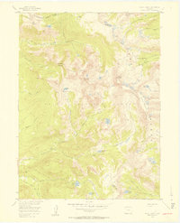
 1955 Davis Peak1956 Print · USGSThe high alpine country of the Park Range comes into focus during the mid-1950s, showing a landscape defined by seasonal industry and rugged navigation. Researchers can trace the Stock Driveway, locate an early Sawmill (Aband), and find remote water features like Seven Lakes.5 unique versions available
 - 1955 Map of Independence Mountain, 1956 Print
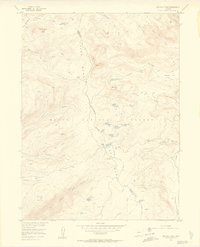
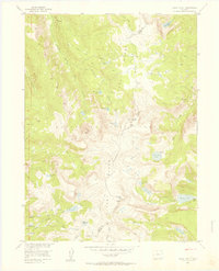
 1955 Independence Mountain1956 Print · USGSJackson County ranching and water management are the focus of this mid-fifties survey of the high-country landscape. Genealogists and historians can locate remote family landmarks like Simmons Ranch, the Threemile Sch, and the Placer Mine.5 unique versions available
 - 1955 Map of Lake John, 1956 Print
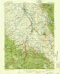
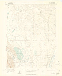 1955 Lake John1956 Print · USGSJackson County ranching and water rights are meticulously documented in this mid-century survey of the high North Park basin. Researchers can trace the legacy of local families through Brands Ranch and Wattenberg Ranch, or follow the complex network of the Legal Tender Ditch and Victor Ditch.4 unique versions available
 - 1955 Map of Buffalo Pass, 1956 Print
 1955 Buffalo Pass1956 Print · USGSThe high Continental Divide in the mid-fifties is captured here during a period of Missouri River Basin development surveys. Researchers can trace historic high-country routes like the Wyoming Trail and locate the Summit Lake Guard Sta near Buffalo Pass.6 unique versions available
 - 1955 Map of Mount Zirkel, 1957 Print
 1955 Mount Zirkel1957 Print · USGSThe high peaks of the Park Range in the mid-1950s are preserved here, centered on the Continental Divide and the settlement at Slavonia. Local historians can trace old wilderness trails and primitive camps near Mount Zirkel, Mica Lake, and Three Island Lake.6 unique versions available
 - 1955 Map of Pitchpine Mountain, 1957 Print
 1955 Pitchpine Mountain1957 Print · USGSThe ranching and irrigation systems of Jackson County are captured here in the mid-1950s. Genealogists and historians can trace family land use through Carlstrom Brothers Ranch and Brands Ranch or follow historic routes like the Lone Pine Trail.7 unique versions available
 - 1955 Map of Mount Ethel, 1957 Print
 1955 Mount Ethel1957 Print · USGSThe Park Range highlands and the Continental Divide define this Colorado wilderness as it appeared in the mid-1950s. Trace the paths of the historic Wyoming Trail and Rainbow Lake Trail to remote landmarks like Mount Ethel and Big Creek Lake.6 unique versions available
 - 1955 Map of Eagle Hill, 1957 Print
 1955 Eagle Hill1957 Print · USGSJackson County ranching and energy production intersect in the mid-1950s along the winding Canadian River. Genealogists and local historians can locate early family sites like the Dowell Homestead, Blevins Ranch, and the infrastructure of the North McCallum Oil Field.4 unique versions available
 - 1955 Map of Teal Lake, 1957 Print
 1955 Teal Lake1957 Print · USGSJackson County ranching and forest management are captured here in the mid-1950s, showing a remote mountain landscape before modern development. You can trace early backcountry routes like the Helena Trail and locate historic sites like the Butler Sch and Grizzly Creek Guard Station.6 unique versions available
Showing maps 1-25 of 325
Top cities of Jackson County
Frequently asked questions
- What are the different types of historical maps available for Jackson County?
- What is the oldest map of Jackson County?
- Where can I purchase historical maps of Jackson County for my home or office?
- Where can I download high-res historical maps of Jackson County?
- Are there historical topographic maps available for Jackson County?
- Is there historical aerial imagery available for Jackson County?
- Where are historical maps of Jackson County sourced from?