2000s (21st Century) Maps of Jackson County, Colorado
Explore 250 historic maps of Jackson County from the 2000s (21st Century). These maps offer a rare glimpse into what life looked like during the 2000s — showing old roads, neighborhoods, homes, and landmarks that have changed or disappeared over time.
Whether you're researching your family's past, planning a metal detecting trip, or studying how Jackson County's landscape evolved across the 2000s, these high-resolution maps are a powerful tool for exploring the history of this region.
- Focus on a specific era: All maps on this page are from the 2000s, giving you a focused view of this time period.
- See what’s changed: Compare century-old streets, trails, and buildings to today's modern landscape using overlays and satellite layers.
- Research with precision: Use these maps for genealogy, historical research, land use analysis, or educational projects.
- View, download, or print: Maps are fully viewable online in high resolution, and can be downloaded or printed for your own records.
Start exploring Jackson County's history through authentic maps from the 2000s. This is your window into the past.
Jackson County, CO maps
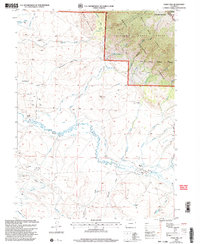
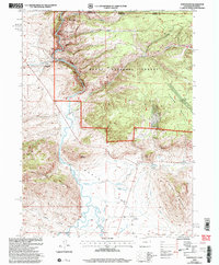
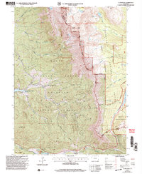
(250)- 2000 Map of Parkview Mountain, 2004 Print
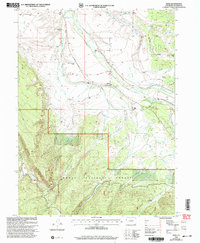
 2000 Parkview Mountain2004 Print · USGSThe high peaks of the Colorado Rockies meet at the turn of the millennium where the Continental Divide crosses the Rabbit Ears Range. Researchers can trace remote alpine routes like the Troublesome Trail or locate the King Mountain Ranch near the county line.
 - 2000 Map of Eagle Hill, 2004 Print
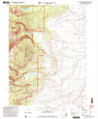
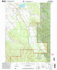
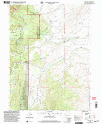
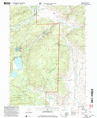
 2000 Eagle Hill2004 Print · USGSThe high Jackson County basin at the turn of the millennium shows a working landscape where energy production and ranching meet protected forest lands. Genealogists and historians can trace family landholdings at the Dowell Homestead or Blevins Ranch and locate early energy sites like the North Mc Callum Oil Field.
 - 2000 Map of Pitchpine Mountain, 2004 Print
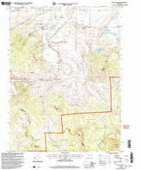
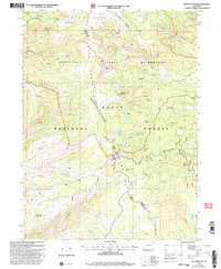
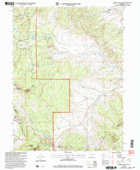
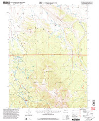
 2000 Pitchpine Mountain2004 Print · USGSHigh-country ranching and complex irrigation networks define this Jackson County landscape at the turn of the millennium. Genealogists and historians can locate established family lands like Irvine Ranch and trace early water engineering through the Erickson and Bohn Ditch and Manville Ditch.
 - 2000 Map of Spicer Peak, 2004 Print
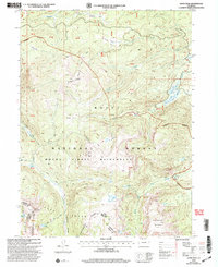
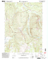
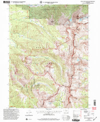
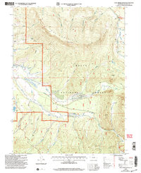
 2000 Spicer Peak2004 Print · USGSJackson County ranching and water management are detailed here at the turn of the millennium. Genealogists and historians can trace family land like the Murphy Desert Ranch and follow the intricate Koping Ditch system near Spicer.
 - 2000 Map of Davis Peak, 2004 Print
 2000 Davis Peak2004 Print · USGSJackson and Routt counties meet along the Continental Divide in this high-altitude survey from the turn of the millennium. Trace the paths of the Buffalo Ridge Trail to remote landmarks like Seven Lakes and Lake Eileen.
 - 2000 Map of Whiteley Peak, 2004 Print
 2000 Whiteley Peak2004 Print · USGSHigh-altitude ranching and wilderness come together in Grand County at the turn of the millennium. Genealogists and local historians can trace legacy holdings like Dietrich Ranch or the Carter Mountain Ranch near the Muddy Valley Sch.
 - 2000 Map of Lake Agnes, 2004 Print
 2000 Lake Agnes2004 Print · USGSThe Rabbit Ears Range and Continental Divide dominate this Colorado high-country landscape at the turn of the century. Trace mountain ranching and timber history through the Smokey Sawmill, Lichen Lodge, and Anderson Ranch.
 - 2000 Map of Northgate, 2004 Print
 2000 Northgate2004 Print · USGSJackson County ranching and mining operations are captured here at the turn of the millennium near the Wyoming border. Trace the water-rights history of the Canadian River and locate historic sites like Ginger Quill Ranch and the Fluorspar Mine.
 - 2000 Map of Gould, 2004 Print
 2000 Gould2004 Print · USGSJackson County ranching and forest lands are captured here at the turn of the millennium, documenting a landscape of high-country irrigation and family-held estates. Researchers can trace the layout of the Gould settlement and locate historic sites like the Haworth Sch and the Michigan River Ranger Station.
 - 2000 Map of Buffalo Pass, 2004 Print
 2000 Buffalo Pass2004 Print · USGSThe high alpine crest of the Park Range is captured here at the turn of the century, centered on the historic Buffalo Pass. Hikers and researchers can trace the Continental Divide National Scenic Trail as it passes high-elevation water bodies like Summit Lake and Lake Dinosaur.
 - 2000 Map of West Fork Lake, 2004 Print
 2000 West Fork Lake2004 Print · USGSHigh in the Colorado Rockies at the turn of the century, this survey documents the rugged ridgelines where the Continental Divide meets the Sierra Madre. Outdoorsmen and researchers can trace the routes of the Wyoming Trail past alpine landmarks like West Fork Lake and the Hog Park Guard Station.
 - 2000 Map of Rand, 2004 Print
 2000 Rand2004 Print · USGSHigh-altitude ranching and complex water management define this Jackson County community at the turn of the century. Genealogists and local historians can trace legacy family holdings like the Stephens Brothers Ranch and Howard Ranch alongside the Rand Sch and Rand Cem.
 - 2000 Map of Teal Lake, 2004 Print
 2000 Teal Lake2004 Print · USGSJackson County ranching and water rights come into focus at the turn of the millennium. Trace the historical irrigation network of the Lucky Penny Ditch and find local landmarks like the Butler Sch and Grizzly Creek Guard Sta.
 - 2000 Map of Mount Werner, 2004 Print
 2000 Mount Werner2004 Print · USGSThe high country of the Routt National Forest is captured here at the turn of the century, centered on the Steamboat Ski Area. Researchers can trace the Continental Divide and locate remote landmarks like Fish Creek Reservoir and Lake Percy.
 - 2000 Map of Rabbit Ears Peak, 2004 Print
 2000 Rabbit Ears Peak2004 Print · USGSThe high ridges and forest boundaries of Jackson County are captured here at the end of the century. Genealogists and local historians can locate early mountain life at the Mc Gowen Homestead and trace the complex border of the Arapaho National Forest.
 - 2000 Map of Mount Richthofen, 2004 Print
 2000 Mount Richthofen2004 Print · USGSHigh alpine summits and the Continental Divide define this Colorado landscape at the turn of the millennium. Trace the headwaters of the Michigan River and Illinois River among peaks like Mount Richthofen and the striking Nokhu Crags.
 - 2000 Map of Clark Peak, 2004 Print
 2000 Clark Peak2004 Print · USGSThe high divide of Jackson County is captured here at the turn of the millennium, showing a rugged intersection of wilderness and state forestry. Researchers can locate remote landmarks like the Bockman Lumber Camp, Preachers Cabin, and Seven Utes Lodge.
 - 2000 Map of Hyannis Peak, 2004 Print
 2000 Hyannis Peak2004 Print · USGSGrand County at the turn of the century shows a landscape of high-elevation ranching and remote forest trails along the Continental Divide. Researchers can trace historic routes like the Arapaho Ridge Trail or locate landmarks such as Hendricks Ranch and the Matheson Reservoir.
 - 2000 Map of Pearl, 2004 Print
 2000 Pearl2004 Print · USGSNear the Wyoming border at the turn of the millennium, this area shows a high-country landscape of ranching outposts and legacy mining. Genealogists and historians can locate family-named landmarks like Lobdell Ranch and trace the industrial footprint of the Swede Group Mines and Smelter Stack.
 - 2000 Map of Buffalo Peak, 2004 Print
 2000 Buffalo Peak2004 Print · USGSJackson County high country comes alive in this survey of the late twentieth-century ranching and water infrastructure between the Routt and Arapaho forests. Trace the complex irrigation system of the Slack-Weiss Ditch and find remote landmarks like Buffalo Ranch and Aspen Knoll Cabin.
 - 2000 Map of Mount Ethel, 2004 Print
 2000 Mount Ethel2004 Print · USGSThe high peaks of the Colorado Divide are preserved here at the turn of the millennium within the Mount Zirkel Wilderness. Hikers and researchers can trace the high-altitude Continental Scenic Trail past landmarks like Mount Ethel and Lake Katherine.
 - 2000 Map of Johnny Moore Mountain, 2004 Print
 2000 Johnny Moore Mountain2004 Print · USGSNorth of the Michigan River at the turn of the twenty-first century, this high-country landscape reveals a sophisticated network of mountain ranching and water engineering. Researchers can trace historic property boundaries at Dodge Ranch and Mace Ranch or locate industrial sites like the Marr Mine.
 - 2000 Map of Jack Creek Ranch, 2004 Print
 2000 Jack Creek Ranch2004 Print · USGSJackson County high country comes into focus at the turn of the millennium, showing a landscape defined by historic ranching and silver mining ruins. Trace the remains of Teller City (Site) or follow the complex irrigation networks of the Oldenburg Ditch and Parkview Ditch.
 - 2000 Map of Boettcher Lake, 2004 Print
 2000 Boettcher Lake2004 Print · USGSJackson County high country at the turn of the millennium shows a fascinating mix of working ranches and protected wilderness. Researchers can locate early homesteads like Brown Homestead or trace the legacy of local industry at Monahan Coal Mine.
 - 2000 Map of Mount Zirkel, 2004 Print
 2000 Mount Zirkel2004 Print · USGSThe high peaks of the Park Range and the Sawtooth Range are captured here at the turn of the millennium. Hikers and historians can trace the paths to the Gilpin Mine, the settlement at Slavonia, and remote alpine waters like Mica Lake.
Showing maps 1-25 of 250
Top cities of Jackson County
Frequently asked questions
- What are the different types of historical maps available for Jackson County?
- What is the oldest map of Jackson County?
- Where can I purchase historical maps of Jackson County for my home or office?
- Where can I download high-res historical maps of Jackson County?
- Are there historical topographic maps available for Jackson County?
- Is there historical aerial imagery available for Jackson County?
- Where are historical maps of Jackson County sourced from?