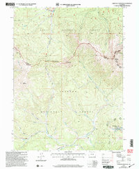
2000 Map of Parkview Mountain
USGS Topo · Published 2004About this map
The Continental Divide crests through this high-altitude landscape where the Rabbit Ears Range separates the drainage basins of the North and South Plattes. This area at the boundary of Jackson and Grand counties shows a complex network of headwaters, including the East Fork Troublesome Creek and Willow Creek. The high peaks of Parkview Mountain and Haystack Mountain dominate the skyline, overseeing a wilderness managed by the Routt and Arapaho national forests.
Find a feature on this map
38 named features on this map. Tap any name to fly to it.
Don’t see what you’re looking for? This feature index may not catch every label — zoom into the map to look around manually.
Map Details
Editions of this 2000 Parkview Mountain Map
This is the sole edition of this map. No revisions or reprints were ever made.
Other maps of this area

1954 · Craig
USGS Topo · 1:250,000

1956 · Radial Mountain
USGS Topo · 1:24,000

1956 · Jack Creek Ranch
USGS Topo · 1:24,000

1956 · Kremmling
USGS Topo · 1:62,500

1956 · Parkview Mountain
USGS Topo · 1:24,000

1956 · Buffalo Peak
USGS Topo · 1:24,000

1956 · Hyannis Peak
USGS Topo · 1:24,000

1956 · Rand
USGS Topo · 1:24,000

1956 · Hyannis Peak
USGS Topo · 1:62,500

1956 · Rand
USGS Topo · 1:62,500