1960s Maps of Las Animas County, Colorado
Explore 11 historic maps of Las Animas County from the 1960s. These maps offer a rare glimpse into what life looked like during the 1960s — showing old roads, neighborhoods, homes, and landmarks that have changed or disappeared over time.
Whether you're researching your family's past, planning a metal detecting trip, or studying how Las Animas County's landscape evolved across the 1960s, these high-resolution maps are a powerful tool for exploring the history of this region.
- Focus on a specific era: All maps on this page are from the 1960s, giving you a focused view of this time period.
- See what’s changed: Compare century-old streets, trails, and buildings to today's modern landscape using overlays and satellite layers.
- Research with precision: Use these maps for genealogy, historical research, land use analysis, or educational projects.
- View, download, or print: Maps are fully viewable online in high resolution, and can be downloaded or printed for your own records.
Start exploring Las Animas County's history through authentic maps from the 1960s. This is your window into the past.
Las Animas County, CO maps
(11)- 1962 Map of Dalhart
 1962 Dalhart1962 Print · USGSThe High Plains and volcanic peaks of the tri-state area are shown in detail during the early sixties. Genealogists and historians can trace the rail corridors of the Fort Worth and Denver and find industrial sites like the Cactus Ordnance Works or the Beaver Meade & Englewood Grain Elevator.
 - 1962 Map of Ash Mountain, 1964 Print
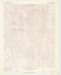
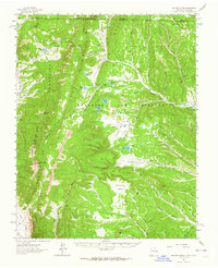 1962 Ash Mountain1964 Print · USGSThe Sangre de Cristo Mountains and the historic Maxwell Land Grant are captured here in the early sixties. Researchers can trace high-altitude ranching and mining history through sites like the Van Lint Mine, Penatlor Ruins, and family-named landmarks like Banning Place.3 unique versions available
 - 1962 Map of Casa Grande, 1965 Print
 1962 Casa Grande1965 Print · USGSThe Maxwell land grant area of Colfax County is shown in the early sixties as a rugged network of ranching camps and old timber routes. Researchers can locate the Catskill (Site), trace the Old Railroad Grade, and find historic Charcoal Kilns.2 unique versions available
 - 1963 Map of Pryor, 1966 Print
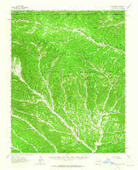
 1963 Pryor1966 Print · USGSThe Huerfano County coal country is captured here in the early sixties as the mining era left its mark on the land. Researchers can trace defunct rail lines and industrial sites like the Hezron Camp (Ruins), Pryor, and the Old Railroad Grade.3 unique versions available
 - 1967 Map of Cucharas Pass, 1970 Print
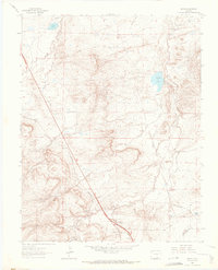
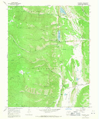
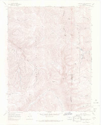
 1967 Cucharas Pass1970 Print · USGSHigh in the Sangre de Cristo foothills in the late sixties, this survey shows the rugged divide between Huerfano and Las Animas counties. Trace old routes across Cucharas Pass or locate high-country landmarks like Parsons Cow Camp and Goemmer Spring.6 unique versions available
 - 1967 Map of Stonewall, 1971 Print
 1967 Stonewall1971 Print · USGSSouthern Colorado's high-country terrain is captured here in the late sixties as the Purgatoire River valley balances ranching and mountain recreation. Researchers can locate family landmarks like Stonewall Cem, the community of Stonewall, and the engineering of Monument Lake.2 unique versions available
 - 1967 Map of Culebra Peak, 1971 Print
 1967 Culebra Peak1971 Print · USGSThe high summits of the Sangre de Cristo Range are captured in the late sixties, showing the remote boundary of Costilla and Las Animas counties. Tracing these peaks reveals isolated landmarks like Culebra Peak, Leandro Lake, and the high basin of Devils Park.2 unique versions available
 - 1967 Map of Torres, 1971 Print
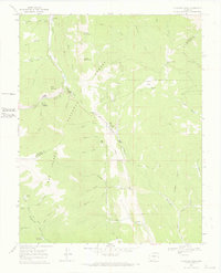
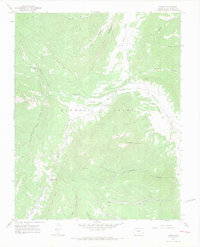 1967 Torres1971 Print · USGSThe South Fork Purgatoire River country of Las Animas County is captured in the late sixties, showing a landscape of mining and high-altitude ranching. Trace local history at Tercio, the Cornell Mine, and the Old Railroad Grade near Tercio Cem.4 unique versions available
 - 1967 Map of El Valle Creek, 1971 Print
 1967 El Valle Creek1971 Print · USGSThe Sangre de Cristo Range and Whiskey Pass define this high Colorado backcountry during the mid-1960s. Genealogists and historians can trace the headwaters of El Valle Creek and navigate the high-altitude Whiskey Pass Road as it crosses the county line.2 unique versions available
 - 1967 Map of Trinchera Peak, 1971 Print
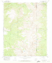
 1967 Trinchera Peak1971 Print · USGSThe Sangre de Cristo Range reaches its heights in the late sixties at the intersection of three Colorado counties. Trace old mountain routes and resource locations including a Mine and several Prospects near landmarks like Trinchera Peak and Blue Lakes.5 unique versions available
 - 1968 Map of La Junta
 1968 La Junta1968 Print · USGSSoutheastern Colorado and the high plains appear in remarkable detail during the late 1960s, showing the intersection of irrigation, ranching, and rail. Genealogists can trace family footprints at the Lycan Post Office, Konantz Cem, and across numerous named cattle ranches.
End of results
Showing maps 1-11 of 11
Top cities of Las Animas County
- Trinidad historical maps
- Aguilar historical maps
- Cokedale historical maps
- Kim historical maps
- Branson historical maps
- Starkville historical maps
Frequently asked questions
- What are the different types of historical maps available for Las Animas County?
- What is the oldest map of Las Animas County?
- Where can I purchase historical maps of Las Animas County for my home or office?
- Where can I download high-res historical maps of Las Animas County?
- Are there historical topographic maps available for Las Animas County?
- Is there historical aerial imagery available for Las Animas County?
- Where are historical maps of Las Animas County sourced from?