1990s Maps of Las Animas County, Colorado
Explore 45 historic maps of Las Animas County from the 1990s. These maps offer a rare glimpse into what life looked like during the 1990s — showing old roads, neighborhoods, homes, and landmarks that have changed or disappeared over time.
Whether you're researching your family's past, planning a metal detecting trip, or studying how Las Animas County's landscape evolved across the 1990s, these high-resolution maps are a powerful tool for exploring the history of this region.
- Focus on a specific era: All maps on this page are from the 1990s, giving you a focused view of this time period.
- See what’s changed: Compare century-old streets, trails, and buildings to today's modern landscape using overlays and satellite layers.
- Research with precision: Use these maps for genealogy, historical research, land use analysis, or educational projects.
- View, download, or print: Maps are fully viewable online in high resolution, and can be downloaded or printed for your own records.
Start exploring Las Animas County's history through authentic maps from the 1990s. This is your window into the past.
Las Animas County, CO maps
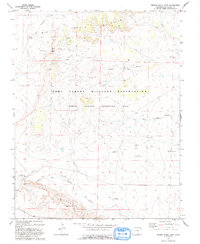
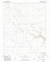
(45)- 1993 Map of Delhi
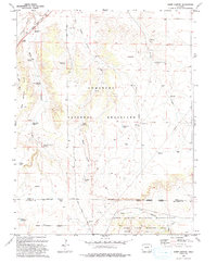
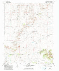
 1993 Delhi1993 Print · USGSThe high plains of the Colorado borderlands are captured here in the early 1990s, where the Santa Fe railroad meets the Comanche National Grassland. Researchers can trace old ranching infrastructure through local landmarks like Barbee Windmill, Hixon Spring, and the small settlement of Delhi.
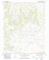
 - 1993 Map of Sheep Canyon
 1993 Sheep Canyon1993 Print · USGSSoutheast Colorado ranching lands and military training grounds converge in the 1990s near the Santa Fe National Historic Trail. Researchers can trace old family ranching legacies through remote landmarks like Mills Well, the Hoffman Windmill, and Kennedy Ponds.
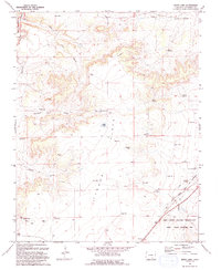
 - 1993 Map of Thatcher
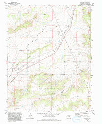 1993 Thatcher1993 Print · USGSLas Animas County in the early nineties reveals a landscape shaped by military maneuvers and deep western history. Trace the path of the Historic Santa Fe National Trail or explore the settlements of Thatcher and Houghton along the Old RR Grade.
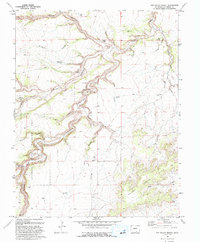
 - 1993 Map of Bloom
 1993 Bloom1993 Print · USGSSoutheast Colorado's high plains reveal a landscape of transit and ranching in the early nineties, where the Historic Santa Fe Trail follows the same path as the railroad. Researchers can trace the small settlement at Bloom or locate family-named landmarks like Cochran Reservoir and Fultz Reservoir.
 - 1993 Map of Stage Canyon
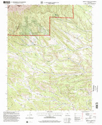
 1993 Stage Canyon1993 Print · USGSThe high plains of Las Animas County are seen here during the early nineties within the Fort Carson Military Reservation. Researchers can trace old routes like Red Rock Road and locate critical water sources such as Stage Spring and Sugarloaf Spring.2 unique versions available
 - 1993 Map of Tyrone
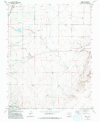
 1993 Tyrone1993 Print · USGSLas Animas County ranchlands are shown here in the early 1990s as the military reservation transformed the local landscape. Genealogists and historians can trace the Santa Fe National Historic Trail and locate the Simpson Cem and Tyrone settlement.
 - 1993 Map of Brown Sheep Camp
 1993 Brown Sheep Camp1993 Print · USGSLas Animas County ranchlands meet military training grounds in the 1990s as the Fort Carson Military Reservation expands. Trace the remote history of the high plains through outposts like Brown Sheep Camp and Burson Camp.
 - 1993 Map of Lockwood Arroyo
 1993 Lockwood Arroyo1993 Print · USGSIn the early nineties, this Las Animas County landscape shows the expansion of the Fort Carson Military Reservation. Researchers can trace the drainage of Lockwood Arroyo and find early sites like Graves.
 - 1993 Map of Bates Lake
 1993 Bates Lake1993 Print · USGSLas Animas County in the early 1990s showcases a landscape shaped by military maneuvers and historic migration routes. Researchers can trace the Santa Fe National Historic Trail or locate remote ranching landmarks like the Smith Ranch Windmill and Poitrey.
 - 1993 Map of Sun Valley Ranch
 1993 Sun Valley Ranch1993 Print · USGSLas Animas County in the early nineties remains a landscape of deep canyons and isolated cattle-ranching infrastructure. Researchers can trace the rugged drainage of the Apishapa River through the Sun Valley Ranch or locate remote water sources like Box Spring and Bruenellie Windmill.
 - 1993 Map of Rock Crossing
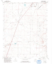
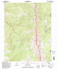
 1993 Rock Crossing1993 Print · USGSThe Piñon Canyon Maneuver Site in Las Animas County is shown here in the 1990s as a vast military training area. You can trace early transit routes and water sources like Pipeline Road, Rock Crossing, and Big Water Arroyo.
 - 1993 Map of Riley Canyon, 1994 Print
 1993 Riley Canyon1994 Print · USGSSoutheastern Colorado canyon country is captured in the 1990s as ranching heritage meets military maneuver grounds. Trace local family history at Martinez Cem and find remote water sources like Antone Spring and River Windmill.
 - 1993 Map of O V Mesa, 1994 Print
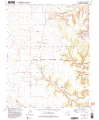
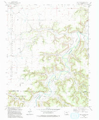
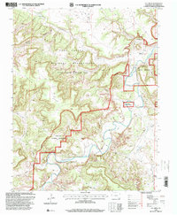
 1993 O V Mesa1994 Print · USGSLas Animas County ranching and military history converge in the early nineties along the Purgatoire River. Trace family footprints at the Rourke Ranch, find the secluded Cem, or locate old water sources like the Cistern Windmill.
 - 1993 Map of Model, 1994 Print
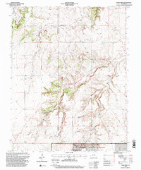
 1993 Model1994 Print · USGSThe high plains of Las Animas County come into focus in the early nineties, showing a landscape defined by arroyos and ranching. Genealogists and historians can trace the course of the Purgatoire River and locate Model and the landmark Fishers Crossing.
 - 1993 Map of Packers Gap, 1994 Print
 1993 Packers Gap1994 Print · USGSSoutheast Colorado in the early nineties is revealed as a landscape of federal land management and deep canyon systems. Researchers can trace the varied terrain from Packers Gap to the military training grounds of the Fort Carson Military Reservation.
 - 1994 Map of Trinchera Peak, 1998 Print
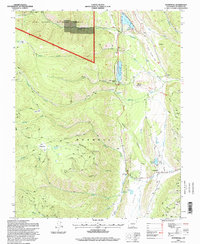
 1994 Trinchera Peak1998 Print · USGSThe Sangre De Cristo Range stands as a massive barrier in the 1990s, where high-altitude peaks meet the edge of the Cuchara Valley. Genealogists and hikers can trace the Indian Creek Trail, locate remote Mine sites, and explore the geography of the Cuchara Valley Ski Area.
 - 1994 Map of Stonewall, 1998 Print
 1994 Stonewall1998 Print · USGSThe Stonewall Valley of the 1990s shows a landscape of high-country water management and mountain ranching. Researchers can trace the Maxwell Grant Boundary and locate the Stonewall Cem near Stonewall Gap.
 - 1994 Map of El Valle Creek, 1998 Print
 1994 El Valle Creek1998 Print · USGSThe high peaks of the Sangre de Cristos are captured here in the 1990s, where the county line divides Costilla and Las Animas. Backcountry travelers can trace the Whiskey Pass Road toward Whiskey Pass or locate remote alpine waters like Lost Lake and Strawberry Lake.
 - 1994 Map of Cucharas Pass, 2001 Print
 1994 Cucharas Pass2001 Print · USGSHigh mountain passes and national forest boundaries define this portion of the Sangre de Cristo range in the mid-1990s. Researchers can trace alpine trails and drainage systems around Cuchara, including the Cuchara Valley Ski Area, Cordova Pass, and the Peaks Trail.
 - 1994 Map of Spanish Peaks, 2001 Print
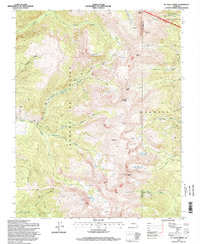
 1994 Spanish Peaks2001 Print · USGSThe peaks and high canyons of the San Isabel National Forest define this landscape in the mid-1990s. Researchers can locate remote landmarks like the Wahatoya School, the Bullseye Mine, and the impressive Big Wall formation.
 - 1994 Map of Herlick Canyon, 2001 Print
 1994 Herlick Canyon2001 Print · USGSSouthern Colorado in the mid-1990s reveals a landscape of high-altitude drainages and canyons within the national forest. Researchers can trace local lineage at Prince Cemetery and Hicks Cemetery or find the remote Aspen Grove Sch.
 - 1995 Map of The Wall, 1997 Print
 1995 The Wall1997 Print · USGSNorthern New Mexico and the Colorado borderland are shown in the mid-nineties, featuring the intersection of historic land grants and national forest. Researchers can trace remote mountain outposts like Bernal Cabin, the Van Diest Mine, and landmarks like Vermejo Peak.
 - 1996 Map of Table Mesa, 2000 Print
 1996 Table Mesa2000 Print · USGSSoutheast Colorado in the late twentieth century remains a landscape of deep canyons and historic pathways along the Las Animas and Baca County border. Historians can trace the Santa Fe National Historic Trail and locate family landmarks like Robb Sch and the Robb Cem.
 - 1996 Map of O V Mesa, 2000 Print
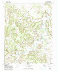
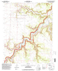
 1996 O V Mesa2000 Print · USGSThe Purgatoire River canyons and mesas of Las Animas County appear here in the mid-1990s as the landscape shifted toward military training and national grasslands. Researchers can locate the historic Rourke Ranch and trace vital water sources like Pameña Windmill and the Cistern Windmill.
 - 1996 Map of Doss Canyon North, 2000 Print
 1996 Doss Canyon North2000 Print · USGSLas Animas County at the close of the twentieth century was a landscape of specialized federal use and deep river canyons. Genealogists and researchers can trace the boundaries of the Comanche National Grassland and the vast Fort Carson Military Reservation along the winding Purgatoire River.
Showing maps 1-25 of 45
Top cities of Las Animas County
- Trinidad historical maps
- Aguilar historical maps
- Cokedale historical maps
- Kim historical maps
- Branson historical maps
- Starkville historical maps
Frequently asked questions
- What are the different types of historical maps available for Las Animas County?
- What is the oldest map of Las Animas County?
- Where can I purchase historical maps of Las Animas County for my home or office?
- Where can I download high-res historical maps of Las Animas County?
- Are there historical topographic maps available for Las Animas County?
- Is there historical aerial imagery available for Las Animas County?
- Where are historical maps of Las Animas County sourced from?