Old Maps of Las Animas County, Colorado for Academic Research
Study the evolution of Las Animas County with 800 high-resolution historic maps. Whether you're teaching, researching, or modeling changes in land use, these maps provide essential visual documentation of urban, environmental, and geographic change.
- Analyze long-term change: Track patterns in development, transportation, and natural features.
- Ideal for environmental or urban studies: Support academic projects with primary historical map data.
- Use in the classroom or lab: Educators and researchers rely on these maps to bring historical context to life.
These maps are a powerful tool for teaching, research, and visualizing how Las Animas County has changed over the decades.
Las Animas County, CO maps
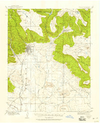
(800)- 1891 Map of Walsenburg
 1891 Walsenburg1891 Print · USGSHuerfano County in the early 1890s was a landscape shaped by coal and steam as the Denver and Rio Grande Railroad expanded through the region. Genealogists and historians can trace early settlements and junctions like Walsenburg, Rouse, and Cuchara Junction.
 - 1891 Map of Higbee
 1891 Higbee1891 Print · USGSSoutheastern Colorado’s high plains and canyon country are captured in the late 1880s, showcasing a frontier landscape. Trace early water sources like Alkali Springs and follow the deep cuts of Smith Canon near the isolated outpost of Higbee.
 - 1891 Map of Spanish Peaks
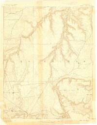
 1891 Spanish Peaks1891 Print · USGSLas Animas county at the end of the nineteenth century was a rugged landscape of new rail lines and river settlements. Genealogists and historians can trace the early footprints of Trinidad, the path of the Denver Texas and Fort Worth Railroad, and canyon outposts like Starkville and Sopris.2 unique versions available
 - 1891 Map of Timpas
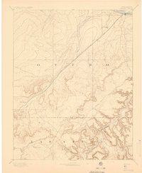
 1891 Timpas1891 Print · USGSHigh plains ranching and steam-era railroading dominate this Otero County landscape during the late 1800s. Genealogists and researchers can trace the historic route of the Atchison Topeka and Santa Fe Railroad through early stops at Timpas and Iron Springs.
 - 1891 Map of Apishapa
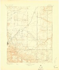
 1891 Apishapa1891 Print · USGSSoutheastern Colorado was a land of high mesas and vital rail connections in the 1890s. Genealogists and historians can trace early rail stops like Thatcher and Delhi along the Atchison Topeka and Santa Fe Railroad.
 - 1891 Map of Mesa De Maya
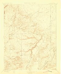
 1891 Mesa De Maya1891 Print · USGSLas Animas County ranching country appears here in the early 1890s as a landscape of deep rimrock canyons and isolated mesas. Trace early settlements like Indianapolis and Troy or the route of the Denver Texas & Ft Worth railroad near Watervale.
 - 1892 Map of Elmoro
 1892 Elmoro1892 Print · USGSThe high plains of southern Colorado meet the mesa country in the late nineteenth century, just as the regional rail network was expanding. Genealogists and historians can trace early settlements like Elmoro, Barela, and Trinidad along the Atchison Topeka and Santa Fe Railroad.
 - 1892 Map of Mt Carrizo
 1892 Mt Carrizo1892 Print · USGSSoutheastern Colorado in the early 1890s remained a landscape of high mesas and vital water holes. Historians can trace the original topography of Las Animas and Baca counties, locating critical sites like Carrizo Springs and Willow Spring.7 unique versions available
 - 1893 Map of Higbee
 1893 Higbee1893 Print · USGSSoutheastern Colorado’s canyon country is documented in the 1890s at the meeting point of Otero, Bent, and Las Animas counties. Genealogists and historians can trace early ranching footprints at JJ Ranch, the settlement at Higbee, and landmarks like Alkali Springs.6 unique versions available
 - 1893 Map of Spanish Peaks
 1893 Spanish Peaks1893 Print · USGSSouthern Colorado was a land of expanding rail and river commerce in the late nineteenth century. Genealogists and historians can trace the early footprints of Trinidad and mountain outposts like Starkville, Morley, and Schultze Plaza.2 unique versions available
 - 1893 Map of Apishapa
 1893 Apishapa1893 Print · USGSThe Colorado high plains of the 1890s are defined here by the winding Apishapa River and the arrival of steam power. Trace the early rail stops at Thatcher and Delhi or locate the distinctive volcanic landmarks of the Rattlesnake Buttes.
 - 1893 Map of Elmoro
 1893 Elmoro1893 Print · USGSSouthern Colorado at the dawn of the 1890s was a land of expanding rails and river valley settlements. Genealogists and historians can trace early railroad lines like the D. & R. G. R. R. and locate vanished stopovers at Tyrone, Earl, or the canyon town of Barela.
 - 1893 Map of Mesa de Maya
 1893 Mesa de Maya1893 Print · USGSSoutheast Colorado at the end of the nineteenth century was a frontier of canyonlands and high mesas shaped by the Purgatoire River. Genealogists can trace early settlements like Troy and Indianapolis alongside the route of the Denver Texas & Ft. Worth R. R.6 unique versions available
 - 1894 Map of Timpas
 1894 Timpas1894 Print · USGSSoutheast Colorado in the late nineteenth century was a rugged landscape defined by the transition from river valleys to high plateaus. Genealogists and historians can trace the early rail stops at Benton and Iron Springs or follow the route of the Santa Fe Trail through Packers Gap.5 unique versions available
 - 1894 Map of Walsenburg
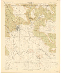
 1894 Walsenburg1894 Print · USGSWalsenburg and the surrounding coal country are captured in the late nineteenth century as the rail network expanded. Map collectors and genealogists can trace early railroad settlements like Cuchara Junction and industrial sites including the Rouse Mines and Tioga.
 - 1895 Map of Spanish Peaks, 1961 Print
 1895 Spanish Peaks1961 Print · USGSSouthern Colorado at the close of the nineteenth century was a land of high peaks and industrial transition. Genealogists can trace family names through traditional plazas like Trujillo Plaza or follow the early rail stops at Ludlow, Sopris, and Aguilar.
 - 1897 Map of Walsenburg
 1897 Walsenburg1897 Print · USGSSouthern Colorado at the close of the century reveals a landscape of expanding railroads and coal settlements. Genealogists and historians can trace the early rail stops and mining camps of Walsenburg, Pictou, and Rouse along the DENVER AND RIO GRANDE R. R. network.4 unique versions available
 - 1897 Map of Elmoro
 1897 Elmoro1897 Print · USGSLas Animas County at the turn of the century shows a landscape defined by the arrival of major railroads. Trace the development of Trinidad and Elmoro, along with early rural centers like Trinchera Plaza and the Brazil P.O. near the Maxwell Grant.5 unique versions available
 - 1897 Map of Spanish Peaks
 1897 Spanish Peaks1897 Print · USGSLas Animas County was a hub of mining and rail activity in the late nineteenth century as the industrial frontier pushed into the canyons. Genealogists and historians can trace early settlements like Trujillo Plaza and mining camps at Ludlow and Berwind.5 unique versions available
 - 1897 Map of Apishapa
 1897 Apishapa1897 Print · USGSSoutheastern Colorado appears here during the cattle-ranching era of the late nineteenth century. Researchers can trace the legacy of early western transit along the Santa Fe Trail or locate family landmarks like the Baca Ranch and Thatcher.4 unique versions available
 - 1900 Map of Spanish Peaks
 1900 Spanish Peaks1900 Print · USGSSouthern Colorado at the turn of the century is a landscape of high peaks, Spanish land grants, and booming coal towns. Genealogists can trace family roots through traditional plazas like Trujillo Plaza or industrial centers like Aguilar and Starkville.
 - 1900 Map of Walsenburg
 1900 Walsenburg1900 Print · USGSSouthern Colorado at the turn of the century shows a landscape being transformed by the arrival of the Denver and Rio Grande RR. Genealogists and historians can trace early settlements and transit points like Huerfano Sta. (Ute P.O.), the coal town of Rouse, and the landmark Huerfano Butte.
 - 1912 Map of Raton, 1958 Print
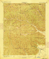
 1912 Raton1958 Print · USGSRaton and the high mesas of the Colorado-New Mexico border are captured here just as the railroad era reached its peak. Researchers can trace the early industrial landscape of coal towns like Gardiner and Blossburg or locate the historic Clifton House and Raton Tunnel.2 unique versions available
 - 1914 Map of Raton
 1914 Raton1914 Print · USGSRaton served as a vital mountain gateway during the early twentieth century as railroads and early highways crested the Colorado border. Researchers can trace the industrial spurs of the Wagon Mine or locate vanished stops like Blossburg, Gardiner, and Clifton House.5 unique versions available
 - 1915 Map of Brilliant
 1915 Brilliant1915 Print · USGSColfax County, New Mexico, was a hub of coal and rail activity in the years before the Great War. Researchers can trace the spur lines of the Atchison Topeka and Santa Fe into mining camps like Brilliant and Van Houten.3 unique versions available
Showing maps 1-25 of 800
Top cities of Las Animas County
- Trinidad historical maps
- Aguilar historical maps
- Cokedale historical maps
- Kim historical maps
- Branson historical maps
- Starkville historical maps
Frequently asked questions
- What are the different types of historical maps available for Las Animas County?
- What is the oldest map of Las Animas County?
- Where can I purchase historical maps of Las Animas County for my home or office?
- Where can I download high-res historical maps of Las Animas County?
- Are there historical topographic maps available for Las Animas County?
- Is there historical aerial imagery available for Las Animas County?
- Where are historical maps of Las Animas County sourced from?