1970s Maps of Kim, Colorado
Explore 2 historic maps of Kim from the 1970s. These maps offer a rare glimpse into what life looked like during the 1970s — showing old roads, neighborhoods, homes, and landmarks that have changed or disappeared over time.
Whether you're researching your family's past, planning a metal detecting trip, or studying how Kim's landscape evolved across the 1970s, these high-resolution maps are a powerful tool for exploring the history of this region.
- Focus on a specific era: All maps on this page are from the 1970s, giving you a focused view of this time period.
- See what’s changed: Compare century-old streets, trails, and buildings to today's modern landscape using overlays and satellite layers.
- Research with precision: Use these maps for genealogy, historical research, land use analysis, or educational projects.
- View, download, or print: Maps are fully viewable online in high resolution, and can be downloaded or printed for your own records.
Start exploring Kim's history through authentic maps from the 1970s. This is your window into the past.
Kim, CO maps
(2)- 1978 Map of Kim South, 1979 Print
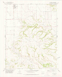 1978 Kim South1979 Print · USGSThe high plains of Las Animas County meet the rugged breaks of the canyonlands during the late 1970s. Local historians can trace the settlement at Kim or locate remote burial sites like Troy Cem near the banks of West Carrizo Creek.
 - 1979 Map of Kim North
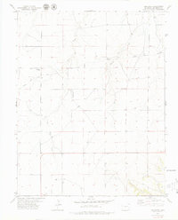 1979 Kim North1979 Print · USGSLas Animas County during the late 1970s reveals a vast ranching landscape shaped by high plains watercourses. Genealogists and historians can trace the diagonal path of the Santa Fe Trail or locate the Edenview Cem and the small community of Kim.
End of results
Showing maps 1-2 of 2
Frequently asked questions
- What are the different types of historical maps available for Kim?
- What is the oldest map of Kim?
- Where can I purchase historical maps of Kim for my home or office?
- Where can I download high-res historical maps of Kim?
- Are there historical topographic maps available for Kim?
- Is there historical aerial imagery available for Kim?
- Where are historical maps of Kim sourced from?