1960s Maps of Montezuma County, Colorado
Explore 46 historic maps of Montezuma County from the 1960s. These maps offer a rare glimpse into what life looked like during the 1960s — showing old roads, neighborhoods, homes, and landmarks that have changed or disappeared over time.
Whether you're researching your family's past, planning a metal detecting trip, or studying how Montezuma County's landscape evolved across the 1960s, these high-resolution maps are a powerful tool for exploring the history of this region.
- Focus on a specific era: All maps on this page are from the 1960s, giving you a focused view of this time period.
- See what’s changed: Compare century-old streets, trails, and buildings to today's modern landscape using overlays and satellite layers.
- Research with precision: Use these maps for genealogy, historical research, land use analysis, or educational projects.
- View, download, or print: Maps are fully viewable online in high resolution, and can be downloaded or printed for your own records.
Start exploring Montezuma County's history through authentic maps from the 1960s. This is your window into the past.
Montezuma County, CO maps
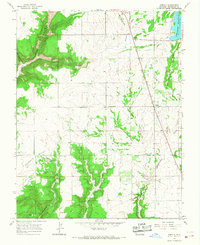
(46)- 1960 Map of Elk Creek, 1962 Print
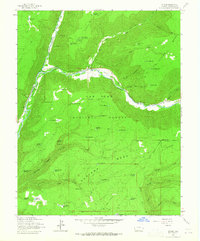
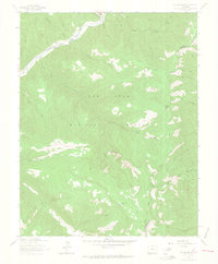
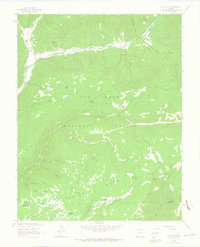
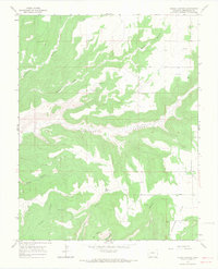
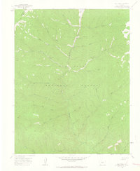 1960 Elk Creek1962 Print · USGSLa Plata County during the early 1960s remains a wilderness of remote forest and rugged drainage basins. Researchers can trace the high-country paths of the High Line Trail, the meadows of Hermosa Park, and the course of Hermosa Creek.5 unique versions available
 - 1960 Map of Hermosa Peak, 1962 Print
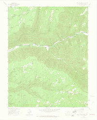
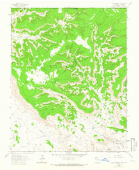
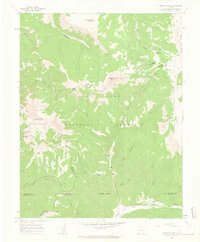 1960 Hermosa Peak1962 Print · USGSHigh in the Rico Mountains during the early sixties, this area shows the intersection of four Colorado counties amid mining and forest lands. Researchers can trace historic extraction sites like the Spanish King No 1 Mine and navigate through Bolam Pass or Tin Can Basin.4 unique versions available
 - 1960 Map of Rico, 1963 Print
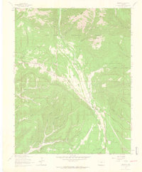
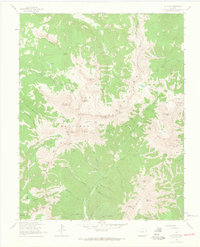
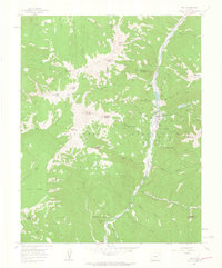 1960 Rico1963 Print · USGSRico and the upper Dolores River valley appear here in the early sixties, highlighting a landscape defined by mining and mountain transit. Genealogists and historians can trace old operations like the Enterprise Mine and the winding path of the Old Railroad Grade.4 unique versions available
 - 1961 Map of Durango
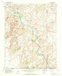
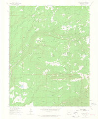
 1961 Durango1961 Print · USGSThe high San Juan country in the early sixties is shown here as a network of historic mining towns and early reservoir projects. Genealogists and researchers can trace the Denver & Rio Grande Western RR as it connects Durango, Silverton, and Arboles.
 - 1962 Map of Cortez
 1962 Cortez1962 Print · USGSThe Four Corners region comes alive in the early sixties, showing a landscape defined by reservation lands and federal forests. Trace the route of the Rio Grande Southern RR or locate the Uranium and vanadium mines near Monticello.
 - 1962 Map of Aneth, 1964 Print
 1962 Aneth1964 Print · USGSThe Four Corners region in the early sixties reveals a landscape where ancient history and modern industry meet along the San Juan River. Genealogists and historians can trace indigenous heritage and early infrastructure through features like the Aneth settlement, Cliff Dwellings, and the Navajo Trail.
 - 1963 Map of Durango
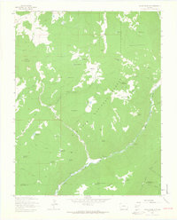
 1963 Durango1963 Print · USGSThe San Juan Mountains and San Luis Valley are captured here in the early 1950s as mining, rail, and tribal lands shaped the region. Researchers can trace the Denver & Rio Grande Western RR through high-country towns like Telluride and Silverton, or locate landmarks such as the Asiatic Mine.
 - 1963 Map of Stoner, 1964 Print
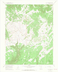
 1963 Stoner1964 Print · USGSMontezuma County's high forest plateaus are captured here in the early sixties, showing a landscape defined by timber, water, and early recreation. You can trace the Old RR Grade along the river or locate seasonal landmarks like the Stoner Ski Area and Stoner Guard Station.4 unique versions available
 - 1963 Map of Wallace Ranch, 1965 Print
 1963 Wallace Ranch1965 Print · USGSMontezuma County ranching and water management are front and center in this mid-century survey of the San Juan National Forest. Researchers can trace old stock routes and livestock landmarks like Wallace Ranch, Circle K Ranch, and the Highline Driveway.4 unique versions available
 - 1963 Map of Hesperus, 1965 Print
 1963 Hesperus1965 Print · USGSIn the high San Juan Mountains during the early 1960s, this landscape shows a deep history of mining and water engineering. You can trace old transit lines like the Old Railroad Grade and locate mining sites such as the Bay City Mine and Pioneer Mine.4 unique versions available
 - 1963 Map of Rampart Hills, 1965 Print
 1963 Rampart Hills1965 Print · USGSMontezuma County high country is mapped here in the early sixties, showing a landscape defined by timber, mining, and mountain water management. Researchers can locate the Red Arrow Mine, the Sheek Cem, and the Jersey Jim Lookout Tower.3 unique versions available
 - 1963 Map of Orphan Butte, 1965 Print
 1963 Orphan Butte1965 Print · USGSMontezuma and La Plata counties are mapped here during the early sixties, showing a high-country landscape of stock driveways and timbered ridges. Researchers can trace the Old Railroad Grade along the Dolores River and locate historic points like Truelson Ranch and Grindstone Lake.6 unique versions available
 - 1963 Map of Thompson Park, 1965 Print
 1963 Thompson Park1965 Print · USGSThe La Plata Mountains and San Juan National Forest define this rugged landscape in the early sixties. Researchers can trace early infrastructure and community sites like the Old Railroad Grade, Thompson Park Sch, and Thompson Park Cem.3 unique versions available
 - 1963 Map of La Plata, 1965 Print
 1963 La Plata1965 Print · USGSThe high peaks of the San Juan Mountains are documented here in the early 1960s, showing a landscape defined by mining exploration and national forest management. Researchers can trace historic operations like the Gold King Mill, Tomahawk Mine, and Columbus Mine.5 unique versions available
 - 1963 Map of Nipple Mountain, 1965 Print
 1963 Nipple Mountain1965 Print · USGSThe high country of the San Juan National Forest comes into focus during the early sixties, showing a landscape of river-fed canyons and ranching outposts. Trace family history or old trails near King Ranch, Cottonwood Guard Station, and the many reservoirs dotting Stoner Mesa.4 unique versions available
 - 1963 Map of Clyde Lake, 1965 Print
 1963 Clyde Lake1965 Print · USGSHigh country ranching and forestry define this Colorado landscape in the early sixties, as seen through the river valleys and timbered mesas. Researchers can trace historic pack routes like the Johnny Bull Trail and locate family holdings such as Miller Ranch and Cesto Ranch.4 unique versions available
 - 1963 Map of Heifer Point, 1966 Print
 1963 Heifer Point1966 Print · USGSThe Colorado and New Mexico borderlands come alive in the early sixties, showing a landscape defined by ancestral tribal lands and modern energy exploration. Researchers can find Ruins near Picket Canyon and trace water sources like Navajo Spring.2 unique versions available
 - 1965 Map of Cahone, 1967 Print
 1965 Cahone1967 Print · USGSThe high plateau of Dolores County is captured here in the mid-sixties as the community of Cahone sits at a vital crossroads. Genealogists and local historians can locate the Cahone Sch, the Cahone Ch, and tracing the rugged path of Cross Canyon.2 unique versions available
 - 1965 Map of Willow Spring, 1967 Print
 1965 Willow Spring1967 Print · USGSThe Dolores and Montezuma county line in the mid-1960s is defined by a dense network of upland water reservoirs and ranching infrastructure. Researchers can trace the path of the Old Railroad Grade or locate historic sites like the Willow Spring Guard Station and Sagebrush Spring.2 unique versions available
 - 1965 Map of Woods Canyon, 1967 Print
 1965 Woods Canyon1967 Print · USGSMontezuma County in the mid-sixties reveals a landscape of deep history and high-desert terrain. Researchers can locate numerous Indian Ruins and trace the paths of Yellowjacket Canyon, Moqui Lake, and early Oil Well sites.4 unique versions available
 - 1965 Map of Cortez, 1967 Print
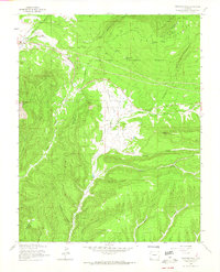
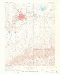 1965 Cortez1967 Print · USGSMontezuma County centers on the growing city of Cortez in the mid-sixties, where the agricultural valley meets the high mesas. Researchers can trace the town’s schools and landmarks or locate archaeological sites like Indian Ruins and Cliff Dwellings.3 unique versions available
 - 1965 Map of Dolores East, 1967 Print
 1965 Dolores East1967 Print · USGSIn the mid-1960s, the area east of Dolores showcases a high-altitude landscape transitioning from early rail commerce to a heavy reliance on irrigation. Researchers can trace the Old Railroad Grade and locate local landmarks like the East Lakeview Sch and Sunset Memorial Gardens (Cemetery).2 unique versions available
 - 1965 Map of Dolores West, 1968 Print
 1965 Dolores West1968 Print · USGSMontezuma County's agricultural and irrigation network is documented here in the mid-1960s, showing the town of Dolores and the high mesa settlements. Researchers can trace the Old RR Grade, locate family sites at Lebanon Cem, and find Mildred Sch or Lakeview Sch.2 unique versions available
 - 1965 Map of Yellow Jacket, 1968 Print
 1965 Yellow Jacket1968 Print · USGSMontezuma County at the height of the mid-sixties reveals a landscape defined by deep draws and the winding course of the Dolores River. Genealogists can locate family landmarks like Fairview Cem, Emmanuel Ch, and the rural community of Yellow Jacket.4 unique versions available
 - 1965 Map of Arriola, 1968 Print
 1965 Arriola1968 Print · USGSMontezuma County's high-plateau landscape in the mid-sixties reveals a fascinating layering of ancient sites and modern irrigation. Genealogists and historians can trace the foundations of Arriola, locate Indian Ruins near the Goodman Point Cem, or study the Narraguinnep Reservoir system.3 unique versions available
Showing maps 1-25 of 46
Top cities of Montezuma County
Frequently asked questions
- What are the different types of historical maps available for Montezuma County?
- What is the oldest map of Montezuma County?
- Where can I purchase historical maps of Montezuma County for my home or office?
- Where can I download high-res historical maps of Montezuma County?
- Are there historical topographic maps available for Montezuma County?
- Is there historical aerial imagery available for Montezuma County?
- Where are historical maps of Montezuma County sourced from?