1970s Maps of Montezuma County, Colorado
Explore 9 historic maps of Montezuma County from the 1970s. These maps offer a rare glimpse into what life looked like during the 1970s — showing old roads, neighborhoods, homes, and landmarks that have changed or disappeared over time.
Whether you're researching your family's past, planning a metal detecting trip, or studying how Montezuma County's landscape evolved across the 1970s, these high-resolution maps are a powerful tool for exploring the history of this region.
- Focus on a specific era: All maps on this page are from the 1970s, giving you a focused view of this time period.
- See what’s changed: Compare century-old streets, trails, and buildings to today's modern landscape using overlays and satellite layers.
- Research with precision: Use these maps for genealogy, historical research, land use analysis, or educational projects.
- View, download, or print: Maps are fully viewable online in high resolution, and can be downloaded or printed for your own records.
Start exploring Montezuma County's history through authentic maps from the 1970s. This is your window into the past.
Montezuma County, CO maps
(9)- 1972 Map of Cortez SW
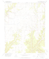
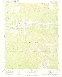
 1972 Cortez SW1972 Print · USGSMontezuma County at the dawn of the seventies reveals a landscape of high-desert canyons and developing infrastructure. Researchers can trace ancestral sites near Yucca House National Monument and the early layout of the Montezuma County Airport and Hogan.
 - 1978 Map of Champagne Spring, 1979 Print
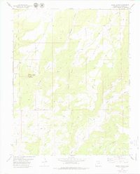
 1978 Champagne Spring1979 Print · USGSHigh mesa country on the Dolores and Montezuma County line comes into focus in the late 1970s. Trace the deep drainages of Squaw Canyon and Cross Canyon, find the namesake Champagne Spring, and locate early industrial markers like the Gravel Pit.
 - 1979 Map of Negro Canyon
 1979 Negro Canyon1979 Print · USGSMontezuma County's high desert landscape is documented here in the late seventies, showing where ancient sites meet modern ranching. Researchers can locate the Cutthroat Castle Group Ruins near Cajon Mesa and trace several primitive trails through Negro Canyon.2 unique versions available
 - 1979 Map of Bowdish Canyon
 1979 Bowdish Canyon1979 Print · USGSMontezuma County remained a landscape of high mesas and deep canyons during the late 1970s. Trace old travel routes and tribal boundaries through Cannon Ball Mesa, the Ute Mountain Indian Reservation, and along Mc Elmo Creek.2 unique versions available
 - 1979 Map of Mariano Wash East
 1979 Mariano Wash East1979 Print · USGSMontezuma County, Colorado, is shown in the late seventies as a landscape centered on the Ute Mountain Indian Reservation. Researchers can trace spiritual and geographical landmarks like the Sun Dance Ground and the distinct profile of Sleeping Ute Mountain.
 - 1979 Map of Mud Creek
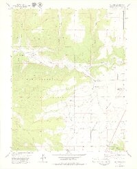 1979 Mud Creek1979 Print · USGSThe high desert of Montezuma County is captured here in the late seventies, showing the vital irrigation network of the Montezuma Valley. Researchers can trace tribal boundaries on the Ute Mountain Indian Reservation and locate local landmarks like Majors Cem and Yucca House Nat Mon.2 unique versions available
 - 1979 Map of Mariano Wash West
 1979 Mariano Wash West1979 Print · USGSMontezuma County in the late seventies is captured here as a landscape of reservation lands and desert drainage systems. Researchers can trace the paths of McElmo Creek and Mariano Wash or locate specific points of interest like a Well and Drill Hole.
 - 1979 Map of Battle Rock
 1979 Battle Rock1979 Print · USGSMontezuma County is shown in the late seventies as a landscape of deep canyons and reservation lands. Genealogists and historians can locate the Battle Rock Sch, the Lamb Cem, and trace resource sites like the Dry Ice Plant.2 unique versions available
 - 1979 Map of Ruin Canyon
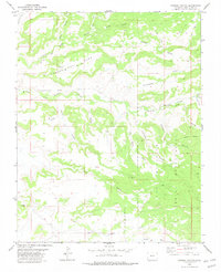
 1979 Ruin Canyon1979 Print · USGSThe high mesas of Montezuma and Dolores counties are captured here in the late seventies, showing a landscape shaped by ancient history and modern energy. Genealogists and historians can locate Sylvan Cem, the Lowry Pueblo Ruins, and rural outposts like Heaton.
End of results
Showing maps 1-9 of 9
Top cities of Montezuma County
Frequently asked questions
- What are the different types of historical maps available for Montezuma County?
- What is the oldest map of Montezuma County?
- Where can I purchase historical maps of Montezuma County for my home or office?
- Where can I download high-res historical maps of Montezuma County?
- Are there historical topographic maps available for Montezuma County?
- Is there historical aerial imagery available for Montezuma County?
- Where are historical maps of Montezuma County sourced from?