1960s Maps of Morgan County, Colorado
Explore 11 historic maps of Morgan County from the 1960s. These maps offer a rare glimpse into what life looked like during the 1960s — showing old roads, neighborhoods, homes, and landmarks that have changed or disappeared over time.
Whether you're researching your family's past, planning a metal detecting trip, or studying how Morgan County's landscape evolved across the 1960s, these high-resolution maps are a powerful tool for exploring the history of this region.
- Focus on a specific era: All maps on this page are from the 1960s, giving you a focused view of this time period.
- See what’s changed: Compare century-old streets, trails, and buildings to today's modern landscape using overlays and satellite layers.
- Research with precision: Use these maps for genealogy, historical research, land use analysis, or educational projects.
- View, download, or print: Maps are fully viewable online in high resolution, and can be downloaded or printed for your own records.
Start exploring Morgan County's history through authentic maps from the 1960s. This is your window into the past.
Morgan County, CO maps
(11)- 1961 Map of Greeley
 1961 Greeley1961 Print · USGSNorthern Colorado's transition from high mountain peaks to irrigated plains is captured here just as the post-war population boom reached the Front Range. Researchers can trace early water infrastructure and rail lines like the Great Western RR connecting sugar beet hubs from Fort Collins to Greeley.
 - 1963 Map of Lamb, 1965 Print
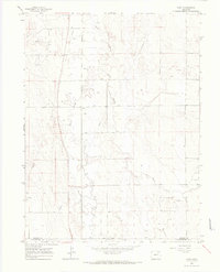
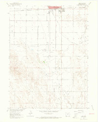 1963 Lamb1965 Print · USGSFort Morgan and the surrounding plains are captured in the early sixties as a center of oil production and irrigation. Researchers can trace the extensive Fort Morgan Oil Field, the route of the Old Old Road, and the siding at Moseley.3 unique versions available
 - 1963 Map of Round Top, 1965 Print
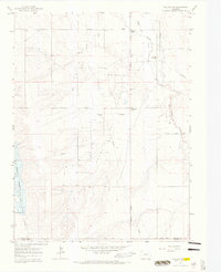
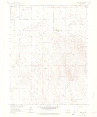 1963 Round Top1965 Print · USGSNortheast Colorado in the early sixties was defined by a mix of high plains ranching and a growing energy sector. Trace the historic route of the Chicago Burlington and Quincy railroad and the Allen Oil Field pipelines.2 unique versions available
 - 1963 Map of Vallery, 1965 Print
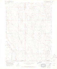
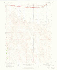 1963 Vallery1965 Print · USGSThe Morgan County plains are captured here in the early sixties during a period of peak petroleum development. Trace the intersection of energy and transport along the Chicago Burlington and Quincy rail line, the historic Old Dld Road, and the sprawling Vallery Oil Field.3 unique versions available
 - 1963 Map of Adena, 1965 Print
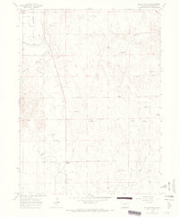
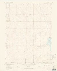 1963 Adena1965 Print · USGSThe high plains of Morgan and Adams counties are captured in the early sixties, centered on the rural community of Adena. Researchers can trace old family footprints near the Adena Union Ch and early energy infrastructure like Oil Well sites.4 unique versions available
 - 1964 Map of Greeley
 1964 Greeley1964 Print · USGSThe Front Range corridor and high peaks of the Rockies appear here in the mid-1960s, showing the intersection of mountain wilderness and plains agriculture. Trace the rail routes of the Great Western RR or locate landmarks like Longs Peak and Horsetooth Reservoir.
 - 1965 Map of Greeley
 1965 Greeley1965 Print · USGSNorthern Colorado in the mid-sixties shows a landscape defined by high mountain summits and the growing irrigation networks of the plains. Genealogists and historians can trace rail-side towns like Wellington or follow the early tracks of the Union Pacific Railroad past Longs Peak.
 - 1965 Map of Gary, 1967 Print
 1965 Gary1967 Print · USGSMorgan County and Washington County meet on the high plains during the mid-sixties, an era of expanding water and oil infrastructure. Genealogists and historians can trace the small settlements of Gary and Stivers alongside the winding Beaver Creek.2 unique versions available
 - 1965 Map of Vallery SE, 1967 Print
 1965 Vallery SE1967 Print · USGSMorgan and Adams counties come into focus during the mid-1960s as the local economy balanced ranching with energy production. Researchers can trace the legacy of the Adena Field through features like the Gasoline Plant, Adena Sch, and Adena Station.3 unique versions available
 - 1965 Map of Huey Ranch, 1967 Print
 1965 Huey Ranch1967 Print · USGSEastern Colorado ranching and oil extraction meet on the high plains in the mid-1960s. Researchers can trace family-named landmarks like Huey Ranch and Rediess Ranch or the industrial footprint of the Sand River Oil Field.3 unique versions available
 - 1965 Map of Miller Ranch, 1967 Print
 1965 Miller Ranch1967 Print · USGSMorgan County ranching and irrigation are captured here in the mid-1960s, showing a landscape defined by water rights and family-named landmarks. Researchers can locate specific sites like Miller Ranch, Ninemile Corner, and the Zorichak Oil Field.3 unique versions available
End of results
Showing maps 1-11 of 11
Top cities of Morgan County
- Fort Morgan historical maps
- Brush historical maps
- Log Lane Village historical maps
- Wiggins historical maps
- Morgan Heights historical maps
- Hillrose historical maps
See more
Frequently asked questions
- What are the different types of historical maps available for Morgan County?
- What is the oldest map of Morgan County?
- Where can I purchase historical maps of Morgan County for my home or office?
- Where can I download high-res historical maps of Morgan County?
- Are there historical topographic maps available for Morgan County?
- Is there historical aerial imagery available for Morgan County?
- Where are historical maps of Morgan County sourced from?