1950s Maps of Park County, Colorado
Explore 48 historic maps of Park County from the 1950s. These maps offer a rare glimpse into what life looked like during the 1950s — showing old roads, neighborhoods, homes, and landmarks that have changed or disappeared over time.
Whether you're researching your family's past, planning a metal detecting trip, or studying how Park County's landscape evolved across the 1950s, these high-resolution maps are a powerful tool for exploring the history of this region.
- Focus on a specific era: All maps on this page are from the 1950s, giving you a focused view of this time period.
- See what’s changed: Compare century-old streets, trails, and buildings to today's modern landscape using overlays and satellite layers.
- Research with precision: Use these maps for genealogy, historical research, land use analysis, or educational projects.
- View, download, or print: Maps are fully viewable online in high resolution, and can be downloaded or printed for your own records.
Start exploring Park County's history through authentic maps from the 1950s. This is your window into the past.
Park County, CO maps
(48)- 1953 Map of Denver, 1964 Print
 1953 Denver1964 Print · USGSDenver and the Colorado Front Range are captured here during a decade of post-war growth and military expansion. Researchers can trace the sprawling rail lines of the Union Pacific, locate the State Capitol, and explore historic mountain mining hubs like Central City.6 unique versions available
 - 1954 Map of Windy Peak, 1955 Print
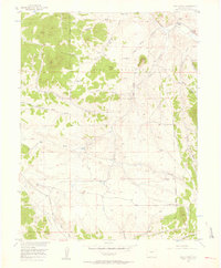
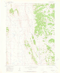
 1954 Windy Peak1955 Print · USGSThe Colorado high country in the mid-1950s was a land of pack trails and remote mountain ranches. You can trace early homesteads like Soderstrom Ranch and Sunnyside Ranch or follow the winding Pack Trails through Wigwam Park and the Kenosha Mountains.8 unique versions available
 - 1954 Map of Pueblo, 1966 Print
 1954 Pueblo1966 Print · USGSMid-century Colorado comes alive in this survey of the Front Range and the high plains as the region expanded after the war. Genealogists and historians can trace family roots through rural landmarks like Hanover Church, Pioneer Cemetery, and the Grandview School.3 unique versions available
 - 1955 Map of Buena Vista, 1957 Print
 1955 Buena Vista1957 Print · USGSThe Upper Arkansas River Valley is captured here in the mid-fifties as it balances ranching, transit, and state institutions. Genealogists and historians can locate the Mt Olivet Cemetery, the Little Annie Mine, and rural schools like the Pine Creek School.8 unique versions available
 - 1956 Map of Eagle Rock, 1957 Print
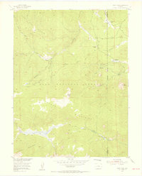
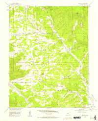
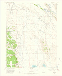
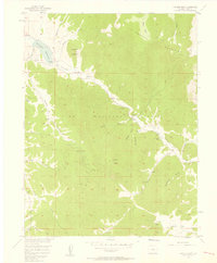
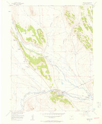
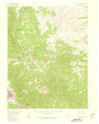
 1956 Eagle Rock1957 Print · USGSPark County high country during the mid-fifties reveals a landscape of isolated ranching and water infrastructure within the Pike National Forest. Trace family-named landmarks like the Paige Ranch or follow the route of the Aqueduct through Schoolmarm Draw.5 unique versions available
 - 1956 Map of Mc Curdy Mountain, 1957 Print
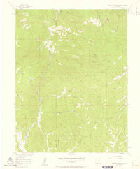
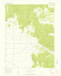
 1956 Mc Curdy Mountain1957 Print · USGSThe Tarryall Mountains and Pike National Forest appear here in the mid-fifties, showing a landscape of high summits and remote drainages. Hikers and researchers can trace old routes like the Pack Trail to the Bearcat Mines or locate Hankins Pass.9 unique versions available
 - 1956 Map of Elkhorn, 1957 Print
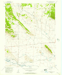
 1956 Elkhorn1957 Print · USGSPark County, Colorado, is captured here in the mid-1950s as a landscape of remote ranches and high-mountain drainage basins. Researchers can locate family landmarks like Elkhorn Ranch or trace the path of the regional Aqueduct near Logan Hill.5 unique versions available
 - 1956 Map of Tarryall, 1957 Print
 1956 Tarryall1957 Print · USGSPark County in the mid-fifties is characterized by high-altitude ranching and forest management. Researchers can trace historic access routes like the La Salle Pass Road and locate remote sites such as the St Joe Tunnel or Landis Ranch.4 unique versions available
 - 1956 Map of Hackett Mountain, 1957 Print
 1956 Hackett Mountain1957 Print · USGSThe Teller and Park county lines meet in the high country of the Pike National Forest during the mid-fifties. Local historians can trace old mountain routes and outposts such as Wildhorn Ranch, Custer Cabins, and the remote Mine near Metberry Gulch.9 unique versions available
 - 1956 Map of Sulphur Mountain, 1957 Print
 1956 Sulphur Mountain1957 Print · USGSPark County ranching and water rights take center stage in the mid-fifties, just as the mountain valley's landscape began to shift. Genealogists and historians can trace the Old Platte Railroad Grade and historic homesteads like Buckley Ranch and Spinney Ranch.3 unique versions available
 - 1956 Map of Garo, 1957 Print
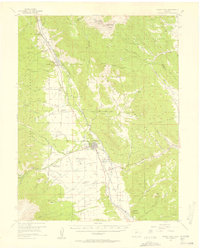
 1956 Garo1957 Print · USGSPark County ranching and water management are captured here in the mid-1950s, centered on the settlement of Garo. Researchers can trace old property lines at Cargill Ranch, follow the Old Railroad Grade, and locate the Buffalo Springs site.3 unique versions available
 - 1956 Map of Lake George, 1957 Print
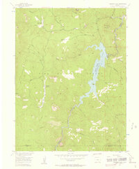
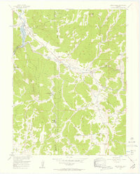 1956 Lake George1957 Print · USGSThe ranching and timber country of Teller County is captured here in the mid-1950s, showing a landscape of family-held land and early tourism. Genealogists and historians can trace property boundaries at Bantleon Ranch, locate the Florissant Cem, or follow the Old Railroad Grade.7 unique versions available
 - 1956 Map of Elevenmile Canyon, 1957 Print
 1956 Elevenmile Canyon1957 Print · USGSPark County ranching and recreation are captured in the mid-fifties as the South Platte River winds through the Pumpkin Hills. Genealogists and historians can locate family holdings like Abell Ranch, find the Sch (Aban'd), or trace the Wagon Tongue Road.5 unique versions available
 - 1956 Map of Antero Reservoir, 1957 Print
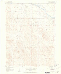
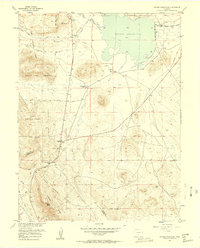 1956 Antero Reservoir1957 Print · USGSSouth Park's high-plateau ranching and rail history come alive in the mid-fifties, centered on the Antero Reservoir. Researchers can trace the Old Grade Railroad or locate family sites like Salt Works Ranch and the settlement at Haver.4 unique versions available
 - 1956 Map of Farnum Peak, 1957 Print
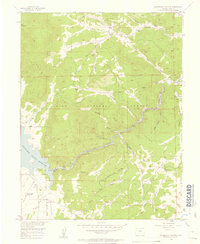
 1956 Farnum Peak1957 Print · USGSThe Tarryall Mountains are captured here in the mid-fifties, showing a landscape of high peaks and cattle ranching within the Pike National Forest. Researchers can locate the small Cem near Tarryall Creek or trace the early paths of the Mc Curdy Trail and Lazy River Ranch.6 unique versions available
 - 1956 Map of Antero Reservoir NE, 1957 Print
 1956 Antero Reservoir NE1957 Print · USGSPark County ranching life in the mid-fifties is frozen in time here, documenting a landscape where many homesteads had already begun to fade. Researchers can trace family sites like Poyner Ranch and abandoned locations such as the Pleasant Valley Sch (Aband) and Weber Ranch (Aband).5 unique versions available
 - 1956 Map of Fairplay East, 1957 Print
 1956 Fairplay East1957 Print · USGSHigh-altitude ranching and mining legacies meet near Fairplay during the mid-fifties. Genealogists and historians can trace family landholdings like Cargill Ranch and Trout Creek Ranch or follow the path of the Old Railroad Grade.3 unique versions available
 - 1956 Map of Cheesman Lake, 1957 Print
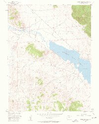
 1956 Cheesman Lake1957 Print · USGSJefferson and Douglas counties are defined by the reservoir and peaks of the Pike National Forest in the mid-fifties. Trace the remote Wigwam Club and Flying G Ranch or locate the engineering of Cheesman Dam.9 unique versions available
 - 1956 Map of Hartsel, 1957 Print
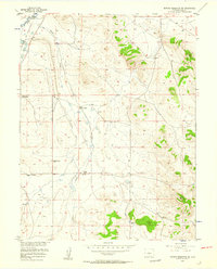
 1956 Hartsel1957 Print · USGSThe ranching country of South Park comes to life in the mid-fifties, showing the vital water systems of the South Platte headwaters. Researchers can trace historic family holdings like the Santa Maria Ranch, the Old Railroad Grade, and the mineral Hot Springs near the Hartsel townsite.4 unique versions available
 - 1956 Map of Guffey NW, 1957 Print
 1956 Guffey NW1957 Print · USGSPark County ranching and river history are preserved here in the mid-1950s, showing the early infrastructure of the South Platte basin. Genealogists and researchers can trace the Old Railroad Grade and locate the sites of the Richardson No 1 Ranch and Palat-Howe Ranch.2 unique versions available
 - 1956 Map of Glentivar, 1957 Print
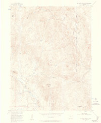
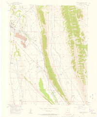
 1956 Glentivar1957 Print · USGSPark County's high country is captured here in the mid-1950s, showing the intersection of mountain passes and early ranching landmarks. You can trace the geography of family names and transit points like Glentivar, Wilkerson Pass, and Rishaberger Mountain.5 unique versions available
 - 1956 Map of Spinney Mountain, 1958 Print
 1956 Spinney Mountain1958 Print · USGSThe high mountain ranching country of Park County is captured here in the mid-1950s, showing the expansive Elevenmile Canyon Reservoir and the South Platte River. Researchers can trace the Old Railroad Grade and identify local landmarks like Spinney Mtn and the Hartsel Ranch (Rogers Unit).3 unique versions available
 - 1956 Map of Cameron Mountain, 1959 Print
 1956 Cameron Mountain1959 Print · USGSThe Arkansas River valley near Salida and Cleora is shown here in the mid-fifties as the local mining and rail economy thrived. Researchers can trace the DENVER AND RIO GRANDE WESTERN line, the remote Oklahoma A & M Engineering Camp, and the Golden Wonder Mine.4 unique versions available
 - 1956 Map of Montrose, 1963 Print
 1956 Montrose1963 Print · USGSThe Colorado western slope in the late fifties and early sixties shows a landscape defined by the Denver & Rio Grande Western RR and the Gunnison River. Trace the development of Blue Mesa Reservoir or locate high-country sites like the Bachelor Mine.3 unique versions available
 - 1957 Map of Denver
 1957 Denver1957 Print · USGSDenver and the Colorado Front Range are seen here during a mid-century period of intense military and urban expansion. Trace the footprints of the Rocky Mountain Arsenal, the early United States Air Force Academy, and the Lowry AF Base.
Showing maps 1-25 of 48
Top cities of Park County
Frequently asked questions
- What are the different types of historical maps available for Park County?
- What is the oldest map of Park County?
- Where can I purchase historical maps of Park County for my home or office?
- Where can I download high-res historical maps of Park County?
- Are there historical topographic maps available for Park County?
- Is there historical aerial imagery available for Park County?
- Where are historical maps of Park County sourced from?