1900s (20th Century) Maps of Park County, Colorado
Explore 148 historic maps of Park County from the 1900s (20th Century). These maps offer a rare glimpse into what life looked like during the 1900s — showing old roads, neighborhoods, homes, and landmarks that have changed or disappeared over time.
Whether you're researching your family's past, planning a metal detecting trip, or studying how Park County's landscape evolved across the 1900s, these high-resolution maps are a powerful tool for exploring the history of this region.
- Focus on a specific era: All maps on this page are from the 1900s, giving you a focused view of this time period.
- See what’s changed: Compare century-old streets, trails, and buildings to today's modern landscape using overlays and satellite layers.
- Research with precision: Use these maps for genealogy, historical research, land use analysis, or educational projects.
- View, download, or print: Maps are fully viewable online in high resolution, and can be downloaded or printed for your own records.
Start exploring Park County's history through authentic maps from the 1900s. This is your window into the past.
Park County, CO maps
(148)- 1901 Map of Pikes Peak
 1901 Pikes Peak1901 Print · USGSThe Cripple Creek mining district is in its golden age on this turn-of-the-century sheet. Genealogists and historians can trace the rail lines and mountain camps that defined the rush, from Victor and Goldfield to the Fossil Beds at Florissant.6 unique versions available
 - 1903 Map of Georgetown, 1957 Print
 1903 Georgetown1957 Print · USGSMining operations and mountain railroads define the Clear Creek valley at the dawn of the twentieth century. Trace the iconic Georgetown Loop railroad and locate historic mining centers like Silver Plume, Lamartine, and the Stanley Mines.
 - 1905 Map of Georgetown
 1905 Georgetown1905 Print · USGSThe Clear Creek valley was a hive of industrial activity at the start of the twentieth century, anchored by the rail connection between Georgetown and Silver Plume. Trace the famous Georgetown Loop and find high-altitude mining sites at Lamartine and Freeland.5 unique versions available
 - 1924 Map of Montezuma
 1924 Montezuma1924 Print · USGSHigh Colorado peaks and mining camps define the landscape during the 1920s and 1930s. Genealogists and historians can trace the foundations of Montezuma and Keystone, and locate historic operations like the Hamill Mine and Waldorf Mine.2 unique versions available
 - 1926 Map of Montezuma
 1926 Montezuma1926 Print · USGSThe Continental Divide during the 1920s reveals a high-country landscape defined by its mining heritage and high mountain passes. Researchers can trace the rugged operations at the Waldorf Mine and Stevens Mine or locate the early mountain settlements of Montezuma and Swandyke.3 unique versions available
 - 1933 Map of Montezuma, 1956 Print
 1933 Montezuma1956 Print · USGSThe mining districts of the high Rockies are caught in a period of transition in the 1930s. Researchers can locate remote industrial sites like the Waldorf Mine and follow early mountain routes over Loveland Pass and Argentine Pass.3 unique versions available
 - 1934 Map of Climax
 1934 Climax1934 Print · USGSThe Colorado high country in the mid-1930s reveals a landscape of industrial mining and high-altitude transport. Trace the routes of the Colorado and Southern RR or locate the historic mining district of Quartzville and the London Mine.
 - 1937 Map of Como
 1937 Como1937 Print · USGSPark County at the height of the mining era is captured here, centered on the high mountain passes and rail corridors. Genealogists and historians can trace the early footprints of Como, Jefferson, and the high-altitude Ute Mine or the remote Bakers Tank.3 unique versions available
 - 1938 Map of Mt. Lincoln
 1938 Mt. Lincoln1938 Print · USGSSummit and Park counties are captured here in the late 1930s, documenting the high-altitude mining landscape of the Tenmile Range. Researchers can trace the early footprints of Alma, the mining sites at Kokomo and London, and historic routes over Mosquito Pass.7 unique versions available
 - 1942 Map of Leadville, 1943 Print
 1942 Leadville1943 Print · USGSHigh in the Rockies during the early war years, this area served as a critical hub for military training and mining operations. Trace the rail lines of the Denver and Rio Grande Western RR and find local landmarks like the U. S. Fish Hatchery or the Adelaide mine.
 - 1942 Map of Cover Mtn., 1972 Print
 1942 Cover Mtn.1972 Print · USGSHigh mountain ranching and feldspar mining dominate this Fremont County landscape during the early 1940s. Genealogists and historians can trace family-named sites like F L Rowe Ranch and Stahl Ranch, alongside rural landmarks like the Twelvemile Sch.
 - 1945 Map of Mount Lincoln
 1945 Mount Lincoln1945 Print · USGSBreckenridge and the surrounding mining districts were still active industrial hubs when this survey was updated in the mid-1940s. Researchers can trace historic claims and mineral landmarks such as USLM No 16 and the remote high-altitude site of Climax.2 unique versions available
 - 1945 Map of Bailey, 1956 Print
 1945 Bailey1956 Print · USGSThe North Fork South Platte River valley comes alive in the mid-1940s, showing a landscape of family ranches and early mountain retreats. Researchers can trace the lineage of the canyon through Bailey, Horn Cem, and historic schools like Dry Creek Sch.5 unique versions available
 - 1945 Map of Shawnee, 1957 Print
 1945 Shawnee1957 Print · USGSThe mountain settlements of the North Fork South Platte valley are captured here at the end of the Second World War. Genealogists and local historians can trace family locations and community hubs like Case School, Shawnee, and the Willow Creek Ranch.2 unique versions available
 - 1945 Map of Mount Logan, 1960 Print
 1945 Mount Logan1960 Print · USGSPark County high country comes alive in this mid-century survey of the Front Range before modern expansion. Tracing the North Fork South Platte River, you can locate early settlements at Webster and Grant, or explore family-named landmarks like Ben Tyler Gulch.5 unique versions available
 - 1948 Map of Mount Logan
 1948 Mount Logan1948 Print · USGSThe North Fork of the South Platte River defines this post-war mountain landscape, connecting small valley settlements like Webster and Grant. Local historians can trace the early route of the Hoosier Trail and family-named landmarks like Ben Tyler Gulch.2 unique versions available
 - 1948 Map of Cover Mtn.
 1948 Cover Mtn.1948 Print · USGSFremont and Park Counties at the close of the 1940s show a high-altitude ranching and mining landscape defined by the Colorado Feldspar Company Mine. Genealogists can trace legacy holdings like the Nash Ranch or locate local landmarks like the Twelvemile Sch and Wilson Creek Sch.3 unique versions available
 - 1948 Map of Shawnee
 1948 Shawnee1948 Print · USGSThe North Fork of the South Platte River corridor is captured here in the mid-1940s as a series of mountain ranching and travel outposts. Genealogists and historians can trace family-named landmarks like Willow Creek Ranch or the community life centered at the Case School.2 unique versions available
 - 1949 Map of Bailey
 1949 Bailey1949 Print · USGSPark County mountain life in the late 1940s centers on the river valley settlements and family ranchlands. Genealogists and historians can trace lineage through landmarks like Potter Ranch, Pine Gl Cem, and the old Dry Creek Sch.2 unique versions available
 - 1953 Map of Denver, 1964 Print
 1953 Denver1964 Print · USGSDenver and the Colorado Front Range are captured here during a decade of post-war growth and military expansion. Researchers can trace the sprawling rail lines of the Union Pacific, locate the State Capitol, and explore historic mountain mining hubs like Central City.6 unique versions available
 - 1954 Map of Windy Peak, 1955 Print
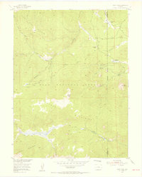 1954 Windy Peak1955 Print · USGSThe Colorado high country in the mid-1950s was a land of pack trails and remote mountain ranches. You can trace early homesteads like Soderstrom Ranch and Sunnyside Ranch or follow the winding Pack Trails through Wigwam Park and the Kenosha Mountains.8 unique versions available
 - 1954 Map of Pueblo, 1966 Print
 1954 Pueblo1966 Print · USGSMid-century Colorado comes alive in this survey of the Front Range and the high plains as the region expanded after the war. Genealogists and historians can trace family roots through rural landmarks like Hanover Church, Pioneer Cemetery, and the Grandview School.3 unique versions available
 - 1955 Map of Buena Vista, 1957 Print
 1955 Buena Vista1957 Print · USGSThe Upper Arkansas River Valley is captured here in the mid-fifties as it balances ranching, transit, and state institutions. Genealogists and historians can locate the Mt Olivet Cemetery, the Little Annie Mine, and rural schools like the Pine Creek School.8 unique versions available
 - 1956 Map of Eagle Rock, 1957 Print
 1956 Eagle Rock1957 Print · USGSPark County high country during the mid-fifties reveals a landscape of isolated ranching and water infrastructure within the Pike National Forest. Trace family-named landmarks like the Paige Ranch or follow the route of the Aqueduct through Schoolmarm Draw.5 unique versions available
 - 1956 Map of Mc Curdy Mountain, 1957 Print
 1956 Mc Curdy Mountain1957 Print · USGSThe Tarryall Mountains and Pike National Forest appear here in the mid-fifties, showing a landscape of high summits and remote drainages. Hikers and researchers can trace old routes like the Pack Trail to the Bearcat Mines or locate Hankins Pass.9 unique versions available
Showing maps 1-25 of 148
Top cities of Park County
Frequently asked questions
- What are the different types of historical maps available for Park County?
- What is the oldest map of Park County?
- Where can I purchase historical maps of Park County for my home or office?
- Where can I download high-res historical maps of Park County?
- Are there historical topographic maps available for Park County?
- Is there historical aerial imagery available for Park County?
- Where are historical maps of Park County sourced from?