1980s Maps of Park County, Colorado
Explore 23 historic maps of Park County from the 1980s. These maps offer a rare glimpse into what life looked like during the 1980s — showing old roads, neighborhoods, homes, and landmarks that have changed or disappeared over time.
Whether you're researching your family's past, planning a metal detecting trip, or studying how Park County's landscape evolved across the 1980s, these high-resolution maps are a powerful tool for exploring the history of this region.
- Focus on a specific era: All maps on this page are from the 1980s, giving you a focused view of this time period.
- See what’s changed: Compare century-old streets, trails, and buildings to today's modern landscape using overlays and satellite layers.
- Research with precision: Use these maps for genealogy, historical research, land use analysis, or educational projects.
- View, download, or print: Maps are fully viewable online in high resolution, and can be downloaded or printed for your own records.
Start exploring Park County's history through authentic maps from the 1980s. This is your window into the past.
Park County, CO maps
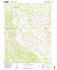
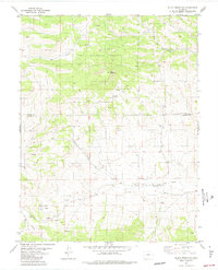
(23)- 1982 Map of Marmot Peak, 1983 Print
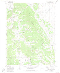
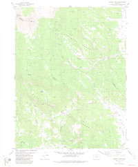 1982 Marmot Peak1983 Print · USGSHigh in the mountains of central Colorado in the early eighties, this area straddles the county line through the national forests. Researchers can trace the path of an Old Railroad Grade near Chubb or locate remote mines and the Natural Arch.2 unique versions available
 - 1982 Map of Harvard Lakes, 1983 Print
 1982 Harvard Lakes1983 Print · USGSChaffee County in the early 1980s reveals a landscape of high-altitude mining and transit along the Arkansas River. Genealogists and historians can trace the Denver and Rio Grande Western rail line and locate old sites like Little Annie Mine, Princeton, and Americus.2 unique versions available
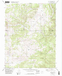
 - 1983 Map of Witcher Mountain
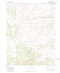
 1983 Witcher Mountain1983 Print · USGSPark County high country is shown here in the early eighties, centered on the towering peaks of Witcher Mountain and Saddle Mountain. Researchers can trace old mining claims through numerous labeled prospects and find isolated landmarks like the rural Landing Strip.2 unique versions available
 - 1983 Map of Denver West
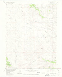
 1983 Denver West1983 Print · USGSThe Front Range and Denver's western suburbs meet in the early 1980s, documenting the era's growth from the mountain peaks to the valley floor. Genealogists and historians can trace the foundations of Lakewood and Golden, or locate high-altitude landmarks like the Moffat Tunnel and Mount Olivet Cem.2 unique versions available
 - 1983 Map of Cameron Mountain
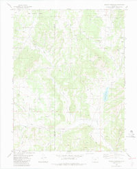
 1983 Cameron Mountain1983 Print · USGSHigh-country mining and timber lands at the border of Chaffee, Park, and Fremont counties are documented here in the early 1980s. Local researchers can trace old mining sites like the Marble Quarry or locate landmarks such as Bassam Guard Station and Manoa Springs.
 - 1983 Map of Cover Mountain
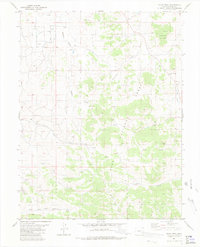
 1983 Cover Mountain1983 Print · USGSHigh-altitude ranching and mining country in the early 1980s is captured here at the Park and Fremont County line. Modern researchers can trace old Mines and Prospect sites tucked near Cover Mountain and along the drainages of Mack Gulch.2 unique versions available
 - 1983 Map of High Park
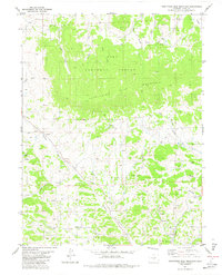
 1983 High Park1983 Print · USGSThe high-country terrain of central Colorado appears here in the early 1980s, showing a landscape shaped by mining and water rights. Researchers can trace numerous Prospects and remote landmarks like Big Baldy and Booger Red Hill.2 unique versions available
 - 1983 Map of Gribbles Park
 1983 Gribbles Park1983 Print · USGSThe Park and Fremont County borderlands are captured here in the early 1980s, showcasing a landscape of high-country ranching and mining. Researchers can trace the historic Ute Trail or locate remote sites like the Everett Cow Camp and Suckerville Spring.2 unique versions available
 - 1983 Map of Agate Mountain
 1983 Agate Mountain1983 Print · USGSPark County, Colorado, is shown in the early 1980s as a high-altitude landscape of springs, gulches, and mining prospects. Researchers can locate the settlement of Trump, trace the route of Wagon Tongue Creek, or find several mountain quarries.
 - 1983 Map of Pikes Peak
 1983 Pikes Peak1983 Print · USGSIn the early eighties, the high-altitude mining districts of Teller County remained deeply etched into the mountain landscape. Researchers can trace the legacy of the Gold Belt through sites like the Stratton Mine and vanished rail stops near Cripple Creek or Altman.
 - 1983 Map of Black Mountain
 1983 Black Mountain1983 Print · USGSFremont and Park County ranching and forest lands are captured in the early eighties as the high-elevation landscape remained largely undeveloped. Trace early land use through named features like Poncha Park, Stirrup Ranch, and numerous Prospects sites.
 - 1983 Map of Wrights Reservoir
 1983 Wrights Reservoir1983 Print · USGSTeller County in the early eighties shows a high-country landscape defined by the Park County line and the waters of Wrights Reservoir. Researchers can locate local landmarks like the Fourmile Cem, the Fourmile Ch, and the settlement at Pinewood.2 unique versions available
 - 1983 Map of Dicks Peak
 1983 Dicks Peak1983 Print · USGSPark County high country during the early eighties shows a landscape of forest service trails and remote drainages. Outdoor enthusiasts and researchers can trace the routes through Currant Creek Pass and identify landmarks like Dicks Peak and Threemile Mountain.
 - 1983 Map of Leadville
 1983 Leadville1983 Print · USGSThe Colorado high country in the early eighties shows a landscape of world-class peaks and deep-rooted mining industry. Trace the historic tracks of the Denver and Rio Grande Western RR and locate high-altitude operations like the Climax Mine or London Mine.2 unique versions available
 - 1983 Map of Castle Rock Gulch
 1983 Castle Rock Gulch1983 Print · USGSChaffee County was a center of mountain mining and rail transport in the early eighties. You can trace the Old RR Grade past Newett, find the lonely Grave near Chubb Park, and locate mining sites like the Lucky Jack Mine.2 unique versions available
 - 1983 Map of Thirtyone Mile Mountain
 1983 Thirtyone Mile Mountain1983 Print · USGSThe high-altitude border of Park and Fremont Counties comes into focus in the early eighties. Local researchers can trace numerous mining Prospects and remote landmarks like Thirtyone Mile Mountain or Yellow Soda Spring.2 unique versions available
 - 1983 Map of Bailey
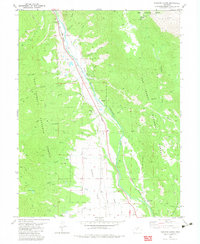
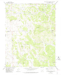
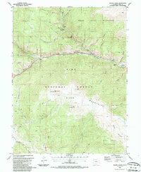
 1983 Bailey1983 Print · USGSPark County and the high Front Range are captured here during the early 1980s as traditional mountain settlements met new development patterns. Genealogists and researchers can trace the Denver and Rio Grande Western Railroad and old mountain hamlets like Bailey, Webster, and Garo.2 unique versions available
 - 1983 Map of Thirtynine Mile Mountain
 1983 Thirtynine Mile Mountain1983 Print · USGSPark County high country during the early 1980s reveals a landscape of isolated settlements and mineral exploration. Genealogists and historians can locate the community of Guffey, the meadows of Chumway Park, and numerous Prospect sites near Currant Creek.2 unique versions available
 - 1984 Map of Gunnison
 1984 Gunnison1984 Print · USGSHigh mountain passes and historic mining districts define this mid-eighties record of the central Colorado Rockies. Genealogists and historians can trace the foundations of Gunnison and Crested Butte or locate remote sites like St Elmo, Tincup, and Hancock.2 unique versions available
 - 1987 Map of Shawnee
 1987 Shawnee1987 Print · USGSPark County mountain life in the 1980s centered on the canyon floor where the highway and river met. Genealogists and hikers can trace local landmarks like Shawnee, the Cem, and the steep drainage of Slaughterhouse Gulch deep in the Pike National Forest.2 unique versions available
 - 1987 Map of Mount Logan
 1987 Mount Logan1987 Print · USGSThe high valleys of Park County are captured here in the late eighties, showing a landscape defined by the Platte River Mountains. Local historians can trace the Old Kenosha Grade, find a secluded Cem near Webster, and locate historical mining Prospects along Kenosha Creek.
 - 1987 Map of Bailey
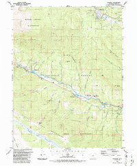
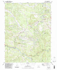 1987 Bailey1987 Print · USGSPark and Jefferson County mountain life in the late 1980s is centered on the river canyons and timbered slopes. Trace the historic route along the North Fork South Platte River to find Bailey, the old resort at Glenisle, and local landmarks like the Observatory.2 unique versions available
 - 1989 Map of Pueblo
 1989 Pueblo1989 Print · USGSIn the late eighties, the Colorado Front Range balanced its deep mining history with massive military expansion and water development. Researchers can trace the rail lines of the AT & SF RR or locate remote high-altitude settlements like Rosita and Querida.
End of results
Showing maps 1-23 of 23
Top cities of Park County
Frequently asked questions
- What are the different types of historical maps available for Park County?
- What is the oldest map of Park County?
- Where can I purchase historical maps of Park County for my home or office?
- Where can I download high-res historical maps of Park County?
- Are there historical topographic maps available for Park County?
- Is there historical aerial imagery available for Park County?
- Where are historical maps of Park County sourced from?