1930s Maps of Pitkin County, Colorado
Explore 5 historic maps of Pitkin County from the 1930s. These maps offer a rare glimpse into what life looked like during the 1930s — showing old roads, neighborhoods, homes, and landmarks that have changed or disappeared over time.
Whether you're researching your family's past, planning a metal detecting trip, or studying how Pitkin County's landscape evolved across the 1930s, these high-resolution maps are a powerful tool for exploring the history of this region.
- Focus on a specific era: All maps on this page are from the 1930s, giving you a focused view of this time period.
- See what’s changed: Compare century-old streets, trails, and buildings to today's modern landscape using overlays and satellite layers.
- Research with precision: Use these maps for genealogy, historical research, land use analysis, or educational projects.
- View, download, or print: Maps are fully viewable online in high resolution, and can be downloaded or printed for your own records.
Start exploring Pitkin County's history through authentic maps from the 1930s. This is your window into the past.
Pitkin County, CO maps
(5)- 1934 Map of Taylor Park, 1959 Print
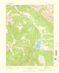 1934 Taylor Park1959 Print · USGSGunnison County high country in the mid-1930s reveals a landscape of industrial mining and remote ranching. Genealogists and historians can trace family-named sites like Gandy Ranch and Brown Ranch, or locate workings at Pieplant Mine and Star Mine.3 unique versions available
 - 1935 Map of Mount Elbert, 1955 Print
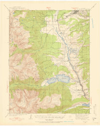 1935 Mount Elbert1955 Print · USGSThe Lake County high country comes alive in the mid-1930s, showing a landscape defined by mining, mountain trails, and the headwaters of the Arkansas. Genealogists and researchers can trace the rail stops at Yale Sta, old mines like the Columbine Mine, and early mountain pathways like the Mt Elbert Trail.4 unique versions available
 - 1937 Map of Taylor Park
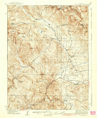 1937 Taylor Park1937 Print · USGSThe Sawatch Mountains and Gunnison National Forest are captured here in the 1930s during a peak era of alpine mining and ranching. Researchers can trace historic operations like the Forest Hill Mine and isolated outposts such as Dorchester or Bright Ranch.3 unique versions available
 - 1938 Map of Mount Elbert, 1944 Print
 1938 Mount Elbert1944 Print · USGSThe Colorado high country in the late thirties is defined by its massive peaks and the industrial rail lines of the Arkansas River valley. Trace historic mining sites like Columbine Mine and rail stops at Malta and Yale Sta.
 - 1939 Map of Mount Elbert
 1939 Mount Elbert1939 Print · USGSThe high peaks and mining corridors of Lake County are captured here in the late thirties as the industrial legacy of the Rockies met new conservation and water projects. Genealogists and historians can trace the rail lines through Leadville, locate the Columbine Mine, or find the Soda Springs Sch near the Arkansas River.2 unique versions available
End of results
Showing maps 1-5 of 5
Top cities of Pitkin County
Frequently asked questions
- What are the different types of historical maps available for Pitkin County?
- What is the oldest map of Pitkin County?
- Where can I purchase historical maps of Pitkin County for my home or office?
- Where can I download high-res historical maps of Pitkin County?
- Are there historical topographic maps available for Pitkin County?
- Is there historical aerial imagery available for Pitkin County?
- Where are historical maps of Pitkin County sourced from?