1960s Maps of Pitkin County, Colorado
Explore 30 historic maps of Pitkin County from the 1960s. These maps offer a rare glimpse into what life looked like during the 1960s — showing old roads, neighborhoods, homes, and landmarks that have changed or disappeared over time.
Whether you're researching your family's past, planning a metal detecting trip, or studying how Pitkin County's landscape evolved across the 1960s, these high-resolution maps are a powerful tool for exploring the history of this region.
- Focus on a specific era: All maps on this page are from the 1960s, giving you a focused view of this time period.
- See what’s changed: Compare century-old streets, trails, and buildings to today's modern landscape using overlays and satellite layers.
- Research with precision: Use these maps for genealogy, historical research, land use analysis, or educational projects.
- View, download, or print: Maps are fully viewable online in high resolution, and can be downloaded or printed for your own records.
Start exploring Pitkin County's history through authentic maps from the 1960s. This is your window into the past.
Pitkin County, CO maps
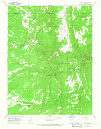
(30)- 1960 Map of Leadville
 1960 Leadville1960 Print · USGSThe Colorado high country in the mid-fifties comes alive through its mining camps, river valleys, and rail lines. Trace the industrial legacy of the Climax Molybdenum Mine and explore the alpine reaches of the Camp Hale Military Reservation.2 unique versions available
 - 1960 Map of Montrose
 1960 Montrose1960 Print · USGSThe Colorado high country in the mid-fifties is captured here during a period of steady ranching and persistent mining. Researchers can trace the path of the Denver & Rio Grande Western RR or locate small settlements like Somerset, Maher, and Sargent.2 unique versions available
 - 1960 Map of Marble, 1964 Print
 1960 Marble1964 Print · USGSThe town of Marble and its famed high-altitude quarries are captured here in the early sixties. Researchers can trace the industrial footprint of the Yule Quarry, locate the Marble Cem, and identify old homesteads like Bair Ranch and Prospect Ranch.5 unique versions available
 - 1960 Map of Highland Peak, 1964 Print
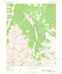
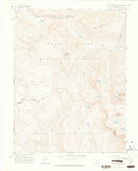
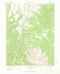
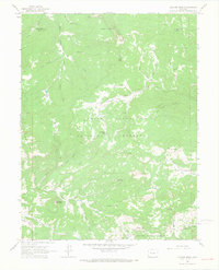
 1960 Highland Peak1964 Print · USGSThe high peaks of Pitkin County stand at the threshold of the modern ski era in this early 1960s survey. Hikers and historians can trace the network of irrigation ditches and remote campsites like Maroon Creek Campground 1 near Highland Peak and Burnt Mountain.4 unique versions available
 - 1960 Map of Maroon Bells, 1964 Print
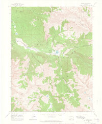
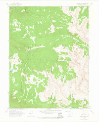
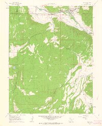
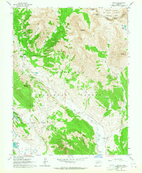
 1960 Maroon Bells1964 Print · USGSThe high peaks of the Elk Mountains define this Pitkin County landscape during the early 1960s. Outdoor enthusiasts and historians can trace the paths of the Minnehaha Trail and locate remote landmarks like Conundrum Hot Springs and the Conundrum Guard Station.8 unique versions available
 - 1960 Map of Hayden Peak, 1964 Print
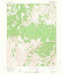
 1960 Hayden Peak1964 Print · USGSHigh in the Elk Mountains during the early sixties, this area shows the intersection of mining history and nascent alpine recreation. Trace old mineral claims like Hope Mine and the Montezuma Mine or locate the site of Ashcroft.6 unique versions available
 - 1960 Map of New York Peak, 1964 Print
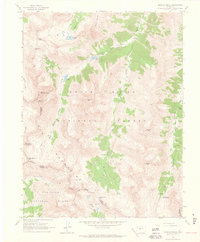
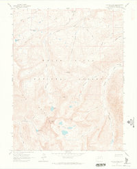
 1960 New York Peak1964 Print · USGSThe high alpine country of Pitkin County in the early sixties showcases a rugged landscape of water engineering and wilderness recreation. Trace the routes of a New York Collection Canal or find remote landmarks like Devils Punchbowl and Tabor Lake.5 unique versions available
 - 1960 Map of Capitol Peak, 1964 Print
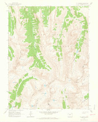
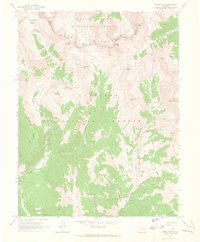
 1960 Capitol Peak1964 Print · USGSPitkin County’s high Elk Mountains were a domain of packers and ranchers in the early sixties. Follow the Pack Trails leading to Capitol Peak or locate the remote Capitol Creek Guard Station and Snowmass Falls Ranch.9 unique versions available
 - 1960 Map of Redstone, 1964 Print
 1960 Redstone1964 Print · USGSThe industrial and natural landscape of the Crystal River valley comes into focus in the early sixties. Researchers can trace local heritage through the Coke Ovens and Cem at Redstone, or locate remote Mines and the Penny Hot Springs.8 unique versions available
 - 1960 Map of Snowmass Mountain, 1964 Print
 1960 Snowmass Mountain1964 Print · USGSHigh in the Elk Mountains during the early 1960s, this area preserves the layout of remote mining camps and high-alpine passes. Researchers can trace the Schofield settlement and locate historic workings like the Baroni Mine and Silver Spruce Mine.9 unique versions available
 - 1960 Map of Thimble Rock, 1964 Print
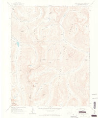
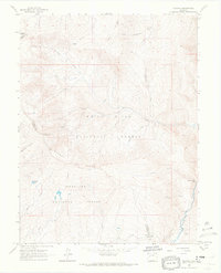
 1960 Thimble Rock1964 Print · USGSHigh in the Rocky Mountains during the late fifties, this area shows a landscape defined by traditional pack routes and alpine watersheds. Trace the paths of the Woody Pack Trail and Midway Pack Trail to remote landmarks like Thimble Rock and Sawyer Lake.3 unique versions available
 - 1960 Map of Aspen, 1964 Print
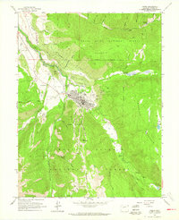 1960 Aspen1964 Print · USGSThe Aspen valley in the late fifties was a landscape of deep mining history and mountain river junctions. Genealogists and historians can trace family roots at Red Butte Cemetery or explore the reach of the Smuggler Shaft and Little Annie Mine.5 unique versions available
 - 1960 Map of Mount Champion, 1964 Print
 1960 Mount Champion1964 Print · USGSThe high Sawatch Range is documented here at the start of the 1960s, capturing the high-altitude divide between the Roaring Fork and Fryingpan basins. Researchers can trace the legacy of alpine mining at the Champion Mine or follow routes across the Continental Divide and South Fork Pass.4 unique versions available
 - 1960 Map of Independence Pass, 1965 Print
 1960 Independence Pass1965 Print · USGSThe high country around the Continental Divide was still a landscape of active water engineering and remnant mining in the 1960s. Researchers can trace the trans-basin New York Collection Canal and find mining era sites like Independence and Ruby Mine.5 unique versions available
 - 1961 Map of Mount Sopris, 1963 Print
 1961 Mount Sopris1963 Print · USGSMount Sopris and the Crystal River valley are shown here in the early sixties as a landscape of alpine peaks and early transit corridors. Researchers can trace the Old Railroad Grade or locate high-altitude landmarks like Thomas Lakes and St John Res.5 unique versions available
 - 1961 Map of Basalt, 1963 Print
 1961 Basalt1963 Print · USGSThe Roaring Fork Valley in the early sixties was a landscape of rail transit and mountain agriculture. Trace the course of the Denver and Rio Grande Western Railroad past Emma and Wingo or locate the St Benedict Monastery near Capitol Creek.6 unique versions available
 - 1961 Map of Woody Creek, 1963 Print
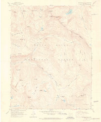
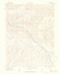 1961 Woody Creek1963 Print · USGSPitkin County in the early sixties reveals a landscape of high-altitude ranching and railroading along the Roaring Fork River. Local historians can trace the Denver and Rio Grande Western tracks, find the Wheatley Cem, and locate early water works like the Walker Wonder Ditch.5 unique versions available
 - 1961 Map of Ruedi, 1963 Print
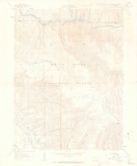 1961 Ruedi1963 Print · USGSPitkin County high country in the early sixties shows the Fryingpan Valley before the landscape was transformed. Researchers can trace historic access routes like the Pack Trail to Cow Camp and find early recreational markers like Rocky Fork Campground.5 unique versions available
 - 1961 Map of Gothic, 1964 Print
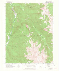
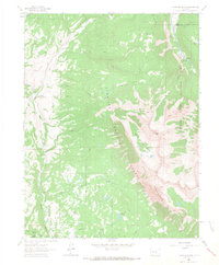
 1961 Gothic1964 Print · USGSThe high alpine country of Gunnison County is captured here in the early sixties, showing the settlement of Gothic before its modern expansion. Researchers can trace the early ski infrastructure of Crested Butte, locate the Brush Creek Cow Camp, and find the small Cem tucked near the East River.7 unique versions available
 - 1961 Map of Pearl Pass, 1965 Print
 1961 Pearl Pass1965 Print · USGSThe high Elk Mountains at the start of the 1960s were a network of primitive routes for explorers and miners. Follow jeep trails and pack trails past high-altitude prospects, Carbonate Hill, and the remote crossing at Pearl Pass.3 unique versions available
 - 1962 Map of Leadville
 1962 Leadville1962 Print · USGSThe Colorado high country in the early sixties was a rugged landscape of mining camps, military training grounds, and emerging ski towns. Researchers can trace the legacy of Camp Hale, locate the Molybdenum mine near Leadville, and follow the Denver and Rio Grande Western RR through the canyons.
 - 1963 Map of Chair Mountain, 1967 Print
 1963 Chair Mountain1967 Print · USGSThe high peaks of Gunnison and Pitkin County appear in the early 1960s as a landscape of remote cattle operations and mountain trails. Family-named landmarks like Jacobs Ranch and Volk Ranch can be traced alongside routes through Buck Creek Basin.6 unique versions available
 - 1963 Map of Placita, 1967 Print
 1963 Placita1967 Print · USGSThe mountain settlement of Placita and the surrounding high-country forests are captured here in the early 1960s. Researchers can trace the mid-century industrial landscape through the Dutch Creek Mine, find old mountain routes over McClure Pass, and locate Hayes Creek Falls.5 unique versions available
 - 1963 Map of Stony Ridge, 1967 Print
 1963 Stony Ridge1967 Print · USGSPitkin and Garfield Counties in the early 1960s reveal a landscape shaped by coal mining and high-altitude ranching. Genealogists and historians can trace industrial remains like the Coke Ovens or locate historic outposts such as Lambert Place and Marion Cem.3 unique versions available
 - 1963 Map of Quaker Mesa, 1967 Print
 1963 Quaker Mesa1967 Print · USGSHigh-altitude Mesa and Garfield counties were still frontiers for energy exploration in the early sixties. Researchers can trace the legacy of resource extraction and mountain travel via Gas Wells, the Clear Creek Pack Trail, and remote camps like Miner Basin.5 unique versions available
Showing maps 1-25 of 30
Top cities of Pitkin County
Frequently asked questions
- What are the different types of historical maps available for Pitkin County?
- What is the oldest map of Pitkin County?
- Where can I purchase historical maps of Pitkin County for my home or office?
- Where can I download high-res historical maps of Pitkin County?
- Are there historical topographic maps available for Pitkin County?
- Is there historical aerial imagery available for Pitkin County?
- Where are historical maps of Pitkin County sourced from?