1900s (20th Century) Maps of Pitkin County, Colorado
Explore 56 historic maps of Pitkin County from the 1900s (20th Century). These maps offer a rare glimpse into what life looked like during the 1900s — showing old roads, neighborhoods, homes, and landmarks that have changed or disappeared over time.
Whether you're researching your family's past, planning a metal detecting trip, or studying how Pitkin County's landscape evolved across the 1900s, these high-resolution maps are a powerful tool for exploring the history of this region.
- Focus on a specific era: All maps on this page are from the 1900s, giving you a focused view of this time period.
- See what’s changed: Compare century-old streets, trails, and buildings to today's modern landscape using overlays and satellite layers.
- Research with precision: Use these maps for genealogy, historical research, land use analysis, or educational projects.
- View, download, or print: Maps are fully viewable online in high resolution, and can be downloaded or printed for your own records.
Start exploring Pitkin County's history through authentic maps from the 1900s. This is your window into the past.
Pitkin County, CO maps
(56)- 1909 Map of Mount Jackson, 1955 Print
 1909 Mount Jackson1955 Print · USGSPitkin County was a thriving center of high-country mining and railroading during the early 1900s. Genealogists and historians can trace the rail lines of the Colorado Midland Railway and locate vanished sites like Ashcroft and the Little Annie Mine.2 unique versions available
 - 1911 Map of Mount Jackson
 1911 Mount Jackson1911 Print · USGSThe high Rockies of Pitkin and Eagle Counties are captured here at the peak of the mountain rail era. Researchers can trace the dual tracks of the Colorado Midland RR and the Denver and Rio Grande RR past Aspen and the Little Annie Mine.3 unique versions available
 - 1934 Map of Taylor Park, 1959 Print
 1934 Taylor Park1959 Print · USGSGunnison County high country in the mid-1930s reveals a landscape of industrial mining and remote ranching. Genealogists and historians can trace family-named sites like Gandy Ranch and Brown Ranch, or locate workings at Pieplant Mine and Star Mine.3 unique versions available
 - 1935 Map of Mount Elbert, 1955 Print
 1935 Mount Elbert1955 Print · USGSThe Lake County high country comes alive in the mid-1930s, showing a landscape defined by mining, mountain trails, and the headwaters of the Arkansas. Genealogists and researchers can trace the rail stops at Yale Sta, old mines like the Columbine Mine, and early mountain pathways like the Mt Elbert Trail.4 unique versions available
 - 1937 Map of Taylor Park
 1937 Taylor Park1937 Print · USGSThe Sawatch Mountains and Gunnison National Forest are captured here in the 1930s during a peak era of alpine mining and ranching. Researchers can trace historic operations like the Forest Hill Mine and isolated outposts such as Dorchester or Bright Ranch.3 unique versions available
 - 1938 Map of Mount Elbert, 1944 Print
 1938 Mount Elbert1944 Print · USGSThe Colorado high country in the late thirties is defined by its massive peaks and the industrial rail lines of the Arkansas River valley. Trace historic mining sites like Columbine Mine and rail stops at Malta and Yale Sta.
 - 1939 Map of Mount Elbert
 1939 Mount Elbert1939 Print · USGSThe high peaks and mining corridors of Lake County are captured here in the late thirties as the industrial legacy of the Rockies met new conservation and water projects. Genealogists and historians can trace the rail lines through Leadville, locate the Columbine Mine, or find the Soda Springs Sch near the Arkansas River.2 unique versions available
 - 1942 Map of Leadville, 1943 Print
 1942 Leadville1943 Print · USGSHigh in the Rockies during the early war years, this area served as a critical hub for military training and mining operations. Trace the rail lines of the Denver and Rio Grande Western RR and find local landmarks like the U. S. Fish Hatchery or the Adelaide mine.
 - 1949 Map of Holy Cross, 1955 Print
 1949 Holy Cross1955 Print · USGSThe Eagle River valley and the high-altitude terrain of the Sawatch Range are captured here just after the war. You can trace the military history of Camp Hale and find old mining claims like the Matchless Mine or the remote Holy Cross City.7 unique versions available
 - 1951 Map of Holy Cross
 1951 Holy Cross1951 Print · USGSHigh in the Sawatch Mountains during the post-war era, this region shows a landscape shaped by military training and alpine mining. Researchers can trace the layout of Camp Hale, locate the Homestake Mine, or find the high-altitude Evergreen Cem.2 unique versions available
 - 1956 Map of Montrose, 1963 Print
 1956 Montrose1963 Print · USGSThe Colorado western slope in the late fifties and early sixties shows a landscape defined by the Denver & Rio Grande Western RR and the Gunnison River. Trace the development of Blue Mesa Reservoir or locate high-country sites like the Bachelor Mine.3 unique versions available
 - 1957 Map of Leadville, 1978 Print
 1957 Leadville1978 Print · USGSHigh-country mining and rail transport define the central Colorado Rockies during the mid-to-late twentieth century. Researchers can trace the industrial footprints of Gilman and Climax, find small rail stops like Malta, and follow the Denver and Rio Grande Western RR.2 unique versions available
 - 1959 Map of Leadville
 1959 Leadville1959 Print · USGSThe Colorado high country in the late fifties is a landscape of mining history and military training, from the streets of Leadville to the Camp Hale grounds. Genealogists and historians can trace the Denver and Rio Grande Western RR alongside now-deserted sites like Ashcroft and Independence.
 - 1959 Map of Montrose
 1959 Montrose1959 Print · USGSWestern Colorado in the late fifties is defined by the high peaks and river valleys of the Southern Rockies. Genealogists and historians can trace the paths of the Denver & Rio Grande Western RR or locate mountain settlements like Crawford, Lazear, and Doyleville.
 - 1960 Map of Leadville
 1960 Leadville1960 Print · USGSThe Colorado high country in the mid-fifties comes alive through its mining camps, river valleys, and rail lines. Trace the industrial legacy of the Climax Molybdenum Mine and explore the alpine reaches of the Camp Hale Military Reservation.2 unique versions available
 - 1960 Map of Montrose
 1960 Montrose1960 Print · USGSThe Colorado high country in the mid-fifties is captured here during a period of steady ranching and persistent mining. Researchers can trace the path of the Denver & Rio Grande Western RR or locate small settlements like Somerset, Maher, and Sargent.2 unique versions available
 - 1960 Map of Marble, 1964 Print
 1960 Marble1964 Print · USGSThe town of Marble and its famed high-altitude quarries are captured here in the early sixties. Researchers can trace the industrial footprint of the Yule Quarry, locate the Marble Cem, and identify old homesteads like Bair Ranch and Prospect Ranch.5 unique versions available
 - 1960 Map of Highland Peak, 1964 Print
 1960 Highland Peak1964 Print · USGSThe high peaks of Pitkin County stand at the threshold of the modern ski era in this early 1960s survey. Hikers and historians can trace the network of irrigation ditches and remote campsites like Maroon Creek Campground 1 near Highland Peak and Burnt Mountain.4 unique versions available
 - 1960 Map of Maroon Bells, 1964 Print
 1960 Maroon Bells1964 Print · USGSThe high peaks of the Elk Mountains define this Pitkin County landscape during the early 1960s. Outdoor enthusiasts and historians can trace the paths of the Minnehaha Trail and locate remote landmarks like Conundrum Hot Springs and the Conundrum Guard Station.8 unique versions available
 - 1960 Map of Hayden Peak, 1964 Print
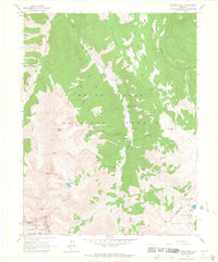 1960 Hayden Peak1964 Print · USGSHigh in the Elk Mountains during the early sixties, this area shows the intersection of mining history and nascent alpine recreation. Trace old mineral claims like Hope Mine and the Montezuma Mine or locate the site of Ashcroft.6 unique versions available
 - 1960 Map of New York Peak, 1964 Print
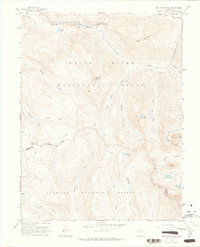 1960 New York Peak1964 Print · USGSThe high alpine country of Pitkin County in the early sixties showcases a rugged landscape of water engineering and wilderness recreation. Trace the routes of a New York Collection Canal or find remote landmarks like Devils Punchbowl and Tabor Lake.5 unique versions available
 - 1960 Map of Capitol Peak, 1964 Print
 1960 Capitol Peak1964 Print · USGSPitkin County’s high Elk Mountains were a domain of packers and ranchers in the early sixties. Follow the Pack Trails leading to Capitol Peak or locate the remote Capitol Creek Guard Station and Snowmass Falls Ranch.9 unique versions available
 - 1960 Map of Redstone, 1964 Print
 1960 Redstone1964 Print · USGSThe industrial and natural landscape of the Crystal River valley comes into focus in the early sixties. Researchers can trace local heritage through the Coke Ovens and Cem at Redstone, or locate remote Mines and the Penny Hot Springs.8 unique versions available
 - 1960 Map of Snowmass Mountain, 1964 Print
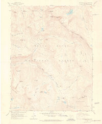 1960 Snowmass Mountain1964 Print · USGSHigh in the Elk Mountains during the early 1960s, this area preserves the layout of remote mining camps and high-alpine passes. Researchers can trace the Schofield settlement and locate historic workings like the Baroni Mine and Silver Spruce Mine.9 unique versions available
 - 1960 Map of Thimble Rock, 1964 Print
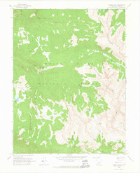 1960 Thimble Rock1964 Print · USGSHigh in the Rocky Mountains during the late fifties, this area shows a landscape defined by traditional pack routes and alpine watersheds. Trace the paths of the Woody Pack Trail and Midway Pack Trail to remote landmarks like Thimble Rock and Sawyer Lake.3 unique versions available
Showing maps 1-25 of 56
Top cities of Pitkin County
Frequently asked questions
- What are the different types of historical maps available for Pitkin County?
- What is the oldest map of Pitkin County?
- Where can I purchase historical maps of Pitkin County for my home or office?
- Where can I download high-res historical maps of Pitkin County?
- Are there historical topographic maps available for Pitkin County?
- Is there historical aerial imagery available for Pitkin County?
- Where are historical maps of Pitkin County sourced from?