1900s (20th Century) Maps of Saguache County, Colorado
Explore 125 historic maps of Saguache County from the 1900s (20th Century). These maps offer a rare glimpse into what life looked like during the 1900s — showing old roads, neighborhoods, homes, and landmarks that have changed or disappeared over time.
Whether you're researching your family's past, planning a metal detecting trip, or studying how Saguache County's landscape evolved across the 1900s, these high-resolution maps are a powerful tool for exploring the history of this region.
- Focus on a specific era: All maps on this page are from the 1900s, giving you a focused view of this time period.
- See what’s changed: Compare century-old streets, trails, and buildings to today's modern landscape using overlays and satellite layers.
- Research with precision: Use these maps for genealogy, historical research, land use analysis, or educational projects.
- View, download, or print: Maps are fully viewable online in high resolution, and can be downloaded or printed for your own records.
Start exploring Saguache County's history through authentic maps from the 1900s. This is your window into the past.
Saguache County, CO maps
(125)- 1905 Map of San Cristobal, 1963 Print
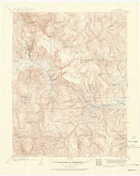
 1905 San Cristobal1963 Print · USGSThe high peaks of the San Juan Mountains are recorded here just after the turn of the century as mining and high-altitude ranching shaped the area. Researchers can trace the layout of early settlements like Whitecross and Sherman or locate the Lakemans Fishponds near the Continental Divide.
 - 1907 Map of San Cristobal
 1907 San Cristobal1907 Print · USGSHinsdale and Mineral counties are shown during the early years of the national forest system, following the Continental Divide through high alpine peaks. Genealogists and researchers can trace the locations of mining-era settlements like Whitecross and Carson, or remote sites like Lakemans Fishponds.5 unique versions available
 - 1908 Map of Uncompahgre, 1954 Print
 1908 Uncompahgre1954 Print · USGSThe Gunnison River canyon and high mesas defined life in this corner of Colorado during the early twentieth century. Genealogists and historians can trace the Denver and Rio Grande Railroad line through mountain outposts like Sapinero, Cebolla, and the Gunnison Mine.2 unique versions available
 - 1911 Map of Uncompahgre
 1911 Uncompahgre1911 Print · USGSThe Colorado high country at the start of the twentieth century reveals a landscape of isolated mining camps and vital mountain railways. Genealogists and historians can trace the Denver and Rio Grande RR through Sapinero to remote operations like the Gunnison Mine and Capitol City.2 unique versions available
 - 1914 Map of Creede
 1914 Creede1914 Print · USGSMineral County mining camps and silver-era infrastructure are preserved in this pre-war survey. Genealogists and historians can trace industrial landmarks like the Nelson Tunnel alongside early settlements including Bachelor, Sunnyside, and Spar City.3 unique versions available
 - 1915 Map of Del Norte, 1957 Print
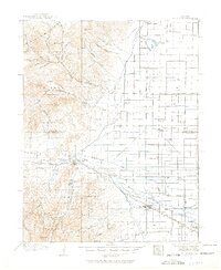 1915 Del Norte1957 Print · USGSThe San Luis Valley was a thriving agricultural and rail hub during the early twentieth century. Researchers can trace the legacy of early settlements and rural schoolhouses like La Garita School, Swede Lane School, and the Denver and Rio Grande rail line.
 - 1916 Map of Creede
 1916 Creede1916 Print · USGSThe silver boom of the San Juan Mountains is in full swing on this 1910s survey of the upper Rio Grande. Researchers can trace mining claims and tunnels at Bachelor, locate the Emma Mine, or find the old Pfeiffer School near Granger.3 unique versions available
 - 1917 Map of Del Norte
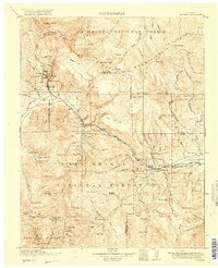
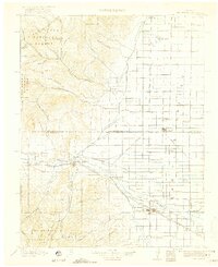 1917 Del Norte1917 Print · USGSThe San Luis Valley thrives in the mid-1910s as irrigation transforms the high desert into a productive agricultural hub. Researchers can locate dozens of country schools like Eureka School and trace the Denver and Rio Grande rail corridor through Monte Vista.3 unique versions available
 - 1945 Map of Durango
 1945 Durango1945 Print · USGSSouthwest Colorado and Northern New Mexico at mid-century are defined by the high peaks of the San Juan Range and the tribal lands of the Southern Ute. Genealogists and historians can trace the paths of the D & R G W RR and locate local landmarks like Animas City and the Blanco Basin School.3 unique versions available
 - 1950 Map of Valley View Hot Springs, 1970 Print
 1950 Valley View Hot Springs1970 Print · USGSSaguache, Colorado is shown here during the post-war era when rural schools and coal mining operations still dotted the plains. Researchers can locate named sites like Valley View School or trace family mining history at the Sunset Mine and Diamond Mines.
 - 1953 Map of Durango, 1963 Print
 1953 Durango1963 Print · USGSThe high peaks of the San Juan Mountains and the Colorado mining country are shown here as they appeared in the early fifties. Genealogists and local historians can trace the rail lines of the D & R G W RR and locate historic mining camps like Silverton, Ouray, and Old Ophir.
 - 1954 Map of Durango
 1954 Durango1954 Print · USGSSouthern Colorado in the mid-1950s was defined by high-altitude mining towns and the expansion of water storage in the San Luis Valley. Trace the narrow-gauge Denver & Rio Grande Western RR as it connects Durango to mountain outposts like Silverton and Creede.2 unique versions available
 - 1954 Map of Iris NW, 1955 Print
 1954 Iris NW1955 Print · USGSThe high-country border of Gunnison and Saguache counties is captured here in the mid-fifties, showing a landscape defined by seasonal creeks and high-altitude trails. Researchers can trace the path of South Beaver Creek or locate the remote Landing Field (Emergency) and the New Mexico Principal Meridian.7 unique versions available
 - 1954 Map of Iola, 1955 Print
 1954 Iola1955 Print · USGSThe Gunnison River valley in the mid-1950s remains a landscape of ranching outposts and historic river crossings. Genealogists and researchers can trace the old railroad grade through Iola and Hierro, or locate family sites like the Shaw Ranch and Kezar.8 unique versions available
 - 1954 Map of Trinidad, 1963 Print
 1954 Trinidad1963 Print · USGSSouthern Colorado is captured here during the mid-fifties, showing the vital rail-and-river connections between the San Luis Valley and the eastern foothills. Researchers can trace the Denver and Rio Grande Western line and locate rural landmarks like Malachite School and San Luis.2 unique versions available
 - 1954 Map of Pueblo, 1966 Print
 1954 Pueblo1966 Print · USGSMid-century Colorado comes alive in this survey of the Front Range and the high plains as the region expanded after the war. Genealogists and historians can trace family roots through rural landmarks like Hanover Church, Pioneer Cemetery, and the Grandview School.3 unique versions available
 - 1955 Map of Trinidad, 1976 Print
 1955 Trinidad1976 Print · USGSSouthern Colorado during the mid-fifties is defined by the high-altitude agriculture of the San Luis Valley and the peaks of the Culebra Range. Genealogists can trace early settlements and rural schoolhouses like Medina Plaza, San Luis, and the Trujillo Creek School.
 - 1956 Map of Montrose, 1963 Print
 1956 Montrose1963 Print · USGSThe Colorado western slope in the late fifties and early sixties shows a landscape defined by the Denver & Rio Grande Western RR and the Gunnison River. Trace the development of Blue Mesa Reservoir or locate high-country sites like the Bachelor Mine.3 unique versions available
 - 1957 Map of Pueblo
 1957 Pueblo1957 Print · USGSMid-century Colorado comes alive as the Front Range urban centers expand alongside massive Cold War military installations. Genealogists and historians can trace the foundations of Stone City, rural sites like Hanover School, and the industrial Canon Imperial Mine.
 - 1958 Map of Trinidad
 1958 Trinidad1958 Print · USGSSouthern Colorado in the late fifties was a landscape of high-altitude agriculture and coal production, centered on the San Luis Valley. Local historians can trace old community centers like the Malachite School or follow the mining and rail activity near Walsenburg and the Allen Mine.
 - 1958 Map of Pueblo
 1958 Pueblo1958 Print · USGSColorado's Front Range and Arkansas River Valley come alive in the late fifties, showing the transition from historic mining districts to major military and rail hubs. Genealogists and historians can trace family roots in ranching communities and find landmarks like Cripple Creek, Manitou, and the Hanover School.
 - 1959 Map of Trinidad
 1959 Trinidad1959 Print · USGSThe San Luis Valley and the high Sangre de Cristo peaks are documented here in the late fifties, during a period of steady ranching and rail activity. Genealogy researchers can locate family-named landmarks and rural institutions like Trujillo Creek School and the historic San Luis settlement.
 - 1959 Map of Montrose
 1959 Montrose1959 Print · USGSWestern Colorado in the late fifties is defined by the high peaks and river valleys of the Southern Rockies. Genealogists and historians can trace the paths of the Denver & Rio Grande Western RR or locate mountain settlements like Crawford, Lazear, and Doyleville.
 - 1959 Map of Electric Peak, 1961 Print
 1959 Electric Peak1961 Print · USGSCuster and Saguache counties meet along the high peaks of the Sangre de Cristos during the late fifties. Genealogists can trace family footprints at the King Homestead and Hutchinson Homestead or locate the historic Ula Cem.6 unique versions available
 - 1959 Map of Creede, 1961 Print
 1959 Creede1961 Print · USGSMineral County mining peaks in the late fifties as the Denver and Rio Grande Western rail line reaches deep into the mountains. Genealogists and historians can trace numerous silver claims and local landmarks like the Amethyst Mine, the Historical Cem, and Fremont Sch No 1.6 unique versions available
Showing maps 1-25 of 125
Top cities of Saguache County
- Center historical maps
- Saguache historical maps
- Crestone historical maps
- Moffat historical maps
- Bonanza historical maps
Frequently asked questions
- What are the different types of historical maps available for Saguache County?
- What is the oldest map of Saguache County?
- Where can I purchase historical maps of Saguache County for my home or office?
- Where can I download high-res historical maps of Saguache County?
- Are there historical topographic maps available for Saguache County?
- Is there historical aerial imagery available for Saguache County?
- Where are historical maps of Saguache County sourced from?