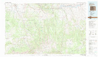
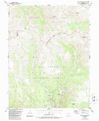
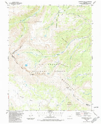
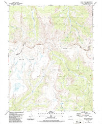
1980s Maps of Saguache County, Colorado
Explore 20 historic maps of Saguache County from the 1980s. These maps offer a rare glimpse into what life looked like during the 1980s — showing old roads, neighborhoods, homes, and landmarks that have changed or disappeared over time.
Whether you're researching your family's past, planning a metal detecting trip, or studying how Saguache County's landscape evolved across the 1980s, these high-resolution maps are a powerful tool for exploring the history of this region.
- Focus on a specific era: All maps on this page are from the 1980s, giving you a focused view of this time period.
- See what’s changed: Compare century-old streets, trails, and buildings to today's modern landscape using overlays and satellite layers.
- Research with precision: Use these maps for genealogy, historical research, land use analysis, or educational projects.
- View, download, or print: Maps are fully viewable online in high resolution, and can be downloaded or printed for your own records.
Start exploring Saguache County's history through authentic maps from the 1980s. This is your window into the past.
Saguache County, CO maps
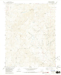
(20)- 1980 Map of Wellsville
 1980 Wellsville1980 Print · USGSNear the turn of the 1980s, this area of Fremont County shows the rugged intersection of the Arkansas River and high alpine forests. Researchers can trace the path of the Denver and Rio Grande Western through Wellsville or locate mountain landmarks like Simmons Peak and Salamander Lake.3 unique versions available
 - 1980 Map of Whale Hill
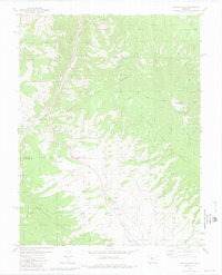
 1980 Whale Hill1980 Print · USGSSaguache County's rugged mining history is preserved here in the late twentieth century, showing a landscape defined by industrial extraction and high peaks. Genealogists and researchers can trace dozens of individual claims, including the Stemwinder Mine, Oregon Mine, and the Old Railroad Grade along San Luis Creek.2 unique versions available
 - 1980 Map of Electric Peak
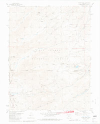
 1980 Electric Peak1980 Print · USGSThe Sangre de Cristo high country is captured here in the 1980s, where county lines follow the peaks of the Great Divide. Genealogists and researchers can trace remote mining sites like the Rita Alta Mine and Cloverdale Mine or locate alpine landmarks such as Lakes of the Clouds and Smith Park.2 unique versions available
 - 1980 Map of Rito Alto Peak, 1981 Print
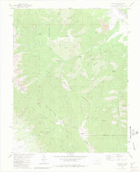
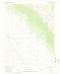
 1980 Rito Alto Peak1981 Print · USGSThe Sangre de Cristo Range comes into sharp focus during the late seventies, showing the high-elevation divide between Saguache and Custer counties. Trace high-altitude mining efforts and early transit routes like the Old Railroad Grade, Hermit Pass, and the Crestone Cem.4 unique versions available
 - 1980 Map of Bonanza, 1981 Print
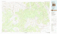
 1980 Bonanza1981 Print · USGSBonanza was a thriving mining hub in the late twentieth century, centered at the meeting point of three National Forests. Genealogists and historians can trace the industrial footprint of the Rawley Mines, find old cemeteries, and locate the Little Bonanza Mill among the high peaks.3 unique versions available
 - 1980 Map of Poncha Pass, 1981 Print
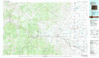
 1980 Poncha Pass1981 Print · USGSThe high mountain pass between Chaffee and Saguache counties is documented here in the early eighties as a corridor of transit and mining. Researchers can trace the path of the Old Railroad Grade and locate long-standing landmarks like Mearx Junction and Camp Rock.4 unique versions available
 - 1980 Map of Mount Ouray, 1981 Print
 1980 Mount Ouray1981 Print · USGSThe high Continental Divide country comes alive in this late twentieth-century survey of the Chaffee and Saguache county border. Researchers can trace the legacy of mining and mountain transit through Shirley (Site), the Cinderella Mine, and the historic Marshall Pass.5 unique versions available
 - 1980 Map of Coaldale, 1981 Print
 1980 Coaldale1981 Print · USGSThe northern Sangre de Cristo foothills near the dawn of the 1980s show a landscape defined by the Arkansas River and high mountain peaks. You can trace early mining and recreation sites like the Strip Mine, Coaldale Campground, and the long Rainbow Trail.2 unique versions available
 - 1981 Map of Bushnell Peak
 1981 Bushnell Peak1981 Print · USGSHigh in the Colorado Rockies during the early eighties, this survey captures the intersection of ranching and mining history. Trace the Old Railroad Grade near Villa Grove or locate remote mining prospects and the Villa Grove Cem.2 unique versions available
 - 1982 Map of Silverton, 1983 Print
 1982 Silverton1983 Print · USGSThe San Juan Mountains were entering a new era in the early eighties as mining heritage met growing wilderness preservation. Researchers can trace historic claims and mountain rail routes through Silverton, Telluride, and the high-altitude Sunnyside Mine.3 unique versions available
 - 1982 Map of Blanca Peak, 1983 Print
 1982 Blanca Peak1983 Print · USGSThe Sangre de Cristo range reaches its highest elevations in the early 1980s, towering over the shifting landscapes of the San Luis Valley. Researchers can trace the path of the Denver and Rio Grande Western railroad or locate remote settlements like Crestone, Sharpsdale, and Gardner.2 unique versions available
 - 1982 Map of Saguache, 1983 Print
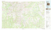
 1982 Saguache1983 Print · USGSThe San Luis Valley meets the high peaks of the Sawatch Range in the early 1980s, revealing a landscape shaped by mining and rail. Researchers can trace the Denver and Rio Grande Western railroad and locate high-altitude sites like the Rawley Mine and the settlement of Bonanza.
 - 1982 Map of Canon City, 1983 Print
 1982 Canon City1983 Print · USGSCentral Colorado in the early eighties shows a landscape shaped by high peaks and river-valley industry. Genealogists can locate family sites near Silver Cliff, Union Highland Cem, or the State Prison Farm.
 - 1982 Map of Del Norte, 1983 Print
 1982 Del Norte1983 Print · USGSThe Rio Grande Valley and San Juan Mountains are seen here in the early eighties, transitioning from rugged alpine peaks to the irrigated San Luis Valley plains. Researchers can trace the Denver and Rio Grande Western rail line and locate old regional hubs like Creede, Monte Vista, and Wagon Wheel Gap.
 - 1983 Map of Montrose
 1983 Montrose1983 Print · USGSThe Uncompahgre Valley and high San Juan peaks come together in the early eighties, showing a landscape defined by deep canyons and mountain mining towns. Genealogists and hikers can trace old routes near Ouray, Lake City, and the Pelican Mine.2 unique versions available
 - 1986 Map of San Luis Peak
 1986 San Luis Peak1986 Print · USGSThe Colorado high country in the mid-eighties reveals a landscape defined by the legacies of the Creede mining district. Historians and mineral seekers can trace dozens of named workings like the Amethyst, Holy Moses, and Equity Mine clustered around Bachelor Mountain.
 - 1986 Map of Halfmoon Pass
 1986 Halfmoon Pass1986 Print · USGSThe high peaks of the Colorado Rockies are captured here in the mid-1980s, centered on the Continental Divide. Researchers can trace remote pack routes like the Skyline Trail (Pack) to landmarks such as Halfmoon Pass and Wheeler Monument.
 - 1986 Map of Baldy Cinco
 1986 Baldy Cinco1986 Print · USGSHigh in the Colorado Rockies during the mid-eighties, this survey captures the intersection of three counties along the Continental Divide. Trace the remote Cebolla Trail across the broad Snow Mesa or locate Prospects near the headwaters of Mineral Creek.
 - 1988 Map of Trinidad
 1988 Trinidad1988 Print · USGSSouthern Colorado in the late eighties reveals a landscape of high-altitude farming and mountain rail corridors. Genealogists and historians can trace the foundations of San Luis and Fort Garland or find old stops on the D & R G W RR and A T & S F Ry.
 - 1989 Map of Pueblo
 1989 Pueblo1989 Print · USGSIn the late eighties, the Colorado Front Range balanced its deep mining history with massive military expansion and water development. Researchers can trace the rail lines of the AT & SF RR or locate remote high-altitude settlements like Rosita and Querida.
End of results
Showing maps 1-20 of 20
Top cities of Saguache County
- Center historical maps
- Saguache historical maps
- Crestone historical maps
- Moffat historical maps
- Bonanza historical maps
Frequently asked questions
- What are the different types of historical maps available for Saguache County?
- What is the oldest map of Saguache County?
- Where can I purchase historical maps of Saguache County for my home or office?
- Where can I download high-res historical maps of Saguache County?
- Are there historical topographic maps available for Saguache County?
- Is there historical aerial imagery available for Saguache County?
- Where are historical maps of Saguache County sourced from?