1960s Maps of Saguache County, Colorado
Explore 70 historic maps of Saguache County from the 1960s. These maps offer a rare glimpse into what life looked like during the 1960s — showing old roads, neighborhoods, homes, and landmarks that have changed or disappeared over time.
Whether you're researching your family's past, planning a metal detecting trip, or studying how Saguache County's landscape evolved across the 1960s, these high-resolution maps are a powerful tool for exploring the history of this region.
- Focus on a specific era: All maps on this page are from the 1960s, giving you a focused view of this time period.
- See what’s changed: Compare century-old streets, trails, and buildings to today's modern landscape using overlays and satellite layers.
- Research with precision: Use these maps for genealogy, historical research, land use analysis, or educational projects.
- View, download, or print: Maps are fully viewable online in high resolution, and can be downloaded or printed for your own records.
Start exploring Saguache County's history through authentic maps from the 1960s. This is your window into the past.
Saguache County, CO maps
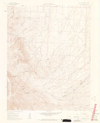
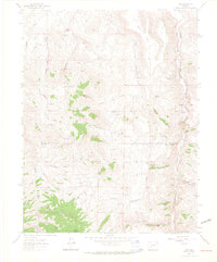
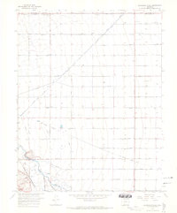
(70)- 1960 Map of Montrose
 1960 Montrose1960 Print · USGSThe Colorado high country in the mid-fifties is captured here during a period of steady ranching and persistent mining. Researchers can trace the path of the Denver & Rio Grande Western RR or locate small settlements like Somerset, Maher, and Sargent.2 unique versions available
 - 1960 Map of Beck Mountain, 1963 Print
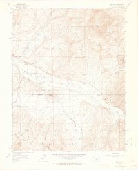
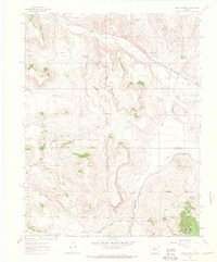
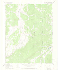
 1960 Beck Mountain1963 Print · USGSHigh-country ranching and remote mountain passes define this 1960s survey of the Sangre de Cristo range. Trace the location of the Beck School, family landmarks like Henrich Ranch, and high-altitude routes through Music Pass.6 unique versions available
 - 1961 Map of Durango
 1961 Durango1961 Print · USGSThe high San Juan country in the early sixties is shown here as a network of historic mining towns and early reservoir projects. Genealogists and researchers can trace the Denver & Rio Grande Western RR as it connects Durango, Silverton, and Arboles.
 - 1962 Map of Pueblo
 1962 Pueblo1962 Print · USGSThe Front Range and high plains meet in the early sixties as military installations and industrial mining shape the corridor from Colorado Springs to Pueblo. Genealogists can trace family names through rural landmarks like the Columbine School, Hanover Church, and Fairview Cem.
 - 1962 Map of Doyleville, 1964 Print
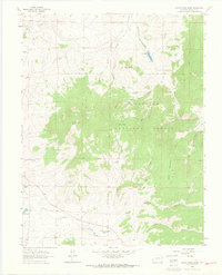
 1962 Doyleville1964 Print · USGSHigh in the Rockies during the early sixties, this area shows the ranching and rail heritage of the Tomichi Creek valley. Trace the Old Railroad Grade past Doyleville and find family-named landmarks like Pleasant View Ranch and Monson Gulch.3 unique versions available
 - 1962 Map of West Baldy, 1964 Print
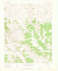
 1962 West Baldy1964 Print · USGSHigh in the Colorado Rockies in the early 1960s, the wilderness around the Continental Divide remained accessible only by horse and jeep. Genealogists and historians can trace high-altitude landmarks like the Hughes Mine Grave, Shortys Cabin, and the remote Lujan settlement.3 unique versions available
 - 1962 Map of Rudolph Hill, 1964 Print
 1962 Rudolph Hill1964 Print · USGSGunnison County ranching and mountain terrain are captured here in the early sixties, showing the remote homesteads and rugged drainages of the region. Researchers can locate family landmarks like Sammons Ranch and Inside Ranch or the Powderhorn Cem.3 unique versions available
 - 1962 Map of Iris, 1964 Print
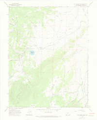
 1962 Iris1964 Print · USGSGunnison and Saguache Counties are captured here in the early sixties, a period when isolated mining claims and family homesteads still dotted the high gulches. Genealogists and historians can locate the Iris Cem, the settlement of Iris, and specific operations like the Lucky Strike Mine or Sillsville.4 unique versions available
 - 1962 Map of Houston Gulch, 1964 Print
 1962 Houston Gulch1964 Print · USGSGunnison County ranching and mountain rail history are preserved in this early 1960s survey. Researchers can trace the path of the Old Railroad Grade and locate historical landmarks like the Alaska Mine and Green Mesa Ranch.2 unique versions available
 - 1962 Map of Razor Creek Dome, 1964 Print
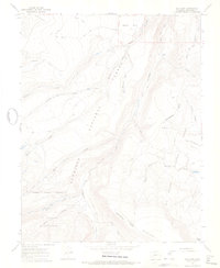
 1962 Razor Creek Dome1964 Print · USGSHigh-altitude ranching and mining operations in Saguache County were well established by the early sixties. Researchers can trace land use through the Flying M Ranch, the Lost Nueva Mine, and the waters of Vouga Reservoir.2 unique versions available
 - 1962 Map of Powderhorn, 1964 Print
 1962 Powderhorn1964 Print · USGSGunnison County ranching and mining operations are captured here in the early sixties. Researchers can locate family landmarks like Youmans Ranch and trace mining history at Vulcan, Spencer, and the Ironcap Mine.3 unique versions available
 - 1962 Map of Spring Hill Creek, 1964 Print
 1962 Spring Hill Creek1964 Print · USGSThe high country of Saguache County is captured here in the early sixties as a region of remote ranching and active mining. Researchers can trace land use at the Watts Homestead and Cooper Ranch or locate old workings at the Continental Mine.5 unique versions available
 - 1962 Map of Sawtooth Mountain, 1964 Print
 1962 Sawtooth Mountain1964 Print · USGSHigh-country ranching and mining terrain in Saguache County come to life in this early 1960s survey. Genealogists and historians can trace old mountain routes to the Mercury Mine, Homestead Gulch, and the remote Townsite Gulch.4 unique versions available
 - 1963 Map of Durango
 1963 Durango1963 Print · USGSThe San Juan Mountains and San Luis Valley are captured here in the early 1950s as mining, rail, and tribal lands shaped the region. Researchers can trace the Denver & Rio Grande Western RR through high-country towns like Telluride and Silverton, or locate landmarks such as the Asiatic Mine.
 - 1963 Map of Mineral Mountain, 1966 Print
 1963 Mineral Mountain1966 Print · USGSHigh in the Colorado Rockies during the early sixties, this terrain centers on the wild headwaters of Cebolla Creek. Trace rugged routes like the Bondholder Trail (Jeep) and find remote mountain landmarks like Mineral Mountain and Dry Lake.6 unique versions available
 - 1964 Map of Sargents, 1967 Print
 1964 Sargents1967 Print · USGSThe high mountain corridors of Gunnison County are captured in the mid-1960s, a time when the legacy of the narrow-gauge rails was still clearly visible on the land. Researchers can trace the Marshall Pass Railroad Grade through Sargents and locate landmarks like Black Sage Pass and the isolated Grave near the creek.4 unique versions available
 - 1964 Map of Sevenmile Plaza, 1968 Print
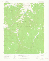
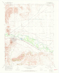
 1964 Sevenmile Plaza1968 Print · USGSThe San Luis Valley in the mid-1960s shows a landscape transformed by intensive irrigation and rail transport. Researchers can trace the Denver and Rio Grande Western rail line and the complex network of the Farmers Union Canal and Sevenmile Plaza.2 unique versions available
 - 1965 Map of Cold Spring Park, 1968 Print
 1965 Cold Spring Park1968 Print · USGSSaguache County high country in the mid-sixties is captured here as a landscape of isolated ranching and irrigation. Researchers can trace historic water rights via the Perry Ditch and locate landmarks like the Old Agency Ranger Station and McDonough Ranch.2 unique versions available
 - 1965 Map of Elk Park, 1968 Print
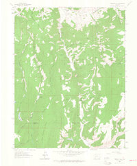
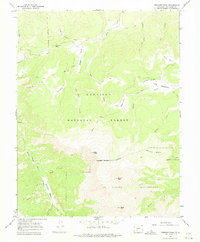
 1965 Elk Park1968 Print · USGSThe Colorado high country near Saguache is captured in the mid-1960s, a landscape defined by the Continental Divide and sprawling wilderness. Trace early backcountry routes like the SKYLINE trail and find landmarks such as La Garita Mountain and Elk Park.4 unique versions available
 - 1965 Map of Stewart Peak, 1968 Print
 1965 Stewart Peak1968 Print · USGSThe high country of Saguache County is captured here in the mid-sixties, dominated by Stewart Peak. Trace high-altitude routes like the Pack Trail through Los Pinos Pass and the waterworks at Cochetopa Meadows Ditch.3 unique versions available
 - 1965 Map of Rock Creek Park, 1968 Print
 1965 Rock Creek Park1968 Print · USGSSaguache County high country in the mid-1960s was a landscape of remote cattle camps and high-altitude timber. Trace the rugged network of jeep trails past the Rock Creek Cow Camp to landmarks like Section School and Monument Rock.3 unique versions available
 - 1966 Map of Durango
 1966 Durango1966 Print · USGSSouthwestern Colorado and the New Mexico borderlands are shown here in the mid-1960s, a time when the narrow-gauge rail network still tied the high peaks to the valley floor. Researchers can trace the Denver & Rio Grande Western Railroad between settlements like Silverton, Antonito, and Pagosa Springs.2 unique versions available
 - 1966 Map of Pueblo
 1966 Pueblo1966 Print · USGSThe Front Range and Arkansas River Valley are captured here in the mid-1960s, showing a landscape shaped by mining, military expansion, and rail. Researchers can locate numerous country schools and mines, such as the Lytle School, Pioneer Cem, and Empire Zinc Mine.
 - 1966 Map of Del Norte, 1968 Print
 1966 Del Norte1968 Print · USGSDel Norte and the San Luis Valley irrigation network are captured here in the mid-1960s as the river economy matured. Researchers can trace family roots at Del Norte Cem, follow the Denver and Rio Grande Western rail line, or locate the old Plaza settlement.3 unique versions available
 - 1966 Map of Indian Head, 1968 Print
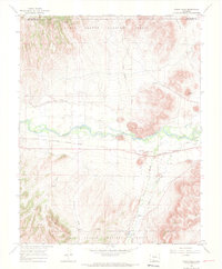 1966 Indian Head1968 Print · USGSThe Rio Grande valley in the mid-sixties shows a landscape shaped by the river and the rail, crossing between Saguache and Rio Grande counties. Genealogists and historians can trace the Denver and Rio Grande Western line through Hanna and locate landmarks like the State Bridge and Town Ponds.3 unique versions available
Showing maps 1-25 of 70
Top cities of Saguache County
- Center historical maps
- Saguache historical maps
- Crestone historical maps
- Moffat historical maps
- Bonanza historical maps
Frequently asked questions
- What are the different types of historical maps available for Saguache County?
- What is the oldest map of Saguache County?
- Where can I purchase historical maps of Saguache County for my home or office?
- Where can I download high-res historical maps of Saguache County?
- Are there historical topographic maps available for Saguache County?
- Is there historical aerial imagery available for Saguache County?
- Where are historical maps of Saguache County sourced from?