2000s (21st Century) Maps of Saguache County, Colorado
Explore 439 historic maps of Saguache County from the 2000s (21st Century). These maps offer a rare glimpse into what life looked like during the 2000s — showing old roads, neighborhoods, homes, and landmarks that have changed or disappeared over time.
Whether you're researching your family's past, planning a metal detecting trip, or studying how Saguache County's landscape evolved across the 2000s, these high-resolution maps are a powerful tool for exploring the history of this region.
- Focus on a specific era: All maps on this page are from the 2000s, giving you a focused view of this time period.
- See what’s changed: Compare century-old streets, trails, and buildings to today's modern landscape using overlays and satellite layers.
- Research with precision: Use these maps for genealogy, historical research, land use analysis, or educational projects.
- View, download, or print: Maps are fully viewable online in high resolution, and can be downloaded or printed for your own records.
Start exploring Saguache County's history through authentic maps from the 2000s. This is your window into the past.
Saguache County, CO maps
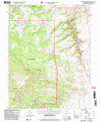
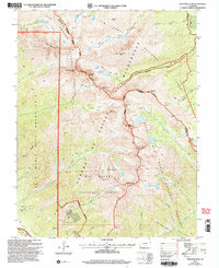
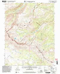
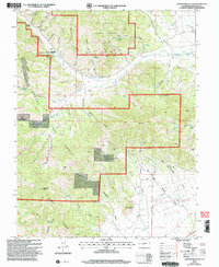
(439)- 2001 Map of Razor Creek Dome, 2004 Print
 2001 Razor Creek Dome2004 Print · USGSSaguache County ranching and mining history come into focus at the turn of the millennium near the Razor Creek Dome. Researchers can trace the legacy of mineral exploration at the Lost Ocho Mine or locate established homesteads like the Flying M Ranch.
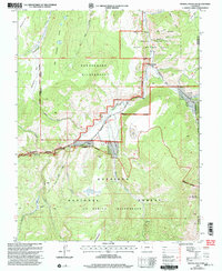
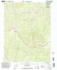
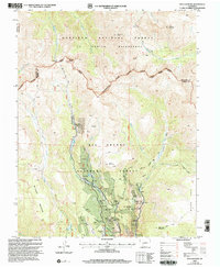
 - 2001 Map of Sargents, 2004 Print
 2001 Sargents2004 Print · USGSGunnison County high country at the turn of the millennium shows a landscape shaped by water and high mountain passes. Genealogists and local historians can trace the routes of Marshall Pass Road, the settlement of Sargents, and family-named landmarks like Deacon Jones Gulch.
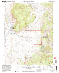
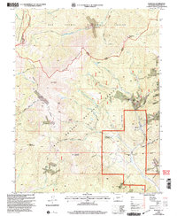
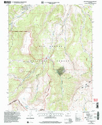
 - 2001 Map of Stewart Peak, 2004 Print
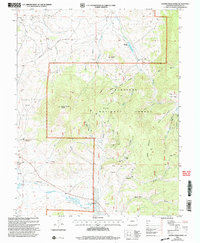
 2001 Stewart Peak2004 Print · USGSThe high Colorado backcountry of the continental divide is captured here in the early twenty-first century. Researchers can trace the rugged boundaries of the La Garita Wilderness and landmarks like Stewart Peak, Baldy Alto, and Las Pinos Pass.
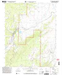
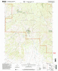
 - 2001 Map of Rock Creek Park, 2004 Print
 2001 Rock Creek Park2004 Print · USGSThe high country of Gunnison National Forest is captured here at the turn of the millennium, showing a landscape of remote ranching and forest management. Trace high-altitude paths like the Devils Hole Trail, the Rock Creek Cow Camp, and McDonough Reservoir.
 - 2001 Map of Spring Hill Creek, 2004 Print
 2001 Spring Hill Creek2004 Print · USGSThe Saguache County high country at the start of the twenty-first century reveals a landscape of isolated homesteads and high-altitude mining. Researchers can locate legacy family sites like Watts Homestead and Shelton Ranch or trace the mineral prospects surrounding South Beaver Creek.
 - 2001 Map of Sawtooth Mountain, 2004 Print
 2001 Sawtooth Mountain2004 Print · USGSSaguache County at the start of the millennium remains a landscape of high-altitude ranching and mining legacy. Researchers can trace historic land use through the Los Ocho Mine, the paths of Townsite Gulch, and the remote Gunnison National Forest boundary.
 - 2001 Map of Mineral Mountain, 2004 Print
 2001 Mineral Mountain2004 Print · USGSHinsdale County at the turn of the millennium was a landscape of massive wilderness tracts and high-mountain outposts. Trace the remote network of pack trails and forest roads connecting Cathedral, Mineral Mountain, and the Powderhorn Wilderness.
 - 2001 Map of Doyleville, 2004 Print
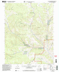
 2001 Doyleville2004 Print · USGSRanching life and high-country surveying meet in this 2001 revision of the Gunnison and Saguache County line. Researchers can trace the layout of Doyleville, find the locations of the Doyleville Sch and Crookton Sch, and locate family-named landmarks like Monson Gulch.
 - 2001 Map of Houston Gulch, 2004 Print
 2001 Houston Gulch2004 Print · USGSGunnison County high country is shown here at the turn of the millennium, following the winding Tomichi Creek through the open Parlin Flats. Researchers can trace old mountain ranching boundaries at Green Mesa Ranch or locate the historic Alaska Mine near the county line.
 - 2001 Map of Cochetopa Park, 2004 Print
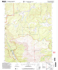
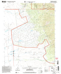
 2001 Cochetopa Park2004 Print · USGSThe Saguache County high country at the turn of the millennium shows a landscape defined by the Continental Divide and conservation areas. Researchers can trace the Colorado Trail past Quarter Circle Ranch and the Dome Lakes State Wildlife Area.
 - 2001 Map of Cold Spring Park, 2004 Print
 2001 Cold Spring Park2004 Print · USGSHigh-altitude ranching and irrigation systems are documented in this Saguache County landscape at the start of the new millennium. Researchers can trace historic water rights and mountain routes through labels like the McDonough Ranch, Smith Ford Ditch, and the Pinos-Cibolla Road.
 - 2001 Map of Crestone Peak, 2005 Print
 2001 Crestone Peak2005 Print · USGSHigh in the Sangre de Cristo range at the turn of the millennium, this survey details the peaks and wilderness bordering Saguache and Custer counties. Trace early mining Prospects near Luis Maria Baca Grant No 4 and high passes like Music Pass.
 - 2001 Map of Medano Pass, 2005 Print
 2001 Medano Pass2005 Print · USGSThe high Sangre de Cristo range at the start of the twenty-first century shows a landscape where wilderness protection meets historic travel corridors. Follow the Medano Pass 4wd Road as it climbs toward Medano Pass and peaks like Mount Herard.
 - 2001 Map of Crestone, 2005 Print
 2001 Crestone2005 Print · USGSThe San Luis Valley meets the high peaks of the Sangre de Cristos at the start of the millennium. Local historians can trace the massive Luis Maria Baca Grant No 4 and find the site of Alpine Camp or old mountain Mines.
 - 2001 Map of Trickle Mountain, 2005 Print
 2001 Trickle Mountain2005 Print · USGSUpper Saguache and the surrounding national forest lands appear here at the start of the millennium, defined by a network of drainage gulches and mining sites. Researchers can find old prospects and water sources like Alkali Spring and Lone Pine Reservoir.
 - 2001 Map of Lookout Mountain, 2005 Print
 2001 Lookout Mountain2005 Print · USGSThe high peaks of the Saguache Range come into focus at the turn of the millennium, showing a landscape dedicated to ranching and recreation. Researchers can trace historic livestock routes like the La Garita Stock Driveway or find recreation spots at Storm King Recreation Area.
 - 2001 Map of Halfmoon Pass, 2005 Print
 2001 Halfmoon Pass2005 Print · USGSSaguache and Mineral counties at the start of the millennium showcase the high-country divide of the Colorado Rockies. You can trace the La Garita Stock Driveway and the primitive routes leading to Halfmoon Pass and the Wheeler Geologic Area.
 - 2001 Map of Sargents Mesa, 2005 Print
 2001 Sargents Mesa2005 Print · USGSIn the high country of Saguache County at the start of the new millennium, this landscape is defined by the high-altitude transit of the Continental Divide. Hikers and researchers can trace the National Scenic Trail past Long Branch Baldy and identify remote administrative outposts like the Long Branch Guard Station.
 - 2001 Map of Bonanza, 2005 Print
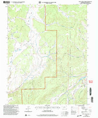
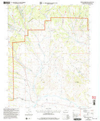
 2001 Bonanza2005 Print · USGSSaguache County's high-country mining district is captured here at the start of the millennium, centered on the historic settlement of Bonanza. Mineral hunters and historians can trace an extensive network of claims including the Rawley Mine, Little Bonanza Mill, and the Liberty Mine along the gulches.
 - 2001 Map of Klondike Mine, 2005 Print
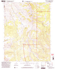
 2001 Klondike Mine2005 Print · USGSSaguache County at the turn of the millennium remains a landscape shaped by its mining and ranching heritage. Researchers can trace historic activity at the Klondike Mine, the settlement at Spook City, and high-altitude landmarks like Ute Pass.
 - 2001 Map of Graveyard Gulch, 2005 Print
 2001 Graveyard Gulch2005 Print · USGSThe Colorado high country in Saguache County reveals its mining and timber roots through the 2001 revision of this high-altitude landscape. Researchers can locate the Parkville (Site), trace old 4WD tracks to the Pershing Mine, or find remote landmarks like Whites Cam.
 - 2001 Map of San Luis Peak, 2005 Print
 2001 San Luis Peak2005 Print · USGSMineral County mining history and wilderness preservation meet at the Continental Divide during the turn of the millennium. Researchers can trace the legacy of silver and gold through former settlements like Bachelor and Weaver or find the Amethyst and Equity Mine operations.
 - 2001 Map of South Fork East, 2005 Print
 2001 South Fork East2005 Print · USGSThe Rio Grande valley near the turn of the millennium shows a landscape of mountain forests and irrigated riverside settlements. Trace local history through the Holy Family Mission, the small community of Gerrard, and the high waters of Lost Lake.
 - 2001 Map of Mesa Mountain, 2005 Print
 2001 Mesa Mountain2005 Print · USGSSaguache County at the turn of the twenty-first century remains a landscape of high-altitude mining and traditional ranching access. Researchers can trace historic pathways like the Saguache Divide Stock Driveway or locate the remote Sky City Mine.
 - 2001 Map of Valley View Hot Springs, 2005 Print
 2001 Valley View Hot Springs2005 Print · USGSThe Sangre de Cristo foothills near the Saguache and Custer county line are captured here as they appeared at the turn of the millennium. Local history researchers can locate the Orient Mine, trace trails into the wilderness, and find the Cotton Creek Cem.
Showing maps 1-25 of 439
Top cities of Saguache County
- Center historical maps
- Saguache historical maps
- Crestone historical maps
- Moffat historical maps
- Bonanza historical maps
Frequently asked questions
- What are the different types of historical maps available for Saguache County?
- What is the oldest map of Saguache County?
- Where can I purchase historical maps of Saguache County for my home or office?
- Where can I download high-res historical maps of Saguache County?
- Are there historical topographic maps available for Saguache County?
- Is there historical aerial imagery available for Saguache County?
- Where are historical maps of Saguache County sourced from?