1980s Maps of Panama City, Florida
Explore 7 historic maps of Panama City from the 1980s. These maps offer a rare glimpse into what life looked like during the 1980s — showing old roads, neighborhoods, homes, and landmarks that have changed or disappeared over time.
Whether you're researching your family's past, planning a metal detecting trip, or studying how Panama City's landscape evolved across the 1980s, these high-resolution maps are a powerful tool for exploring the history of this region.
- Focus on a specific era: All maps on this page are from the 1980s, giving you a focused view of this time period.
- See what’s changed: Compare century-old streets, trails, and buildings to today's modern landscape using overlays and satellite layers.
- Research with precision: Use these maps for genealogy, historical research, land use analysis, or educational projects.
- View, download, or print: Maps are fully viewable online in high resolution, and can be downloaded or printed for your own records.
Start exploring Panama City's history through authentic maps from the 1980s. This is your window into the past.
Panama City, FL maps
(7)- 1981 Map of Panama City
 1981 Panama City1981 Print · USGSPanama City and the Florida Panhandle coast are captured here in the early eighties, showing the region's balance of military installations and maritime industry. Researchers can trace the Atlanta and St Andrews Bay RR or locate coastal sites like Tyndall Air Force Base and Dead Lake.2 unique versions available
 - 1982 Map of Youngstown, 1983 Print
 1982 Youngstown1983 Print · USGSThe Florida Panhandle's piney lowlands and wetlands are captured in the early eighties as the Atlanta and Saint Andrews Bay Railway connects rural outposts. Genealogists and local historians can trace the foundations of Youngstown, locate the Bear Creek Ch, and explore the wetlands around Crash Island.
 - 1982 Map of Springfield, 1983 Print
 1982 Springfield1983 Print · USGSCoastal Bay County was undergoing significant growth in the early eighties as residential developments expanded toward the bayous. Genealogists and local historians can trace the foundations of Springfield and Old Callaway while locating landmarks like Evergreen Memorial Gardens and Everitt Junior High School.2 unique versions available
 - 1982 Map of North Of Allanton, 1983 Print
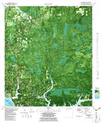
 1982 North Of Allanton1983 Print · USGSThe Florida Panhandle's wetland interior is captured in detail in the early 1980s as suburban growth reached the edge of the swamps. Genealogists and local researchers can locate Kent Cem, the Molette Lookout Tower, and the early footprints of East Callaway.
 - 1982 Map of Bayhead, 1984 Print
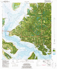
 1982 Bayhead1984 Print · USGSThe northern reaches of the Deer Point Lake reservoir are captured here in the early 1980s, showcasing a growing network of coastal settlements. Researchers can locate family landmarks and early subdivisions like Bayhead, Camp Flowers, and the site of Hobbs Still.
 - 1982 Map of Panama City, 1984 Print
 1982 Panama City1984 Print · USGSPanama City and its waterfront neighbors are captured here in the early eighties as the coastal infrastructure of St. Andrew Bay matured. Genealogists and historians can trace local landmarks like Forest Lawn Memorial Cem, Magnolia Beach, and the historic Atlanta and St Andrews Bay RR corridor.2 unique versions available
 - 1988 Map of Tallahassee
 1988 Tallahassee1988 Print · USGSThe Florida Panhandle and South Georgia are captured here in the late eighties, showing the expansion of the regional highway network and coastal growth. Genealogists and historians can trace rail lines like the Seaboard System Railroad or locate family roots in Blountstown, Graceville, or Crawfordville.2 unique versions available
End of results
Showing maps 1-7 of 7
Top cities near Panama City
- Upper Grand Lagoon historical maps
- Lynn Haven historical maps
- Callaway historical maps
- Panama City Beach historical maps
- Springfield historical maps
- Parker historical maps
See more
Top neighborhoods of Panama City
- Saint Andrew historical maps
- Baker historical maps
- Glenwood historical maps
- Millville historical maps
- Cove historical maps
- Sweet Bay historical maps
See more
Frequently asked questions
- What are the different types of historical maps available for Panama City?
- What is the oldest map of Panama City?
- Where can I purchase historical maps of Panama City for my home or office?
- Where can I download high-res historical maps of Panama City?
- Are there historical topographic maps available for Panama City?
- Is there historical aerial imagery available for Panama City?
- Where are historical maps of Panama City sourced from?