1900s (20th Century) Maps of Calhoun County, Florida
Explore 49 historic maps of Calhoun County from the 1900s (20th Century). These maps offer a rare glimpse into what life looked like during the 1900s — showing old roads, neighborhoods, homes, and landmarks that have changed or disappeared over time.
Whether you're researching your family's past, planning a metal detecting trip, or studying how Calhoun County's landscape evolved across the 1900s, these high-resolution maps are a powerful tool for exploring the history of this region.
- Focus on a specific era: All maps on this page are from the 1900s, giving you a focused view of this time period.
- See what’s changed: Compare century-old streets, trails, and buildings to today's modern landscape using overlays and satellite layers.
- Research with precision: Use these maps for genealogy, historical research, land use analysis, or educational projects.
- View, download, or print: Maps are fully viewable online in high resolution, and can be downloaded or printed for your own records.
Start exploring Calhoun County's history through authentic maps from the 1900s. This is your window into the past.
Calhoun County, FL maps
(49)- 1944 Map of Clarksville
 1944 Clarksville1944 Print · USGSCalhoun County's rural heartland is meticulously documented during the mid-forties, centered on the winding Chipola River. Genealogists and local historians can trace the exact locations of community pillars like Travelers Rest Ch, Carr Sch, and Barfield Cem.
 - 1945 Map of Dead Lake
 1945 Dead Lake1945 Print · USGSThe river and swamp country of the Florida Panhandle is captured here at the end of the war, revealing a landscape defined by its waterways. Researchers can trace historic river landings and family sites like Kentucky Ldg, Iola, and Jehu Cem.4 unique versions available
 - 1945 Map of Juniper Creek
 1945 Juniper Creek1945 Print · USGSCalhoun County's intricate wetlands and creek systems are recorded here as they appeared in the mid-1940s. Researchers can trace the winding path of Juniper Creek through the Buzzards Bay Swamp and locate old landmarks like Buck Head.3 unique versions available
 - 1945 Map of Youngstown
 1945 Youngstown1945 Print · USGSThe Florida Panhandle in the mid-forties reveals a landscape shaped by timber, rail, and water. Genealogists and local historians can trace the rail-side communities of Youngstown, Nixon, and Cairo, and locate the historic Bear Creek Ch.3 unique versions available
 - 1945 Map of Blountstown
 1945 Blountstown1945 Print · USGSCalhoun County's river-and-rail economy is on full display in the mid-1940s, centered on the growing community of Blountstown. Researchers can trace the Marianna and Blountstown rail line and locate community landmarks like Nettle Ridge Cem or the rural settlement of Leonards.4 unique versions available
 - 1945 Map of Clarksville
 1945 Clarksville1945 Print · USGSCalhoun County during the mid-forties reveals a landscape defined by the winding Chipola River and the rural junction at Clarksville. Genealogists and local historians can trace family locations near Rollins Corner, Barfield Cem, or the Abe Springs Ch.2 unique versions available
 - 1945 Map of Broad Branch
 1945 Broad Branch1945 Print · USGSCalhoun County's interior during the mid-forties was a world of vast cypress wetlands and small upland settlements. Researchers can trace the early path of Scotts Ferry Road and locate the crossroads at Broad Branch and Kinard amidst the Wetappo Swamp.3 unique versions available
 - 1945 Map of Estiffanulga
 1945 Estiffanulga1945 Print · USGSThe Apalachicola River corridor in the mid-1940s served as a vital water highway between Calhoun and Liberty counties. Genealogists and historians can trace old river connections at Shingle Landing and locate communities like Estiffanulga and Sharptown.4 unique versions available
 - 1945 Map of Orange
 1945 Orange1945 Print · USGSThe Florida panhandle river country comes into focus during the mid-forties as the river and forest dominate the border of Liberty and Calhoun counties. Researchers can trace historic river access at Gunn Landing, locate the Orange Cem, and explore the swampy terrain around Larkin Fish Camp.4 unique versions available
 - 1945 Map of Bristol
 1945 Bristol1945 Print · USGSLiberty County life centered on the river during the mid-1940s, when Bristol stood as a key settlement overlooking the Apalachicola River. Local researchers can trace old family land markers and geographic features like Lake Mystic, Alum Bluff, and a rural Cem.3 unique versions available
 - 1945 Map of North Of Allanton
 1945 North Of Allanton1945 Print · USGSBay County's dense swamp and bayou country is recorded here in the mid-1940s, showing a landscape defined by timber and tide. Researchers can locate the Kent Cem and trace the early route of Allanton Road past the Majette Fire Tower.3 unique versions available
 - 1945 Map of Frink
 1945 Frink1945 Print · USGSCalhoun County's river-driven landscape is captured here in the mid-1940s, showing the early infrastructure of the Chipola River valley. Genealogists and historians can locate rural landmarks like the Abe Springs Sch, S McClellan Cem, and Pitts Mill Pond.3 unique versions available
 - 1945 Map of Fountain
 1945 Fountain1945 Print · USGSBay County during the mid-forties reveals a landscape shaped by timber interests and rural crossroads. Local researchers can trace old transportation routes like the Tramroad or locate the Youngstown Lookout Tower near Fountain.3 unique versions available
 - 1945 Map of Tenmile Swamp
 1945 Tenmile Swamp1945 Print · USGSGulf County and Calhoun County are captured here just after the war, showing a landscape defined by its complex hydrologic network. Genealogists and researchers can trace the vicinity of the Wetappo Forest Ranger Sta and land features like Two Pen Ridge or Stone Mill Creek.4 unique versions available
 - 1952 Map of Alford SE, 1953 Print
 1952 Alford SE1953 Print · USGSThe Florida Panhandle's rural interior comes into focus here in the early fifties, where the Econfina River meets a landscape of ponds and creeks. Genealogists and local historians can trace family locations near Camps Head Ch and Pippen Cem.
 - 1952 Map of Altha West, 1953 Print
 1952 Altha West1953 Print · USGSThe Chipola River valley and the town of Altha are captured here in the early fifties, documenting a landscape of rural schoolhouses and family cemeteries. Genealogists can trace sites like Old Shiloh Cem, Alliance Sch, and the Marianna and Blountstown rail line.
 - 1952 Map of Compass Lake, 1953 Print
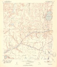 1952 Compass Lake1953 Print · USGSThe Florida Panhandle at mid-century reveals a landscape of lakeside settlements and growing infrastructure at the junction of three counties. Genealogists can trace family landmarks like Sandy Mount Ch, the settlement at Betts, and the Atlanta and St Andrews Bay rail line.3 unique versions available
 - 1952 Map of Altha East, 1953 Print
 1952 Altha East1953 Print · USGSCalhoun and Jackson counties appear in the early 1950s, showing the rural communities of the Florida Panhandle before modern development. Genealogists can trace family landmarks like Henderson Mill, Barton Cem, and several country churches including Sunny Hill Ch.
 - 1954 Map of Tallahassee, 1967 Print
 1954 Tallahassee1967 Print · USGSThe Florida Panhandle and South Georgia are captured here during a period of mid-century growth and military expansion. Researchers can trace the development of Panama City, the footprint of Tyndall Air Force Base, and the rail lines of the Atlantic Coast Line.4 unique versions available
 - 1955 Map of Rock Bluff, 1956 Print
 1955 Rock Bluff1956 Print · USGSThe Florida Panhandle river country is captured here in the mid-fifties, centered on the winding Apalachicola River. Genealogists and historians can trace rural lifeways through landmarks like Rock Bluff, St Stephens Ch, and the high ridges of Torreya State Park.2 unique versions available
 - 1956 Map of North Of Allanton, 1957 Print
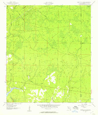 1956 North Of Allanton1957 Print · USGSThe Florida Panhandle's wetland interior is captured here in the mid-fifties, showing a landscape defined by tidewater bayous and extensive swamps. Researchers can locate the Kent Cem, the Majette Lookout Tower, and small industrial Sandpits along the edges of Cooks Bayou.
 - 1959 Map of Tallahassee
 1959 Tallahassee1959 Print · USGSFlorida's Panhandle and the Big Bend region appear here in the mid-fifties, showing a landscape defined by its great river systems and developing coast. Trace the early layout of Panama City, the expansive Apalachicola National Forest, and the coastal St Marks Lighthouse.
 - 1960 Map of Tallahassee
 1960 Tallahassee1960 Print · USGSThe Florida Panhandle and southern Georgia are captured here in the mid-twentieth century, showing a region defined by its rivers and military installations. Genealogists and historians can trace the growth of Tallahassee or locate coastal landmarks like the St Marks Lighthouse and Tyndall Air Force Base.
 - 1978 Map of Bainbridge, 1980 Print
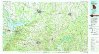 1978 Bainbridge1980 Print · USGSIn the late seventies, this Georgia-Florida borderland was defined by the confluence of the Flint and Chattahoochee rivers. Trace the region's infrastructure via the Seaboard Coast Line Railroad and find sites like Bainbridge State Hospital.
 - 1979 Map of Tallahassee, 1980 Print
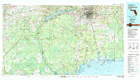 1979 Tallahassee1980 Print · USGSFlorida's capital and the Gulf coast are captured here in the late seventies, showing the region's balance between urban growth and massive protected wetlands. Researchers can trace the routes of the Apalachicola Northern Railroad or locate small inland hubs like Sopchoppy, Panacea, and Hosford.
Showing maps 1-25 of 49
Top cities of Calhoun County
Frequently asked questions
- What are the different types of historical maps available for Calhoun County?
- What is the oldest map of Calhoun County?
- Where can I purchase historical maps of Calhoun County for my home or office?
- Where can I download high-res historical maps of Calhoun County?
- Are there historical topographic maps available for Calhoun County?
- Is there historical aerial imagery available for Calhoun County?
- Where are historical maps of Calhoun County sourced from?