1900s (20th Century) Maps of Brent, Escambia County
Explore 29 historic maps of Brent from the 1900s (20th Century). These maps offer a rare glimpse into what life looked like during the 1900s — showing old roads, neighborhoods, homes, and landmarks that have changed or disappeared over time.
Whether you're researching your family's past, planning a metal detecting trip, or studying how Brent's landscape evolved across the 1900s, these high-resolution maps are a powerful tool for exploring the history of this region.
- Focus on a specific era: All maps on this page are from the 1900s, giving you a focused view of this time period.
- See what’s changed: Compare century-old streets, trails, and buildings to today's modern landscape using overlays and satellite layers.
- Research with precision: Use these maps for genealogy, historical research, land use analysis, or educational projects.
- View, download, or print: Maps are fully viewable online in high resolution, and can be downloaded or printed for your own records.
Start exploring Brent's history through authentic maps from the 1900s. This is your window into the past.
Brent, Escambia County maps
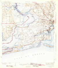
(29)- 1920 Map of Milton
 1920 Milton1920 Print · USGSCovers Brent, including Pensacola, Milton, and other nearby areas
 - 1921 Map of Pensacola
 1921 Pensacola1921 Print · USGSCovers Brent, including Pensacola, Tiger Point, and other nearby areas
 - 1921 Map of Fort Barrancas
 1921 Fort Barrancas1921 Print · USGSCovers Brent, including Pensacola, Lillian, and other nearby areas
 - 1921 Map of Muscogee
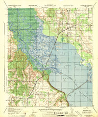
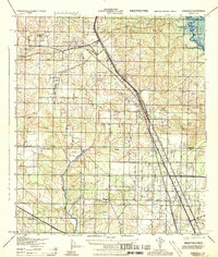
 1921 Muscogee1921 Print · USGSCovers Brent, including Ensley, Molino, and other nearby areas
 - 1941 Map of Fort Barrancas
 1941 Fort Barrancas1941 Print · USGSCovers Brent, including Pensacola, Lillian, and other nearby areas3 unique versions available
 - 1941 Map of Muscogee, 1956 Print
 1941 Muscogee1956 Print · USGSCovers Brent, including Ensley, Molino, and other nearby areas3 unique versions available
 - 1941 Map of Pensacola, 1956 Print
 1941 Pensacola1956 Print · USGSCovers Brent, including Pensacola, Tiger Point, and other nearby areas
 - 1941 Map of Milton, 1956 Print
 1941 Milton1956 Print · USGSCovers Brent, including Pensacola, Milton, and other nearby areas2 unique versions available
 - 1942 Map of Pensacola
 1942 Pensacola1942 Print · USGSCovers Brent, including Pensacola, Tiger Point, and other nearby areas2 unique versions available
 - 1943 Map of Muscogee
 1943 Muscogee1943 Print · USGSCovers Brent, including Ensley, Molino, and other nearby areas2 unique versions available
 - 1943 Map of Fort Barrancas
 1943 Fort Barrancas1943 Print · USGSCovers Brent, including Pensacola, Lillian, and other nearby areas3 unique versions available
 - 1943 Map of Milton
 1943 Milton1943 Print · USGSCovers Brent, including Pensacola, Milton, and other nearby areas2 unique versions available
 - 1944 Map of Floridatown
 1944 Floridatown1944 Print · USGSCovers Brent, including Pensacola, Floridatown, and other nearby areas
 - 1944 Map of West Pensacola
 1944 West Pensacola1944 Print · USGSCovers Brent, including Pensacola, Myrtle Grove, and other nearby areas
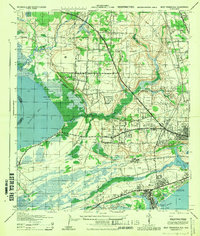
 - 1944 Map of Gonzalez
 1944 Gonzalez1944 Print · USGSCovers Brent, including Ensley, Gonzalez, and other nearby areas
 - 1944 Map of Pensacola
 1944 Pensacola1944 Print · USGSCovers Brent, including Pensacola, East Pensacola Heights, and other nearby areas
 - 1957 Map of Pensacola, 1967 Print
 1957 Pensacola1967 Print · USGSCovers Brent, including Mobile, Pensacola, and other nearby areas3 unique versions available
 - 1959 Map of Pensacola
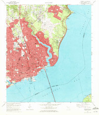
 1959 Pensacola1959 Print · USGSCovers Brent, including Mobile, Pensacola, and other nearby areas
 - 1960 Map of Pensacola
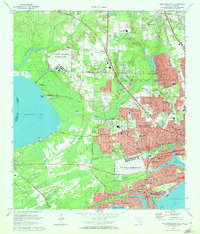
 1960 Pensacola1960 Print · USGSCovers Brent, including Mobile, Pensacola, and other nearby areas
 - 1970 Map of Pensacola, 1972 Print
 1970 Pensacola1972 Print · USGSCovers Brent, including Pensacola, East Pensacola Heights, and other nearby areas3 unique versions available
 - 1970 Map of West Pensacola, 1972 Print
 1970 West Pensacola1972 Print · USGSCovers Brent, including Pensacola, Myrtle Grove, and other nearby areas2 unique versions available
 - 1978 Map of Pace
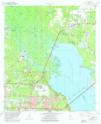 1978 Pace1978 Print · USGSCovers Brent, including Pensacola, Floridatown, and other nearby areas3 unique versions available
 - 1978 Map of Cantonment
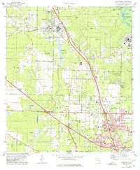 1978 Cantonment1978 Print · USGSCovers Brent, including Ensley, Gonzalez, and other nearby areas3 unique versions available
 - 1978 Map of Pensacola, 1980 Print
 1978 Pensacola1980 Print · USGSCovers Brent, including Pensacola, Fairhope, and other nearby areas3 unique versions available
 - 1981 Map of Bay Minette
 1981 Bay Minette1981 Print · USGSCovers Brent, including Mobile, Pensacola, and other nearby areas2 unique versions available
Showing maps 1-25 of 29
Frequently asked questions
- What are the different types of historical maps available for Brent?
- What is the oldest map of Brent?
- Where can I purchase historical maps of Brent for my home or office?
- Where can I download high-res historical maps of Brent?
- Are there historical topographic maps available for Brent?
- Is there historical aerial imagery available for Brent?
- Where are historical maps of Brent sourced from?