Old Maps of Brent, Escambia County for Academic Research
Study the evolution of Brent with 29 high-resolution historic maps. Whether you're teaching, researching, or modeling changes in land use, these maps provide essential visual documentation of urban, environmental, and geographic change.
- Analyze long-term change: Track patterns in development, transportation, and natural features.
- Ideal for environmental or urban studies: Support academic projects with primary historical map data.
- Use in the classroom or lab: Educators and researchers rely on these maps to bring historical context to life.
These maps are a powerful tool for teaching, research, and visualizing how Brent has changed over the decades.
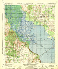
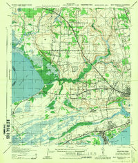
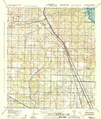
Brent, Escambia County maps
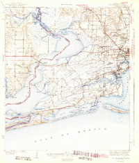
(29)- 1920 Map of Milton
 1920 Milton1920 Print · USGSCovers Brent, including Pensacola, Milton, and other nearby areas
 - 1921 Map of Pensacola
 1921 Pensacola1921 Print · USGSCovers Brent, including Pensacola, Tiger Point, and other nearby areas
 - 1921 Map of Fort Barrancas
 1921 Fort Barrancas1921 Print · USGSCovers Brent, including Pensacola, Lillian, and other nearby areas
 - 1921 Map of Muscogee
 1921 Muscogee1921 Print · USGSCovers Brent, including Ensley, Molino, and other nearby areas
 - 1941 Map of Fort Barrancas
 1941 Fort Barrancas1941 Print · USGSCovers Brent, including Pensacola, Lillian, and other nearby areas3 unique versions available
 - 1941 Map of Muscogee, 1956 Print
 1941 Muscogee1956 Print · USGSCovers Brent, including Ensley, Molino, and other nearby areas3 unique versions available
 - 1941 Map of Pensacola, 1956 Print
 1941 Pensacola1956 Print · USGSCovers Brent, including Pensacola, Tiger Point, and other nearby areas
 - 1941 Map of Milton, 1956 Print
 1941 Milton1956 Print · USGSCovers Brent, including Pensacola, Milton, and other nearby areas2 unique versions available
 - 1942 Map of Pensacola
 1942 Pensacola1942 Print · USGSCovers Brent, including Pensacola, Tiger Point, and other nearby areas2 unique versions available
 - 1943 Map of Muscogee
 1943 Muscogee1943 Print · USGSCovers Brent, including Ensley, Molino, and other nearby areas2 unique versions available
 - 1943 Map of Fort Barrancas
 1943 Fort Barrancas1943 Print · USGSCovers Brent, including Pensacola, Lillian, and other nearby areas3 unique versions available
 - 1943 Map of Milton
 1943 Milton1943 Print · USGSCovers Brent, including Pensacola, Milton, and other nearby areas2 unique versions available
 - 1944 Map of Floridatown
 1944 Floridatown1944 Print · USGSCovers Brent, including Pensacola, Floridatown, and other nearby areas
 - 1944 Map of West Pensacola
 1944 West Pensacola1944 Print · USGSCovers Brent, including Pensacola, Myrtle Grove, and other nearby areas
 - 1944 Map of Gonzalez
 1944 Gonzalez1944 Print · USGSCovers Brent, including Ensley, Gonzalez, and other nearby areas
 - 1944 Map of Pensacola
 1944 Pensacola1944 Print · USGSCovers Brent, including Pensacola, East Pensacola Heights, and other nearby areas
 - 1957 Map of Pensacola, 1967 Print
 1957 Pensacola1967 Print · USGSCovers Brent, including Mobile, Pensacola, and other nearby areas3 unique versions available
 - 1959 Map of Pensacola
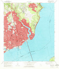
 1959 Pensacola1959 Print · USGSCovers Brent, including Mobile, Pensacola, and other nearby areas
 - 1960 Map of Pensacola
 1960 Pensacola1960 Print · USGSCovers Brent, including Mobile, Pensacola, and other nearby areas
 - 1970 Map of Pensacola, 1972 Print
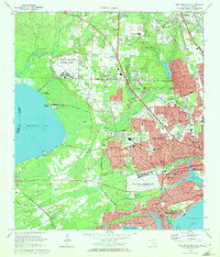
 1970 Pensacola1972 Print · USGSCovers Brent, including Pensacola, East Pensacola Heights, and other nearby areas3 unique versions available
 - 1970 Map of West Pensacola, 1972 Print
 1970 West Pensacola1972 Print · USGSCovers Brent, including Pensacola, Myrtle Grove, and other nearby areas2 unique versions available
 - 1978 Map of Pace
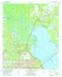 1978 Pace1978 Print · USGSCovers Brent, including Pensacola, Floridatown, and other nearby areas3 unique versions available
 - 1978 Map of Cantonment
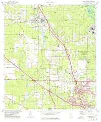 1978 Cantonment1978 Print · USGSCovers Brent, including Ensley, Gonzalez, and other nearby areas3 unique versions available
 - 1978 Map of Pensacola, 1980 Print
 1978 Pensacola1980 Print · USGSCovers Brent, including Pensacola, Fairhope, and other nearby areas3 unique versions available
 - 1981 Map of Bay Minette
 1981 Bay Minette1981 Print · USGSCovers Brent, including Mobile, Pensacola, and other nearby areas2 unique versions available
Showing maps 1-25 of 29
Frequently asked questions
- What are the different types of historical maps available for Brent?
- What is the oldest map of Brent?
- Where can I purchase historical maps of Brent for my home or office?
- Where can I download high-res historical maps of Brent?
- Are there historical topographic maps available for Brent?
- Is there historical aerial imagery available for Brent?
- Where are historical maps of Brent sourced from?