Old Maps of Arbors at Freedom Plaza, Florida for Academic Research
Study the evolution of Arbors at Freedom Plaza with 14 high-resolution historic maps. Whether you're teaching, researching, or modeling changes in land use, these maps provide essential visual documentation of urban, environmental, and geographic change.
- Analyze long-term change: Track patterns in development, transportation, and natural features.
- Ideal for environmental or urban studies: Support academic projects with primary historical map data.
- Use in the classroom or lab: Educators and researchers rely on these maps to bring historical context to life.
These maps are a powerful tool for teaching, research, and visualizing how Arbors at Freedom Plaza has changed over the decades.
Arbors at Freedom Plaza, FL maps
(14)- 1944 Map of Wimauma
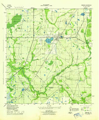 1944 Wimauma1944 Print · USGSMid-century Hillsborough County comes into focus as a landscape of citrus groves and pine flatwoods defined by the Seaboard Air Line. Trace the early development of Wimauma and its local landmarks like Moody Pond and the Wimauma Airport.
 - 1947 Map of Wimauma
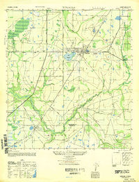 1947 Wimauma1947 Print · USGSCoastal Hillsborough County is captured here just after the war as agriculture and early aviation shaped the region. Genealogists can trace family footprints near Wimauma and Willow, or follow the historical paths of the Tamiami Trail and the Seaboard Air Line.
 - 1956 Map of Wimauma, 1957 Print
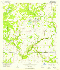 1956 Wimauma1957 Print · USGSThe Florida flatwoods south of Tampa come into focus during the mid-fifties as rural settlements like Wimauma and Willow grew alongside the river systems. Local historians can trace the SEABOARD AIR LINE railroad and the natural bends of the Little Manatee River.4 unique versions available
 - 1956 Map of Tampa, 1964 Print
 1956 Tampa1964 Print · USGSThe Florida Gulf Coast thrived in the mid-fifties, from the bustling docks of Tampa to the quiet shores of Sanibel. Genealogists and historians can trace old rail lines like the Atlantic Coast Line or find early layouts of Port Charlotte and Bokeelia.2 unique versions available
 - 1959 Map of Tampa
 1959 Tampa1959 Print · USGSThe Florida Gulf Coast appears in this late fifties survey during a period of steady coastal growth and established rail commerce. Researchers can trace historic neighborhoods and transit lines from Tampa to St Petersburg, or locate landmarks like Mac Dill AFB and Boca Grande.
 - 1960 Map of Tampa
 1960 Tampa1960 Print · USGSThe Florida Gulf Coast was undergoing a major transformation at the start of the sixties, with new bridges linking burgeoning cities across the bays. Researchers can trace the mid-century footprints of St Petersburg and Tampa, or locate coastal landmarks like Mac Dill AFB and the Sunshine Skyway.2 unique versions available
 - 1972 Map of Tampa, 1974 Print
 1972 Tampa1974 Print · USGSThe Florida Gulf Coast appears in a period of significant growth during the early seventies, from the urban centers of the bay to the quiet southern keys. Researchers can trace the expansion of St Petersburg or locate family sites near Safety Harbor, Valrico, and Boca Ciega.
 - 1981 Map of St Petersburg, 1983 Print
 1981 St Petersburg1983 Print · USGSThe Tampa Bay region is shown here in the early eighties as the urban centers of St Petersburg and Tampa expanded along the coastline. Genealogists and historians can trace rail lines like the Seaboard Coast Line and landmarks from Mac Dill Air Force Base to the Sunshine Skyway.
 - 1988 Map of St Petersburg
 1988 St Petersburg1988 Print · USGSThe Florida Gulf Coast reached a peak of late-twentieth-century development as seen in this late-1980s look at the growing corridor from St Petersburg to Port Charlotte. Researchers can trace the expansion of coastal infrastructure, including MacDill Air Force Base, the Seaboard System RR, and regional parks like Fort De Soto Park.
 - 2012 Map of Wimauma, 2012 Print
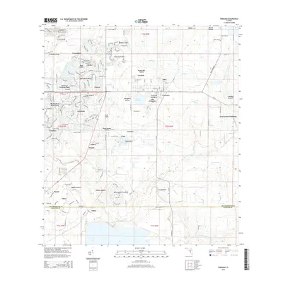
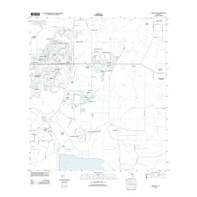 2012 Wimauma2012 Print · USGSCovers Arbors at Freedom Plaza, including Amberwave Estates, Morris Park Farms, and other nearby areas
 - 2015 Map of Wimauma, 2015 Print
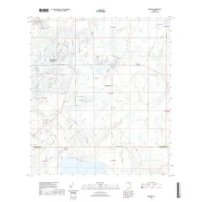
 2015 Wimauma2015 Print · USGSCovers Arbors at Freedom Plaza, including Amberwave Estates, Morris Park Farms, and other nearby areas
 - 2018 Map of Wimauma, 2018 Print
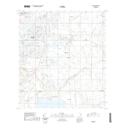
 2018 Wimauma2018 Print · USGSCovers Arbors at Freedom Plaza, including Amberwave Estates, Morris Park Farms, and other nearby areas
 - 2021 Map of Wimauma, 2021 Print
 2021 Wimauma2021 Print · USGSCovers Arbors at Freedom Plaza, including Amberwave Estates, Morris Park Farms, and other nearby areas
 - 2024 Map of Wimauma, 2024 Print
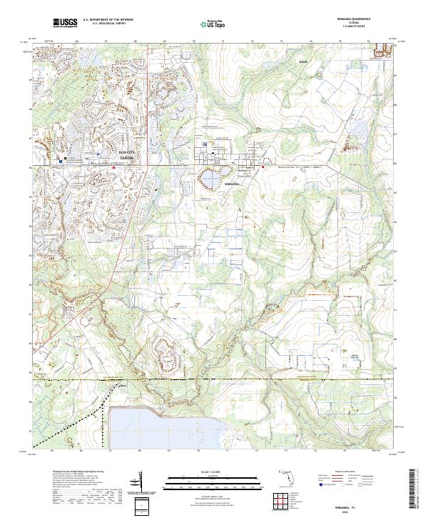 2024 Wimauma2024 Print · USGSHillsborough County at the present day shows the striking contrast between mid-century planned communities and rural river landscapes. Genealogists and researchers can trace local landmarks from Wimauma and Balm to the quiet grounds of Lake Wimauma Memorial Gardens.
End of results
Showing maps 1-14 of 14
Top cities near Arbors at Freedom Plaza
- Tampa historical maps
- Saint Petersburg historical maps
- Brandon historical maps
- Riverview historical maps
- Bradenton historical maps
- Palmetto historical maps
See more
Frequently asked questions
- What are the different types of historical maps available for Arbors at Freedom Plaza?
- What is the oldest map of Arbors at Freedom Plaza?
- Where can I purchase historical maps of Arbors at Freedom Plaza for my home or office?
- Where can I download high-res historical maps of Arbors at Freedom Plaza?
- Are there historical topographic maps available for Arbors at Freedom Plaza?
- Is there historical aerial imagery available for Arbors at Freedom Plaza?
- Where are historical maps of Arbors at Freedom Plaza sourced from?