1970s Maps of Marion County, Florida
Explore 16 historic maps of Marion County from the 1970s. These maps offer a rare glimpse into what life looked like during the 1970s — showing old roads, neighborhoods, homes, and landmarks that have changed or disappeared over time.
Whether you're researching your family's past, planning a metal detecting trip, or studying how Marion County's landscape evolved across the 1970s, these high-resolution maps are a powerful tool for exploring the history of this region.
- Focus on a specific era: All maps on this page are from the 1970s, giving you a focused view of this time period.
- See what’s changed: Compare century-old streets, trails, and buildings to today's modern landscape using overlays and satellite layers.
- Research with precision: Use these maps for genealogy, historical research, land use analysis, or educational projects.
- View, download, or print: Maps are fully viewable online in high resolution, and can be downloaded or printed for your own records.
Start exploring Marion County's history through authentic maps from the 1970s. This is your window into the past.
Marion County, FL maps
(16)- 1970 Map of Ft McCoy, 1973 Print
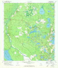
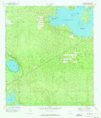
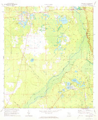 1970 Ft McCoy1973 Print · USGSMarion County's river-fed wetlands and forests are captured here in the early 1970s, showcasing the intricate relationship between the Oklawaha River and its surrounding communities. Researchers can trace historic river access points like Strouds Landing and Parch Landing or locate family sites near Fort McCoy and Graveyard Lake.3 unique versions available
 - 1970 Map of Welaka, 1973 Print
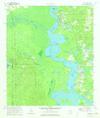 1970 Welaka1973 Print · USGSThe St. Johns River corridor and Ocala National Forest are shown here in the 1970s, during a period of quiet riverside growth. Genealogists and historians can trace old settlements and landings like Welaka, Fruitland, and Norwalk Landing.4 unique versions available
 - 1970 Map of Lake Delancy, 1973 Print
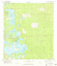
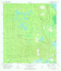
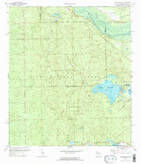 1970 Lake Delancy1973 Print · USGSMarion and Putnam counties meet in this 1970s survey of the Florida scrub, where the Ocala National Forest preserves a landscape of high islands and deep lakes. Researchers can trace the layout of Kerr City or locate recreation spots like Grassy Pond Recreation Area and the remote Lake Delancy.2 unique versions available
 - 1970 Map of Salt Springs, 1973 Print
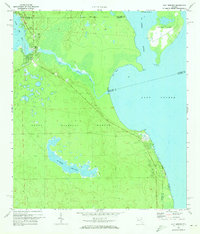 1970 Salt Springs1973 Print · USGSThe Marion County wetlands and Ocala backcountry come alive in the early 1970s, showcasing a landscape of spring runs and vast prairies. Genealogists and historians can trace the paths around Salt Springs, the shores of Lake George, and remote sites like Hopkins Prairie.2 unique versions available
 - 1970 Map of Lynne, 1973 Print
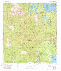
 1970 Lynne1973 Print · USGSMarion County in the early seventies is a landscape of river landings and forest settlements. Genealogists can locate family sites near Grahamsville and Bruceville or trace old routes by the Ocklawaha Bridge Ch and East Marion Sch.3 unique versions available
 - 1970 Map of Halfmoon Lake, 1973 Print
 1970 Halfmoon Lake1973 Print · USGSMarion County's lake-filled wetlands are captured here in the early 1970s within the Ocala National Forest. Researchers can trace old forest access via the Jeep Trail or locate vanished sites like the Trailer Park near Halfmoon Lake.3 unique versions available
 - 1970 Map of Eureka Dam, 1973 Print
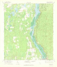 1970 Eureka Dam1973 Print · USGSThe Ocklawaha River is captured during its transformation by the Cross Florida Barge Canal project in the early seventies. Genealogists and historians can locate riverside landmarks like Cracker Landing, Eureka, and the Bethel Ch.3 unique versions available
 - 1970 Map of Lake Weir, 1973 Print
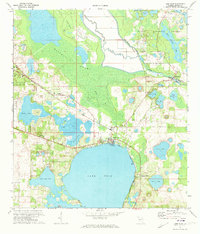 1970 Lake Weir1973 Print · USGSMarion County's lake country is captured here during the early 1970s, showing a landscape defined by the citrus-era railroad and river lock systems. Researchers can trace the Seaboard Coast Line through Candler or locate the Moss Bluff Lock and Dam and St Pauls Ch.4 unique versions available
 - 1970 Map of Lake Kerr, 1973 Print
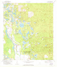
 1970 Lake Kerr1973 Print · USGSIn the heart of the Ocala National Forest during the early 1970s, this area centers on the waters of Lake Kerr. Researchers can trace the Old Railroad Grade, locate the Cem near Kerr City, and find landmarks like the Eureka Lookout Tower.2 unique versions available
 - 1972 Map of Juniper Springs, 1973 Print
 1972 Juniper Springs1973 Print · USGSThe Ocala National Forest in the early seventies reveals a landscape of artesian springs and restricted military territory. Researchers can trace the boundaries of the U S Naval Reservation and locate historic recreation sites like Fern Hammock Springs and Juniper Prairie.3 unique versions available
 - 1972 Map of Farles Lake, 1973 Print
 1972 Farles Lake1973 Print · USGSMarion and Lake counties in the early 1970s reveal a landscape of dense timber and hidden waters within the Ocala National Forest. Researchers can trace the Old Railroad Grade or locate early facilities like Camp Ocala and the Pittman Work Center.2 unique versions available
 - 1972 Map of Lake Mary, 1973 Print
 1972 Lake Mary1973 Print · USGSWithin the Ocala National Forest in the early seventies, this survey traces the wild wetlands and early settlements along the Oklawaha River. Genealogists and researchers can locate landmarks like Moss Bluff, the Big Scrub Camp, and the small Cem tucked near the riverbanks.3 unique versions available
 - 1978 Map of Ocala, 1980 Print
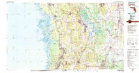
 1978 Ocala1980 Print · USGSFlorida's interior heartland and Gulf coast are seen here in the late seventies, showing the transition from freshwater springs to coastal hammocks. Genealogists and historians can trace the Seaboard Coast Line Railroad through Chiefland, Bronson, and Dunnellon.2 unique versions available
 - 1978 Map of Daytona Beach, 1980 Print
 1978 Daytona Beach1980 Print · USGSCoastal development meets the wild Florida interior in the late seventies, spanning from the Atlantic beaches to the St. Johns River. Trace the growth of Daytona Beach or find inland outposts like Salt Springs, De Leon Springs, and the U S Naval Reservation.2 unique versions available
 - 1979 Map of Inverness, 1980 Print
 1979 Inverness1980 Print · USGSThe West Central Florida coastline and lake regions are captured here in the late seventies, showing the transition from Gulf marshes to the interior wetlands. Genealogists and researchers can locate family sites near Inverness or trace the early rail corridors of the Seaboard Coast Line through Wildwood and Okahumpka.2 unique versions available
 - 1979 Map of Orlando, 1980 Print
 1979 Orlando1980 Print · USGSCentral Florida's lake country and growing urban corridors are captured here just before the decade's end. Genealogists and historians can trace the transition from citrus rail towns like Winter Garden to the suburban expansion along I-4 and Florida's Turnpike.3 unique versions available
End of results
Showing maps 1-16 of 16
Top cities of Marion County
- Ocala historical maps
- Citra historical maps
- Rainbow Springs historical maps
- Belleview historical maps
- Dunnellon historical maps
- Reddick historical maps
See more
Frequently asked questions
- What are the different types of historical maps available for Marion County?
- What is the oldest map of Marion County?
- Where can I purchase historical maps of Marion County for my home or office?
- Where can I download high-res historical maps of Marion County?
- Are there historical topographic maps available for Marion County?
- Is there historical aerial imagery available for Marion County?
- Where are historical maps of Marion County sourced from?