1900s (20th Century) Maps of Marion County, Florida
Explore 87 historic maps of Marion County from the 1900s (20th Century). These maps offer a rare glimpse into what life looked like during the 1900s — showing old roads, neighborhoods, homes, and landmarks that have changed or disappeared over time.
Whether you're researching your family's past, planning a metal detecting trip, or studying how Marion County's landscape evolved across the 1900s, these high-resolution maps are a powerful tool for exploring the history of this region.
- Focus on a specific era: All maps on this page are from the 1900s, giving you a focused view of this time period.
- See what’s changed: Compare century-old streets, trails, and buildings to today's modern landscape using overlays and satellite layers.
- Research with precision: Use these maps for genealogy, historical research, land use analysis, or educational projects.
- View, download, or print: Maps are fully viewable online in high resolution, and can be downloaded or printed for your own records.
Start exploring Marion County's history through authentic maps from the 1900s. This is your window into the past.
Marion County, FL maps
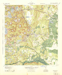
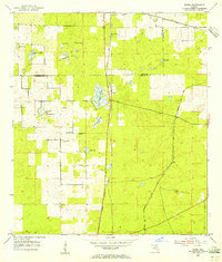
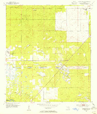
(87)- 1915 Map of Interlachen
 1915 Interlachen1915 Print · USGSThe Florida interior around the lake-heavy Putnam and Marion county lines is shown here in the years before widespread drainage and development. Researchers can trace the early rail stops at Florahome and Mannville or locate rural landmarks like Magnolia Church and the Cedar Landing Ferry.
 - 1916 Map of Interlachen
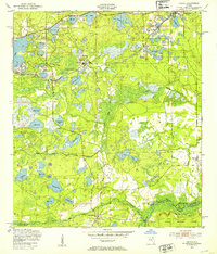
 1916 Interlachen1916 Print · USGSFlorida's lake-filled interior at the start of the Great War is a landscape of scattered rail towns and expansive wetlands. Genealogists and local historians can trace family roots through old settlements like Interlachen, Putnam Hall, and Kenwood Heights, or locate the rural Roscola School and Conch School.6 unique versions available
 - 1938 Map of Hawthorn
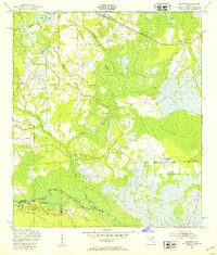
 1938 Hawthorn1938 Print · USGSAlachua County in the late thirties is a landscape of intersecting railroads and sprawling lakeside settlements. Genealogists and historians can trace the foundations of Hawthorn, locate remote burial sites like Riley Cem, and explore the rail junctions at Micanopy Junction.
 - 1943 Map of Hawthorn, 1963 Print
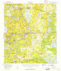
 1943 Hawthorn1963 Print · USGSAlachua County during the early war years reveals a landscape defined by its great lakes and a dual-railroad economy. Researchers can trace the routes of the Seaboard Air Line, locate rural landmarks like Ochwilla Church, or find family roots at Providence Cem and Drummond Cem.
 - 1944 Map of Interlachen
 1944 Interlachen1944 Print · USGSNorth-central Florida's rail-and-water network is captured here in the 1940s, centered on the bustling junction at Interlachen. Genealogists and historians can trace riverside activity at Cedar Landing Ferry and early rural education sites like Congo Sch.
 - 1949 Map of Keuka, 1953 Print
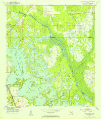
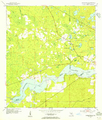
 1949 Keuka1953 Print · USGSFlorida's lake country near the Marion and Putnam county line was a network of river landings and rail stops in the late 1940s. Genealogists and historians can trace community roots at Edgar Community Ch, find old crossings like Brumbridge Ferry, and locate early riverfront points at Agnews Landing.6 unique versions available
 - 1949 Map of Rodman, 1953 Print
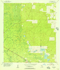
 1949 Rodman1953 Print · USGSInland Florida in the late 1940s was a land of timber mills and riverfront landings. Trace the early boundaries of the Ocala National Forest and locate historical sites like Rainbow Ranch, Rodman, and the riverside Cedar Landing.3 unique versions available
 - 1949 Map of Interlachen, 1955 Print
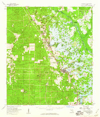
 1949 Interlachen1955 Print · USGSPutnam County's lake-rich interior is captured here just after the war, showing the distinct citrus and rail-centered settlements of the era. Genealogists can locate family landmarks like Mt Bethel Ch, Johnson Park Sch, and the unique Peat Cuttings near Florahome.3 unique versions available
 - 1954 Map of Romeo, 1955 Print
 1954 Romeo1955 Print · USGSMarion and Levy counties in the mid-1950s show a landscape of rail-dependent settlements and seasonal prairies. Genealogists and historians can trace families near Romeo or Hoyt, and locate the historic Zion Hill Cem and Zion Hill Ch.2 unique versions available
 - 1954 Map of Tsala Apopka NE, 1955 Print
 1954 Tsala Apopka NE1955 Print · USGSMid-century Citrus County is defined here by the intricate wetlands and rail lines that once fueled the local economy. Genealogists and historians can trace the foundations of Hernando and locate rural landmarks like Stokes Ferry and Twomile Prairie Lake.5 unique versions available
 - 1954 Map of Dunnellon, 1955 Print
 1954 Dunnellon1955 Print · USGSDunnellon and the surrounding phosphate mining district come into sharp focus in the mid-1950s. Trace the rail-and-river history of the region through the Atlantic Coast Line, the Rockwell Cem, and the Dunnellon Airport (Abandoned).3 unique versions available
 - 1954 Map of Cotton Plant, 1955 Print
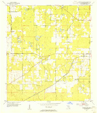 1954 Cotton Plant1955 Print · USGSMarion County in the mid-fifties is a landscape of rural settlements and intersecting rail lines. Genealogists and historians can locate old churches and community centers like Mars Hill Ch, Cotton Plant, and the railway siding at Martel.2 unique versions available
 - 1954 Map of Dunnellon SE, 1955 Print
 1954 Dunnellon SE1955 Print · USGSMarion County in the mid-1950s reveals the interrupted dream of a trans-Florida waterway. Researchers can trace the path of the Proposed Gulf Atlantic Ship Canal (Abandoned) and locate landmarks like Cedar Grove Ch and the Dunnellon Airport (Abandoned).2 unique versions available
 - 1954 Map of Yankeetown SE, 1955 Print
 1954 Yankeetown SE1955 Print · USGSThe Florida hammock country comes into focus in the mid-1950s as the Withlacoochee River flows through the convergence of three counties. You can trace the Atlantic Coast Line rail route and locate secluded landmarks like Lebanon Cem and Dog Ear Cem.3 unique versions available
 - 1954 Map of Inverness, 1960 Print
 1954 Inverness1960 Print · USGSMid-century Citrus County is defined by the intricate wetlands and island communities of the lake region. Genealogists and historians can trace the paths of the Atlantic Coast Line through Hernando or locate the Dampier Cemetery and the Poor Farm Landing Field.2 unique versions available
 - 1954 Map of Dunnellon, 1960 Print
 1954 Dunnellon1960 Print · USGSDunnellon and rural Marion County appear in the mid-1950s as a landscape of phosphate mining, railroads, and fresh water springs. Genealogists and historians can trace family locations near Zion Hill Cem, Cotton Plant, and the Circle Square Ranch.
 - 1954 Map of Gainesville, 1965 Print
 1954 Gainesville1965 Print · USGSMid-century North Central Florida comes into focus as a landscape of timber, rails, and river towns along the Gulf. Trace family roots in established centers like Gainesville or follow the path of the Suwannee River to the coastal docks of Cedar Key.3 unique versions available
 - 1954 Map of Daytona Beach, 1974 Print
 1954 Daytona Beach1974 Print · USGSNortheast Florida is captured in the mid-1950s, showing the transition from river-based commerce to coastal tourism. Researchers can trace the Florida East Coast rail lines and find historic sites like Castillo de San Marcos Nat Mon and Palatka.
 - 1955 Map of Tidewater, 1956 Print
 1955 Tidewater1956 Print · USGSLevy County's forested wetlands and rail corridors are captured here in the mid-fifties, centered on the settlement of Tidewater. Researchers can trace the Atlantic Coast Line railroad and locate rural landmarks like Sand Pond Cem and Tiger Lake.3 unique versions available
 - 1955 Map of Plant City, 1966 Print
 1955 Plant City1966 Print · USGSMid-century Central Florida comes to life in this survey of the Nature Coast and the inland citrus and rail belt. Genealogists and historians can trace the paths of the Atlantic Coast Line, locate the Anclote Keys Lighthouse, or find old communities like Masaryktown and Lacoochee.6 unique versions available
 - 1955 Map of Orlando, 1969 Print
 1955 Orlando1969 Print · USGSCentral Florida was entering the space age in the mid-fifties, balancing its citrus heritage with new military and aerospace frontiers. You can trace early developments at Kennedy Space Center or locate interior settlements like Eatonville and Pine Castle.3 unique versions available
 - 1957 Map of Orlando
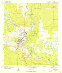
 1957 Orlando1957 Print · USGSCovers Marion County, including Orlando, Palm Bay, and other nearby areas
 - 1958 Map of Orlando
 1958 Orlando1958 Print · USGSCentral Florida was a landscape of citrus, rail, and emerging aerospace technology during the late fifties. Researchers can trace the early footprints of Cape Canaveral and Patrick Air Force Base or locate inland citrus and rail hubs like Sanford and Lakeland.
 - 1958 Map of Daytona Beach
 1958 Daytona Beach1958 Print · USGSThe Florida coast and St. Johns River valley are captured in the late 1950s, showing a landscape defined by citrus-belt rail towns and Atlantic shorelines. Genealogists can trace family roots through riverside settlements like Palatka and Welaka or coastal hubs like Daytona Beach.2 unique versions available
 - 1958 Map of Plant City
 1958 Plant City1958 Print · USGSFlorida's Gulf Coast and inland ridge country are captured here in the mid-fifties, showing the region before modern sprawl. Genealogists and historians can trace rail-era towns like Richland and Trilby or locate coastal landmarks such as the Anclote Keys Lighthouse.
Showing maps 1-25 of 87
Top cities of Marion County
- Ocala historical maps
- Citra historical maps
- Rainbow Springs historical maps
- Belleview historical maps
- Dunnellon historical maps
- Reddick historical maps
See more
Frequently asked questions
- What are the different types of historical maps available for Marion County?
- What is the oldest map of Marion County?
- Where can I purchase historical maps of Marion County for my home or office?
- Where can I download high-res historical maps of Marion County?
- Are there historical topographic maps available for Marion County?
- Is there historical aerial imagery available for Marion County?
- Where are historical maps of Marion County sourced from?