Old Maps of Trinity, Florida for Metal Detecting
Plan your next treasure hunt with 24 historic maps of Trinity. Find old homesites, ghost towns, trails, and gathering spots that may be lost to time — perfect for identifying promising metal detecting locations.
- Locate forgotten sites: Uncover places like long-lost settlements, abandoned rail lines, or gathering spots.
- Plan better hunts: Use map overlays combined with LiDAR or satellite views to narrow in on historically rich areas.
- Made for detectorists: Thousands of hobbyists use these maps to discover relics, coins, and hidden history.
Use these historic maps to boost your research and find new opportunities beneath the surface of Trinity.
Trinity, FL maps
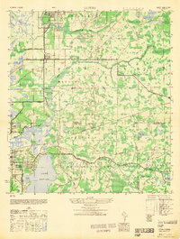
(24)- 1943 Map of Odessa, 1957 Print
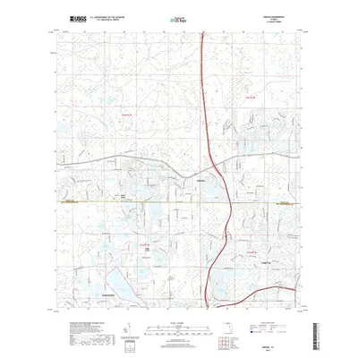
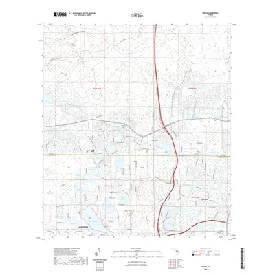
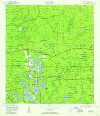 1943 Odessa1957 Print · USGSCoastal Florida pinelands and transit corridors emerge in this mid-century survey of the Pasco and Hillsborough county line. Trace the steam-era rail history through Odessa at the Atlantic Coast Line junction and explore the lakefronts of Keystone Lake and Camp Mawian.3 unique versions available
 - 1943 Map of Elfers, 1957 Print
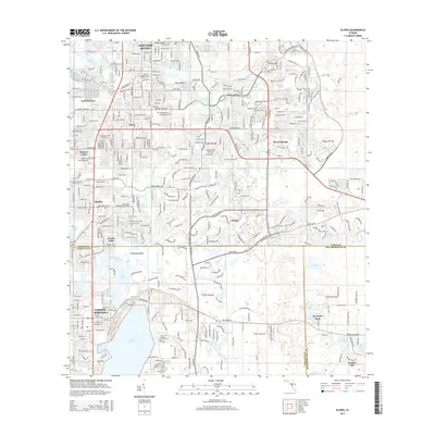
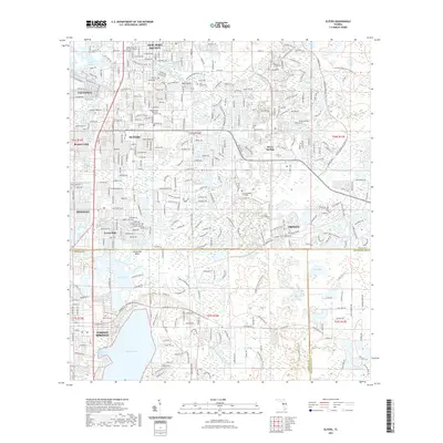
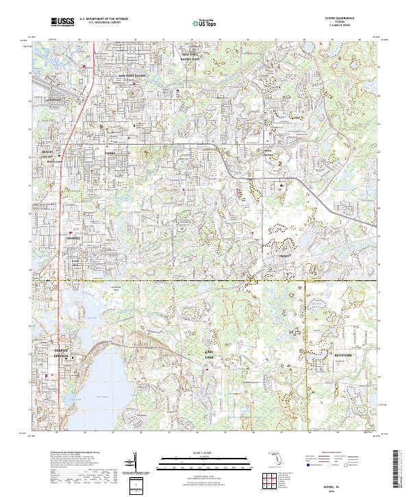
 1943 Elfers1957 Print · USGSThe Florida Gulf Coast comes alive in the 1940s as settlements like New Port Richey and Tarpon Springs begin to take shape. Genealogists and researchers can trace the historic Dixie Highway and locate rural landmarks such as Elfers and Seven Springs.2 unique versions available
 - 1944 Map of Elfers
 1944 Elfers1944 Print · USGSThe Florida Gulf coast comes into focus during the mid-1940s as the communities of New Port Richey and Elfers begin to expand. Genealogists and local historians can trace family locations near Seven Springs, the Anclote River, and early rail lines like the Seaboard Air Line.
 - 1944 Map of Odessa
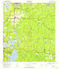
 1944 Odessa1944 Print · USGSMid-century Pasco and Hillsborough counties are shown here as a landscape of citrus groves, rail lines, and cypress swamps. Genealogists and historians can trace the footprint of early communities at Odessa and Lake Fern, or find landmarks like the Lake Fern School and Camp Mawian YMCA.
 - 1948 Map of Elfers
 1948 Elfers1948 Print · USGSThe Florida Gulf Coast near the Pasco and Pinellas border comes alive in this post-war survey. Genealogists and researchers can trace early settlements at New Port Richey, Elfers, and Seven Springs while following the Seaboard Air Line through the cypress swamps.
 - 1949 Map of Odessa
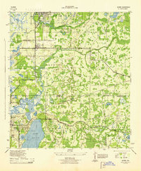
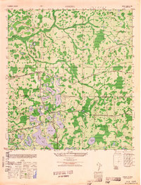 1949 Odessa1949 Print · USGSThe interior of the Florida Gulf Coast is shown here in the late 1940s, a landscape defined by citrus groves and sprawling lake networks. Genealogists and local historians can trace the early community hubs of Odessa and Lake Fern, including the Lake Fern School and the Atlantic Coast Line rail corridor.
 - 1955 Map of Plant City, 1966 Print
 1955 Plant City1966 Print · USGSMid-century Central Florida comes to life in this survey of the Nature Coast and the inland citrus and rail belt. Genealogists and historians can trace the paths of the Atlantic Coast Line, locate the Anclote Keys Lighthouse, or find old communities like Masaryktown and Lacoochee.6 unique versions available
 - 1958 Map of Plant City
 1958 Plant City1958 Print · USGSFlorida's Gulf Coast and inland ridge country are captured here in the mid-fifties, showing the region before modern sprawl. Genealogists and historians can trace rail-era towns like Richland and Trilby or locate coastal landmarks such as the Anclote Keys Lighthouse.
 - 1959 Map of Plant City
 1959 Plant City1959 Print · USGSThe West Florida coast and inland timberlands are captured here in the late fifties, from the bend of the Gulf to the rail hubs of the interior. Trace the paths of the Atlantic Coast Line through Inverness and find landmarks like the Anclote Keys Lighthouse.
 - 1964 Map of Plant City
 1964 Plant City1964 Print · USGSThe West Florida coast and its interior rail corridors come alive in this mid-sixties survey, spanning from the gulf marshes to the agricultural heartland. Researchers can trace the routes of the Atlantic Coast Line through settlements like Bushnell, Inverness, and Plant City.
 - 1974 Map of Odessa, 1975 Print
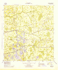
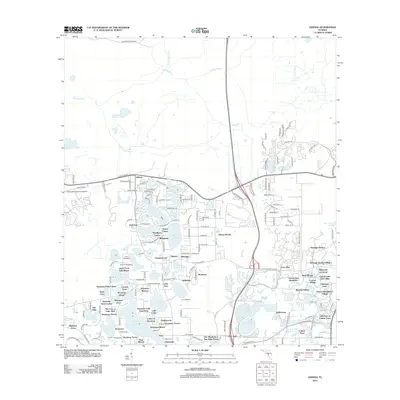
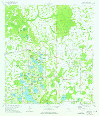 1974 Odessa1975 Print · USGSThe lake-dotted borderlands of Pasco and Hillsborough counties come into focus in the mid-1970s. Trace the rural development of Odessa and its surrounding waters, from Indian Mounds near Mound Lake to the grounds of Camp Keystone and the Odessa Ch.4 unique versions available
 - 1974 Map of Elfers, 1975 Print
 1974 Elfers1975 Print · USGSThe West Florida coast in the mid-seventies shows a landscape in transition as suburbs replaced rural sloughs and bayous. Genealogists and historians can trace the growth of New Port Richey, locate several burial grounds like East Elfers Cem, and follow the Seaboard Coast Line through Seven Springs.2 unique versions available
 - 1978 Map of Tarpon Springs, 1982 Print
 1978 Tarpon Springs1982 Print · USGSCoastal Florida is shown during its late-century period of rapid growth, from the Gulf shores to the deep inland swamps. Researchers can trace the development of the Intracoastal Waterway and locate regional landmarks like the Anclote Missile Tracking Annex and Lake Tarpon.
 - 1998 Map of Elfers, 2001 Print
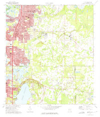
 1998 Elfers2001 Print · USGSCoastal Pasco and Pinellas counties are seen here in the late twentieth century as suburban growth filled the corridors between historic river settlements. Trace local family roots at East Elfers Cem or locate community landmarks like Riverside Chapel and the Tampa Bay Executive Airport.
 - 2012 Map of Elfers, 2012 Print
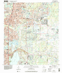
 2012 Elfers2012 Print · USGSCovers Trinity, including Tarpon Springs, Holiday, and other nearby areas
 - 2012 Map of Odessa, 2012 Print
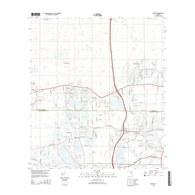
 2012 Odessa2012 Print · USGSCovers Trinity, including Lutz, Keystone Reserve, and other nearby areas
 - 2015 Map of Elfers, 2015 Print
 2015 Elfers2015 Print · USGSCovers Trinity, including Tarpon Springs, Holiday, and other nearby areas
 - 2015 Map of Odessa, 2015 Print
 2015 Odessa2015 Print · USGSCovers Trinity, including Lutz, Keystone Reserve, and other nearby areas
 - 2018 Map of Odessa, 2018 Print
 2018 Odessa2018 Print · USGSCovers Trinity, including Lutz, Keystone Reserve, and other nearby areas
 - 2018 Map of Elfers, 2018 Print
 2018 Elfers2018 Print · USGSCovers Trinity, including Tarpon Springs, Holiday, and other nearby areas
 - 2021 Map of Odessa, 2021 Print
 2021 Odessa2021 Print · USGSCovers Trinity, including Lutz, Keystone Reserve, and other nearby areas
 - 2021 Map of Elfers, 2021 Print
 2021 Elfers2021 Print · USGSCovers Trinity, including Tarpon Springs, Holiday, and other nearby areas
 - 2024 Map of Elfers, 2024 Print
 2024 Elfers2024 Print · USGSThe Florida Gulf Coast near Tarpon Springs and Elfers is shown in this modern era of suburban expansion and waterway preservation. Researchers can trace the layout of local cemeteries like Rose Cem and explore the geography of Lake Tarpon.
 - 2024 Map of Odessa, 2024 Print
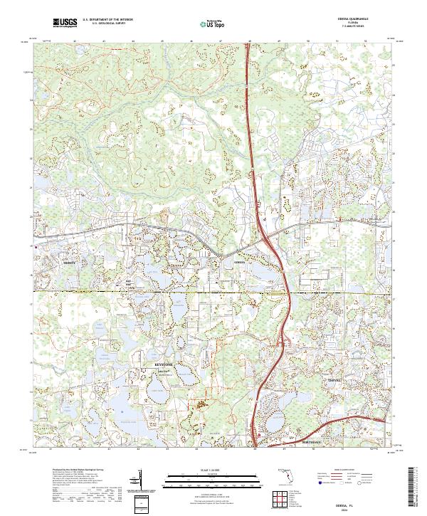 2024 Odessa2024 Print · USGSThe Pasco and Hillsborough borderlands are shown in detail as modern residential communities integrate with the region's many lakes. Local historians and genealogists can trace the development of Odessa, Keystone, and Gulf Pine alongside the Anclote River.
End of results
Showing maps 1-24 of 24
Top cities near Trinity
- Tampa historical maps
- Clearwater historical maps
- Palm Harbor historical maps
- Dunedin historical maps
- East Lake historical maps
- Bayonet Point historical maps
See more
Top neighborhoods of Trinity
- Fox Hollow historical maps
- Spyglass historical maps
- Hampton Cove historical maps
- Bellerive historical maps
- Foxwood historical maps
Frequently asked questions
- What are the different types of historical maps available for Trinity?
- What is the oldest map of Trinity?
- Where can I purchase historical maps of Trinity for my home or office?
- Where can I download high-res historical maps of Trinity?
- Are there historical topographic maps available for Trinity?
- Is there historical aerial imagery available for Trinity?
- Where are historical maps of Trinity sourced from?