1950s Maps of Volusia County, Florida
Explore 21 historic maps of Volusia County from the 1950s. These maps offer a rare glimpse into what life looked like during the 1950s — showing old roads, neighborhoods, homes, and landmarks that have changed or disappeared over time.
Whether you're researching your family's past, planning a metal detecting trip, or studying how Volusia County's landscape evolved across the 1950s, these high-resolution maps are a powerful tool for exploring the history of this region.
- Focus on a specific era: All maps on this page are from the 1950s, giving you a focused view of this time period.
- See what’s changed: Compare century-old streets, trails, and buildings to today's modern landscape using overlays and satellite layers.
- Research with precision: Use these maps for genealogy, historical research, land use analysis, or educational projects.
- View, download, or print: Maps are fully viewable online in high resolution, and can be downloaded or printed for your own records.
Start exploring Volusia County's history through authentic maps from the 1950s. This is your window into the past.
Volusia County, FL maps
(21)- 1950 Map of Maytown, 1952 Print
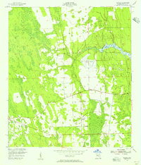
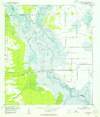
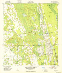 1950 Maytown1952 Print · USGSIn the mid-century Florida marshlands, historical land grants and the railroad define the local landscape. Genealogists and historians can trace the exact boundaries of the Delespine Grant and Peter Fouchard Grant near the settlement of Maytown.6 unique versions available
 - 1950 Map of Ariel, 1952 Print
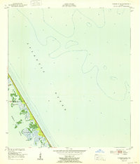
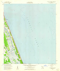
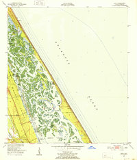 1950 Ariel1952 Print · USGSThe Volusia County coast during the early fifties reveals a landscape of massive land grants and intricate barrier islands. Genealogists and local historians can trace the bounds of the Joseph Wales Grant or locate old sites like Eldora and Turtle Mound.4 unique versions available
 - 1950 Map of Edgewater, 1952 Print
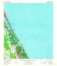
 1950 Edgewater1952 Print · USGSThe Volusia County coastline in the early fifties remains a patchwork of historic Spanish land grants and emerging rail towns. Genealogists and historians can trace family-named landmarks like the Ambrose Hull Grant alongside settlements at Edgewater and Hucomer.5 unique versions available
 - 1950 Map of Aurantia, 1952 Print
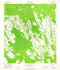
 1950 Aurantia1952 Print · USGSBrevard County was a landscape of Spanish land grants and sprawling wetlands at the mid-century point. Researchers can trace the Florida East Coast rail line as it passes through Aurantia, and locate landmarks like Southmere and the Brevard County Game Refuge.5 unique versions available
 - 1952 Map of Pardon Island
 1952 Pardon Island1952 Print · USGSThe Florida coast near the Volusia and Brevard county line is captured in the early fifties, showing a remote landscape of islands and sloughs. Researchers can trace the early footprints of the Pardon settlement and locate landmarks like Three Cabbage Island and Pardon Slough.
 - 1952 Map of Samsula, 1956 Print
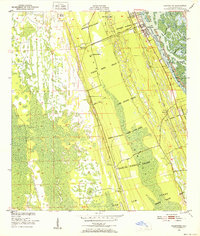
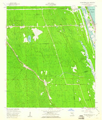
 1952 Samsula1956 Print · USGSCoastal Volusia County is shown in the early fifties as the rural community of Samsula began to expand around its agricultural roots. Researchers can trace the legacy of early aviation at Spruce Creek Airport and follow the path of the Old Railroad Grade.6 unique versions available
 - 1952 Map of Daytona Beach, 1956 Print
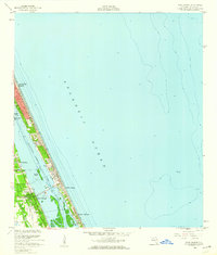
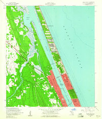
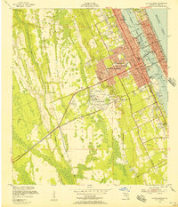 1952 Daytona Beach1956 Print · USGSMid-century Daytona Beach is captured here at a moment of significant coastal development along the Intracoastal Waterway. Local researchers can trace family roots through Bethune-Cookman College or locate vanished landmarks like the Volusia County Kennel Club.7 unique versions available
 - 1953 Map of Geneva, 1955 Print
 1953 Geneva1955 Print · USGSEastern Seminole County is shown in the early 1950s as a landscape of vast river marshes and small inland settlements. Researchers can locate prehistoric sites like Palmer-Taylor Mound or trace family roots near Geneva and the Chuluota Cem.5 unique versions available
 - 1953 Map of Titusville SW, 1955 Print
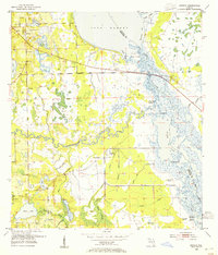
 1953 Titusville SW1955 Print · USGSThe Upper St. Johns River basin is captured here in the early 1950s, showing the intricate wetlands before modern drainage projects. Researchers can locate ancient landmarks like Orange Mound or trace the early path of the Cheney Highway as it crosses the St Johns River.5 unique versions available
 - 1954 Map of Daytona Beach, 1974 Print
 1954 Daytona Beach1974 Print · USGSNortheast Florida is captured in the mid-1950s, showing the transition from river-based commerce to coastal tourism. Researchers can trace the Florida East Coast rail lines and find historic sites like Castillo de San Marcos Nat Mon and Palatka.
 - 1955 Map of Orlando, 1969 Print
 1955 Orlando1969 Print · USGSCentral Florida was entering the space age in the mid-fifties, balancing its citrus heritage with new military and aerospace frontiers. You can trace early developments at Kennedy Space Center or locate interior settlements like Eatonville and Pine Castle.3 unique versions available
 - 1956 Map of Port Orange, 1960 Print
 1956 Port Orange1960 Print · USGSThe Volusia County coastline in the mid-1950s shows a landscape of growing riverfront towns and quiet barrier island retreats. Trace the early layout of Port Orange and Wilbur-by-the-Sea, or locate landmarks like Woodland Cem and the Drive-in Theater.4 unique versions available
 - 1956 Map of Favoretta, 1960 Print
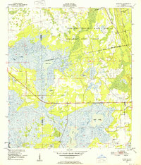
 1956 Favoretta1960 Print · USGSThe borderlands of Flagler and Volusia counties are captured here in the mid-1950s, defined by the expansive wetlands of the Florida lowlands. Researchers can trace the rail corridor at Favoretta or locate the site of the Tomoka Airport and National Gardens.5 unique versions available
 - 1956 Map of New Smyrna Beach, 1960 Print
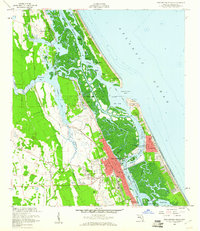 1956 New Smyrna Beach1960 Print · USGSThe Volusia County coastline in the mid-fifties reveals a period of significant growth along the Indian River and Halifax River. Researchers can trace the development of New Smyrna Beach, the legacy of Chisolm High Sch, and the layout of the Florida East Coast Railroad.6 unique versions available
 - 1956 Map of Flagler Beach East, 1960 Print
 1956 Flagler Beach East1960 Print · USGSThe Florida coast at Flagler Beach is shown in the mid-fifties as the region's inland waterways and marshes remained largely undeveloped. Researchers can trace the Intracoastal Waterway past Mound Grove and locate the U S Coast Guard Reservation.3 unique versions available
 - 1956 Map of Flagler Beach West, 1960 Print
 1956 Flagler Beach West1960 Print · USGSCoastal Florida in the mid-fifties is captured here as the interior marshes met growing transit corridors. Researchers can trace the legacy of the Florida East Coast railway or find local landmarks like the Good Hope Cem and Bulow Ruins State Monument.5 unique versions available
 - 1956 Map of Ormond Beach, 1960 Print
 1956 Ormond Beach1960 Print · USGSMid-century development meets the Atlantic coast in this survey of the shoreline and rivers north of Daytona Beach. Researchers can trace the legacy of early Florida at the Addison Blockhouse or locate old community burial grounds like Hillside Cem and Shady Rest Cem.4 unique versions available
 - 1956 Map of Port Orange, 1964 Print
 1956 Port Orange1964 Print · USGSThe Volusia County coastline comes alive in the mid-fifties, showing the growth of beach communities and the vital Florida East Coast rail line. Genealogists and historians can locate Woodland Cem, Chisholm High Sch, and maritime landmarks near Ponce de Leon Inlet.
 - 1957 Map of Orlando
 1957 Orlando1957 Print · USGSCovers Volusia County, including Orlando, Palm Bay, and other nearby areas
 - 1958 Map of Orlando
 1958 Orlando1958 Print · USGSCentral Florida was a landscape of citrus, rail, and emerging aerospace technology during the late fifties. Researchers can trace the early footprints of Cape Canaveral and Patrick Air Force Base or locate inland citrus and rail hubs like Sanford and Lakeland.
 - 1958 Map of Daytona Beach
 1958 Daytona Beach1958 Print · USGSThe Florida coast and St. Johns River valley are captured in the late 1950s, showing a landscape defined by citrus-belt rail towns and Atlantic shorelines. Genealogists can trace family roots through riverside settlements like Palatka and Welaka or coastal hubs like Daytona Beach.2 unique versions available
End of results
Showing maps 1-21 of 21
Top cities of Volusia County
- Deltona historical maps
- Daytona Beach historical maps
- Ormond Beach historical maps
- DeLand historical maps
- New Smyrna Beach historical maps
- Edgewater historical maps
See more
Frequently asked questions
- What are the different types of historical maps available for Volusia County?
- What is the oldest map of Volusia County?
- Where can I purchase historical maps of Volusia County for my home or office?
- Where can I download high-res historical maps of Volusia County?
- Are there historical topographic maps available for Volusia County?
- Is there historical aerial imagery available for Volusia County?
- Where are historical maps of Volusia County sourced from?