1990s Maps of Volusia County, Florida
Explore 5 historic maps of Volusia County from the 1990s. These maps offer a rare glimpse into what life looked like during the 1990s — showing old roads, neighborhoods, homes, and landmarks that have changed or disappeared over time.
Whether you're researching your family's past, planning a metal detecting trip, or studying how Volusia County's landscape evolved across the 1990s, these high-resolution maps are a powerful tool for exploring the history of this region.
- Focus on a specific era: All maps on this page are from the 1990s, giving you a focused view of this time period.
- See what’s changed: Compare century-old streets, trails, and buildings to today's modern landscape using overlays and satellite layers.
- Research with precision: Use these maps for genealogy, historical research, land use analysis, or educational projects.
- View, download, or print: Maps are fully viewable online in high resolution, and can be downloaded or printed for your own records.
Start exploring Volusia County's history through authentic maps from the 1990s. This is your window into the past.
Volusia County, FL maps
(5)- 1994 Map of Juniper Springs, 1998 Print
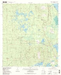 1994 Juniper Springs1998 Print · USGSThe Ocala National Forest in the mid-nineties remains a vast network of springs and prairies before further regional development. Researchers can trace the complex hydrography of Juniper Creek and find specific landmarks like the Juniper Springs Recreation Area and Fern Hammock Springs.
 - 1994 Map of Alexander Springs, 1998 Print
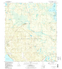 1994 Alexander Springs1998 Print · USGSLake County and the Ocala National Forest are shown in the 1990s as a preserved landscape of cypress bays and winding waterways. Researchers can trace historic access points like the Lookout Tower, the secluded Stockley Cem, and the small settlement of Hinson.
 - 1994 Map of Salt Springs, 1998 Print
 1994 Salt Springs1998 Print · USGSFlorida's riverine borderlands are detailed here in the 1990s, where the St Johns River meets the vast freshwater expanse of Lake George. Trace the waterways from Salt Springs to the marshy reaches of Hopkins Prairie or the shores of Drayton Island.
 - 1994 Map of Pardon Island, 1998 Print
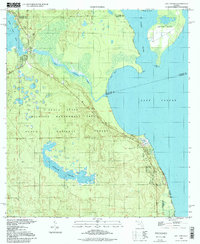
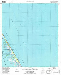 1994 Pardon Island1998 Print · USGSThe Volusia and Brevard county line met at the edge of the space age during the 1990s. Trace the intersection of federal lands at the Kennedy Space Center and the preserved waters of Mosquito Lagoon and Pardon Island.
 - 1999 Map of Lake Woodruff, 2001 Print
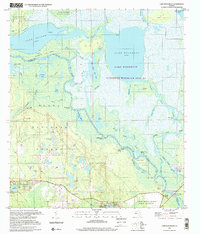 1999 Lake Woodruff2001 Print · USGSThe Volusia County wetlands near the St. Johns River are captured here at the close of the twentieth century. Researchers can trace riverfront history through old landings like Shell Landing and Mosquito Grove or the river site at Saint Francis.
End of results
Showing maps 1-5 of 5
Top cities of Volusia County
- Deltona historical maps
- Daytona Beach historical maps
- Ormond Beach historical maps
- DeLand historical maps
- New Smyrna Beach historical maps
- Edgewater historical maps
See more
Frequently asked questions
- What are the different types of historical maps available for Volusia County?
- What is the oldest map of Volusia County?
- Where can I purchase historical maps of Volusia County for my home or office?
- Where can I download high-res historical maps of Volusia County?
- Are there historical topographic maps available for Volusia County?
- Is there historical aerial imagery available for Volusia County?
- Where are historical maps of Volusia County sourced from?