1920s Maps of Burke County, Georgia
Explore 9 historic maps of Burke County from the 1920s. These maps offer a rare glimpse into what life looked like during the 1920s — showing old roads, neighborhoods, homes, and landmarks that have changed or disappeared over time.
Whether you're researching your family's past, planning a metal detecting trip, or studying how Burke County's landscape evolved across the 1920s, these high-resolution maps are a powerful tool for exploring the history of this region.
- Focus on a specific era: All maps on this page are from the 1920s, giving you a focused view of this time period.
- See what’s changed: Compare century-old streets, trails, and buildings to today's modern landscape using overlays and satellite layers.
- Research with precision: Use these maps for genealogy, historical research, land use analysis, or educational projects.
- View, download, or print: Maps are fully viewable online in high resolution, and can be downloaded or printed for your own records.
Start exploring Burke County's history through authentic maps from the 1920s. This is your window into the past.
Burke County, GA maps
(9)- 1920 Map of Ellenton
 1920 Ellenton1920 Print · USGSThe Savannah River valley in the years following the Great War reveals a landscape of river landings and small rail towns. Genealogists can trace family footprints through rural sites like Ellenton, St Marys Church, and the Burton and Myers Store.
 - 1920 Map of Hilltonia
 1920 Hilltonia1920 Print · USGSScreven County and the Savannah River valley are captured here at the end of the Great War, showing a landscape defined by ferries and rail. Genealogists can trace family footprints at Lovetts Cemetery, Bascom School, and the riverfront at Burtons Ferry.4 unique versions available
 - 1920 Map of Stapleton
 1920 Stapleton1920 Print · USGSEastern Georgia during the early twentieth century was a landscape of bustling cotton-belt rail towns and rural school districts. Genealogists and historians can trace family locations near landmarks like Harts Grove Church, Clarks Mill, and Wrens Sta.3 unique versions available
 - 1920 Map of Millen
 1920 Millen1920 Print · USGSJenkins County at the start of the twenties shows a landscape defined by the Ogeechee River and the busy rail junction at Millen. Genealogists can trace family footprints across dozens of rural landmarks like Old McCoy Church, Walker Academy, and Magnolia Spring.2 unique versions available
 - 1920 Map of Greens Cut
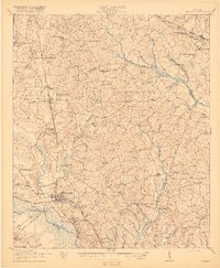
 1920 Greens Cut1920 Print · USGSBurke County, Georgia, and the Savannah River valley are captured here just after the Great War during a period of peak rural density. Genealogists can locate dozens of country institutions like Daniel Grove Church, Red Hill School, and the Old Church Sta along the Central of Georgia line.3 unique versions available
 - 1921 Map of Augusta
 1921 Augusta1921 Print · USGSThe riverfronts of South Carolina and Georgia met at a busy rail and water crossroads just after the Great War. Genealogists can trace family landmarks like the Downer Institute, Cottage Cem, and early rural schools including Freeborn School and Spiderweb School.5 unique versions available
 - 1921 Map of Ellenton
 1921 Ellenton1921 Print · USGSThe Savannah River valley in the early 1920s reveals a lost network of riverside landings and agricultural rail stops. Genealogists can trace family footprints at Ellenton, Meyers Mill, and rural sites like Friendship Church or Bethesda School.2 unique versions available
 - 1922 Map of Harlem
 1922 Harlem1922 Print · USGSEastern Georgia's rural landscape is captured here in the years following the Great War, showing a territory tied together by the Georgia Railroad. Genealogists can locate family-named landmarks such as Lundie Grove School, Arrington Mill, and Old Union Church.3 unique versions available
 - 1922 Map of Hephzibah
 1922 Hephzibah1922 Print · USGSRichmond County at the end of the First World War shows a landscape defined by military mobilization and deep-rooted rural communities. Local historians can trace the sprawling Camp Hancock cantonment or locate family landmarks like Palmer Academy and Hephzibah.3 unique versions available
End of results
Showing maps 1-9 of 9
Top cities of Burke County
- Waynesboro historical maps
- Sardis historical maps
- Midville historical maps
- Girard historical maps
- Vidette historical maps
Frequently asked questions
- What are the different types of historical maps available for Burke County?
- What is the oldest map of Burke County?
- Where can I purchase historical maps of Burke County for my home or office?
- Where can I download high-res historical maps of Burke County?
- Are there historical topographic maps available for Burke County?
- Is there historical aerial imagery available for Burke County?
- Where are historical maps of Burke County sourced from?