1970s Maps of Burke County, Georgia
Explore 9 historic maps of Burke County from the 1970s. These maps offer a rare glimpse into what life looked like during the 1970s — showing old roads, neighborhoods, homes, and landmarks that have changed or disappeared over time.
Whether you're researching your family's past, planning a metal detecting trip, or studying how Burke County's landscape evolved across the 1970s, these high-resolution maps are a powerful tool for exploring the history of this region.
- Focus on a specific era: All maps on this page are from the 1970s, giving you a focused view of this time period.
- See what’s changed: Compare century-old streets, trails, and buildings to today's modern landscape using overlays and satellite layers.
- Research with precision: Use these maps for genealogy, historical research, land use analysis, or educational projects.
- View, download, or print: Maps are fully viewable online in high resolution, and can be downloaded or printed for your own records.
Start exploring Burke County's history through authentic maps from the 1970s. This is your window into the past.
Burke County, GA maps
(9)- 1973 Map of Old Town, 1976 Print
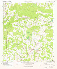
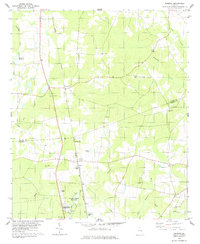
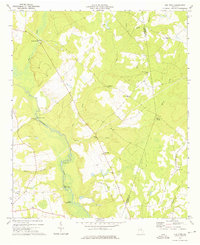 1973 Old Town1976 Print · USGSSettlements and river bends along the Ogeechee River defined this corner of Georgia in the early 1970s. Genealogists and historians can trace the locations of numerous rural churches like Mt Olive Ch and Union Bethel Ch, or locate the Old Railroad Grade near Old Town.
 - 1973 Map of Colemans Lake, 1976 Print
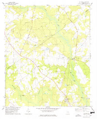
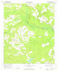 1973 Colemans Lake1976 Print · USGSCoastal plain river life and rural Georgia rail hubs meet in the early 1970s where three counties converge. Genealogists and local historians can trace family church sites like Mt Sinai Ch and Green Grove Ch or explore the river-bottom geography of Seven Cypresses and Franklins Bluff.
 - 1974 Map of Midville, 1976 Print
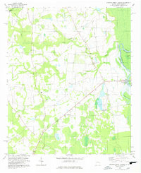
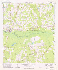 1974 Midville1976 Print · USGSMidville and the Ogeechee River valley are captured here in the mid-1970s, showcasing a landscape defined by swampy oxbows and rural Georgia crossroads. Genealogists can trace family landmarks like Murphree School, Sherrod Cemetery, and Johnsons Grove Church.2 unique versions available
 - 1974 Map of Bellevue, 1976 Print
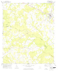
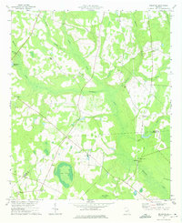 1974 Bellevue1976 Print · USGSCoastal plain wetlands and rural settlements define this Burke County landscape during the mid-seventies. Researchers can trace local heritage through numerous historic sites like Big Buckhead Ch, McCullough Millpond, and Porterville Cem.2 unique versions available
 - 1974 Map of Scotts Corner, 1976 Print
 1974 Scotts Corner1976 Print · USGSThe rural landscape of Burke and Jenkins counties is captured here in the mid-seventies as traditional rail service faded. Genealogists can trace family roots through numerous local landmarks like Bark Camp Ch, Rosier Cem, and Burtons Millpond.
 - 1978 Map of Hilltonia
 1978 Hilltonia1978 Print · USGSScreven County in the late 1970s is a landscape of rural crossroads and river landings along the winding Brier Creek. Genealogists can trace family and community roots through numerous local landmarks like Mt Pleasant Cem, Johnson Grove Ch, and the settlement of Hilltonia.
 - 1978 Map of Burtons Ferry Landing
 1978 Burtons Ferry Landing1978 Print · USGSThe Savannah River borderlands in the 1970s reveal a quiet landscape of oxbow lakes and rural churches. Genealogists can locate family landmarks like St Andrews Chapel, Zion Ch, and the riverside site of Burtons Ferry Landing.
 - 1978 Map of Sardis
 1978 Sardis1978 Print · USGSSardis and the surrounding Burke County countryside are captured here in the late 1970s, reflecting a landscape of established rural churches and winding creeks. Researchers can locate family landmarks like Beech Branch Cem, Old McCoy Ch, and the small settlement at Brinson.
 - 1978 Map of Perkins
 1978 Perkins1978 Print · USGSThe Burke and Jenkins county line comes into focus in the late 1970s, as the railroad network defines the rural landscape. Researchers can locate family landmarks such as Cullen Cem and Habersham Ch, or trace the grounds of Magnolia Springs State Park.
End of results
Showing maps 1-9 of 9
Top cities of Burke County
- Waynesboro historical maps
- Sardis historical maps
- Midville historical maps
- Girard historical maps
- Vidette historical maps
Frequently asked questions
- What are the different types of historical maps available for Burke County?
- What is the oldest map of Burke County?
- Where can I purchase historical maps of Burke County for my home or office?
- Where can I download high-res historical maps of Burke County?
- Are there historical topographic maps available for Burke County?
- Is there historical aerial imagery available for Burke County?
- Where are historical maps of Burke County sourced from?