Old Maps of Azalea Plaza Mobile Home Park, Georgia for Metal Detecting
Plan your next treasure hunt with 14 historic maps of Azalea Plaza Mobile Home Park. Find old homesites, ghost towns, trails, and gathering spots that may be lost to time — perfect for identifying promising metal detecting locations.
- Locate forgotten sites: Uncover places like long-lost settlements, abandoned rail lines, or gathering spots.
- Plan better hunts: Use map overlays combined with LiDAR or satellite views to narrow in on historically rich areas.
- Made for detectorists: Thousands of hobbyists use these maps to discover relics, coins, and hidden history.
Use these historic maps to boost your research and find new opportunities beneath the surface of Azalea Plaza Mobile Home Park.
Azalea Plaza Mobile Home Park, GA maps
(14)- 1942 Map of Savannah
 1942 Savannah1942 Print · USGSCoastal Georgia and the South Carolina borderlands come alive in this wartime survey of the Savannah riverfront. Genealogists and historians can trace industrial housing at Port Wentworth Colored Village, river landmarks like Fort Jackson, and the footprint of the Ogeechee Canal.
 - 1947 Map of Savannah
 1947 Savannah1947 Print · USGSCoastal Georgia and South Carolina are captured here in the mid-forties, showing the rail-and-river networks of the Lowcountry. Genealogists and researchers can trace old crossroads and river towns from Statesboro to Beaufort, alongside military sites like Camp Stewart and Parris Island.
 - 1948 Map of Savannah
 1948 Savannah1948 Print · USGSThe Georgia and South Carolina Lowcountry comes alive in this post-war survey of the coast and its river-fed hinterlands. Genealogists and historians can trace rail lines like the Central of Georgia RR and find established settlements such as Isle of Hope and Sylvania.
 - 1955 Map of Garden City, 1957 Print
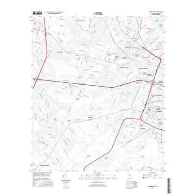
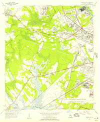 1955 Garden City1957 Print · USGSGarden City and the western outskirts of Savannah are shown here during a period of rapid aviation and rail expansion in the mid-fifties. Genealogists and historians can locate family landmarks like Silk Hope, the Lincoln Memorial Cem, and early recreational sites such as the Oglethorpe Speedway.2 unique versions available
 - 1957 Map of Savannah, 1967 Print
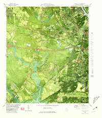
 1957 Savannah1967 Print · USGSThe Lowcountry and Georgia coastal plain are shown here in the late fifties, prior to modern expansion. Researchers can trace the rail-and-river economy through the Central of Georgia lines and the Ogeechee River wetlands.4 unique versions available
 - 1960 Map of Savannah
 1960 Savannah1960 Print · USGSCoastal Georgia and the South Carolina Lowcountry are captured in the late fifties, showcasing the intricate web of islands and tidal rivers before modern expansion. Researchers can trace the rail lines of the Atlantic Coast Line or locate sites like Parris Island, Beaufort, and the Tybee Lighthouse.
 - 1961 Map of Savannah
 1961 Savannah1961 Print · USGSThe Georgia and South Carolina Lowcountry comes alive in this mid-century survey of coastal marshes, barrier islands, and river networks. Genealogists and historians can trace the paths of the Seaboard Air Line RR, locate family sites near Isle of Hope, or study the grounds of Fort Stewart Military Reservation.2 unique versions available
 - 1980 Map of Garden City
 1980 Garden City1980 Print · USGSCoastal Georgia's industrial and rail hubs are in full view during the mid-seventies, from the Savannah River terminals to the edge of Pooler. Genealogists and local historians can trace family-named sites like Waldburgh Cem, Rossignol Hill, and Silk Hope.2 unique versions available
 - 1981 Map of Savannah, 1982 Print
 1981 Savannah1982 Print · USGSCoastal Georgia and the South Carolina borderlands are captured here in the early eighties, showing the region's complex network of riverine islands and military installations. Researchers can trace the rail lines of the Central of Georgia and explore sites like Fort Stewart Military Reservation and Garden City.
 - 2012 Map of Garden City, 2012 Print
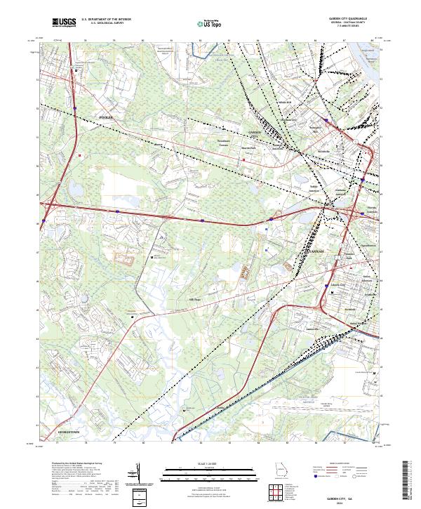
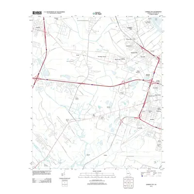 2012 Garden City2012 Print · USGSCovers Azalea Plaza Mobile Home Park, including Savannah, Pooler, and other nearby areas
 - 2014 Map of Garden City, 2014 Print
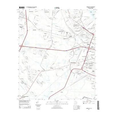 2014 Garden City2014 Print · USGSCovers Azalea Plaza Mobile Home Park, including Savannah, Pooler, and other nearby areas
 - 2017 Map of Garden City, 2017 Print
 2017 Garden City2017 Print · USGSCovers Azalea Plaza Mobile Home Park, including Savannah, Pooler, and other nearby areas
 - 2020 Map of Garden City, 2020 Print
 2020 Garden City2020 Print · USGSCovers Azalea Plaza Mobile Home Park, including Savannah, Pooler, and other nearby areas
 - 2024 Map of Garden City, 2024 Print
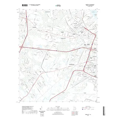
 2024 Garden City2024 Print · USGSThe industrial and military corridors west of Savannah are captured here in the early twenty-first century. Researchers can trace family history at Evergreen Cem, explore the layout of Hunter Army Airfield, or locate established neighborhoods like Rossignol Hill and Lamarville.
End of results
Showing maps 1-14 of 14
Top cities near Azalea Plaza Mobile Home Park
- Savannah historical maps
- Pooler historical maps
- Richmond Hill historical maps
- Wilmington Island historical maps
- Georgetown historical maps
- Garden City historical maps
See more
Frequently asked questions
- What are the different types of historical maps available for Azalea Plaza Mobile Home Park?
- What is the oldest map of Azalea Plaza Mobile Home Park?
- Where can I purchase historical maps of Azalea Plaza Mobile Home Park for my home or office?
- Where can I download high-res historical maps of Azalea Plaza Mobile Home Park?
- Are there historical topographic maps available for Azalea Plaza Mobile Home Park?
- Is there historical aerial imagery available for Azalea Plaza Mobile Home Park?
- Where are historical maps of Azalea Plaza Mobile Home Park sourced from?