2024 Map of Garden City
USGS Topo · Published 2024About this map
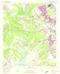
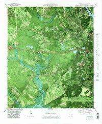
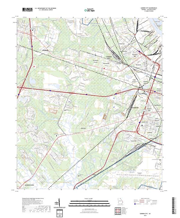
The Savannah River defines the northeastern boundary of this landscape, framing a complex network of industrial corridors and residential enclaves. Modern transportation infrastructure, including the Savannah Pkwy and Seaboard Coastline RR, intersects older settlements such as Rossignol Hill and Silk Hope. The map reveals a dense concentration of civic and military history, anchored by the Hunter Army Airfield and the Eighth Air Force Museum Memorial Gardens near Pooler. Genealogists and local historians will find significant value in the detailed mapping of numerous burial sites, from the large Evergreen Cem and Lincoln Memorial Cem to smaller grounds like Abby West Cem and Waldburgh Cem. The transition from the developed streets of Savannah to the wetlands of Culvert Swamp and the Little Ogeechee River illustrates the persistent influence of the coastal geography on the growth of Garden City.
Find a feature on this map
53 named features on this map. Tap any name to fly to it.
Don’t see what you’re looking for? This feature index may not catch every label — zoom into the map to look around manually.
Map Details
Editions of this 2024 Garden City Map
This is the sole edition of this map. No revisions or reprints were ever made.
Historical Maps of Azalea Plaza Mobile Home Park Through Time
3 maps found