Old Maps of Echols County, Georgia for Metal Detecting
Plan your next treasure hunt with 110 historic maps of Echols County. Find old homesites, ghost towns, trails, and gathering spots that may be lost to time — perfect for identifying promising metal detecting locations.
- Locate forgotten sites: Uncover places like long-lost settlements, abandoned rail lines, or gathering spots.
- Plan better hunts: Use map overlays combined with LiDAR or satellite views to narrow in on historically rich areas.
- Made for detectorists: Thousands of hobbyists use these maps to discover relics, coins, and hidden history.
Use these historic maps to boost your research and find new opportunities beneath the surface of Echols County.
Echols County, GA maps
(110)- 1954 Map of Valdosta, 1967 Print
 1954 Valdosta1967 Print · USGSThe South Georgia and North Florida borderlands are captured here in the mid-fifties, showing the deep timber and wetland networks of the coastal plain. Researchers can trace the path of the Atlantic Coast Line through Valdosta or explore the interior of the Okefenokee Swamp.2 unique versions available
 - 1955 Map of Jasper, 1956 Print
 1955 Jasper1956 Print · USGSJasper and its surrounding borderlands are captured in the mid-fifties, showing a landscape of rail-connected towns and extensive swamp bays. Researchers can trace local genealogy through sites like Evergreen Cem, Nunn Cem, and the rural Kennedy Still settlement.3 unique versions available
 - 1955 Map of Council, 1956 Print
 1955 Council1956 Print · USGSThe Georgia-Florida borderlands come into focus in the mid-1950s, showing a landscape of deep cypress swamps and isolated rail stops. Researchers can trace the Southern railroad through Council or follow the historic Watson Line across Pinhook Swamp.4 unique versions available
 - 1955 Map of Cypress Creek, 1956 Print
 1955 Cypress Creek1956 Print · USGSThe Florida-Georgia borderlands are captured here in the mid-1950s, showing a remote landscape of expansive wetlands and hammocks. Researchers can trace the original state line through Christmas Bay and locate local landmarks like Martin Hammock and Bee Haven Bay.6 unique versions available
 - 1955 Map of Fargo SW, 1956 Print
 1955 Fargo SW1956 Print · USGSThe Suwannee River bottomlands and the Florida-Georgia border are captured here in the mid-fifties. Researchers can locate remote community landmarks like Hopewell Ch, the Lookout Tower, and the historical survey markers along the Watson Line.4 unique versions available
 - 1956 Map of Jennings, 1957 Print
 1956 Jennings1957 Print · USGSNorth Florida and South Georgia met along the Alapaha River in the mid-fifties, where timber and rail lines shaped the local economy. Researchers can locate family landmarks like Sasser Landing Cem, Oak Grove Ch, and the Alapaha Lookout Tower in this rural landscape.3 unique versions available
 - 1956 Map of Octahatchee, 1958 Print
 1956 Octahatchee1958 Print · USGSThe Florida-Georgia borderlands near the mid-century were a landscape of cypress swamps and quiet rural outposts. Genealogists can locate family landmarks like McCall Cem and Blair Cem or trace the community around Bellville High Sch and Triumph Ch.2 unique versions available
 - 1958 Map of Valdosta
 1958 Valdosta1958 Print · USGSSouth Georgia and North Florida are captured here in the mid-fifties, showing the vast Okefenokee Swamp and the vital timber and rail corridors connecting the two states. Researchers can locate the footprint of Moody Air Force Base, trace the Live Oak Perry and Gulf railroad, or find early community sites like Bakers Mill and Paradise Church.
 - 1959 Map of Valdosta
 1959 Valdosta1959 Print · USGSThe Georgia-Florida borderlands in the mid-fifties reveal a landscape of massive blackwater swamps and emerging military aviation hubs. Genealogists and historians can trace rail-stop towns like Fargo and Stockton or explore the interior reaches of the Okefenokee Swamp and Billys Island.
 - 1967 Map of Fargo, 1969 Print
 1967 Fargo1969 Print · USGSDeep in South Georgia during the late sixties, the SUWANNEE RIVER and SOUTHERN RAILWAY shaped the rural landscape near Fargo. Trace old routes like the WOODPECKER ROUTE or find landmarks like Rives Landing and Vickers Crossing.2 unique versions available
 - 1968 Map of Needmore, 1970 Print
 1968 Needmore1970 Print · USGSThe South Georgia swamplands near the Clinch and Echols County line appear here in the late sixties as a landscape of timber camps and winding creeks. Local historians can trace the foundations of Needmore, the riverside Log Landing, and rural landmarks like Bethel Ch or the Old Railroad Grade.2 unique versions available
 - 1971 Map of Indianola, 1976 Print
 1971 Indianola1976 Print · USGSSouth Georgia's rural landscape is captured here in the early 1970s as two major railroads intersect near the Florida border. Genealogists and local historians can trace the foundations of Indianola and Dasher alongside rural landmarks like Twin Hill Ch and Boring Pond.
 - 1971 Map of Thelma, 1976 Print
 1971 Thelma1976 Print · USGSClinch and Echols County landscapes are captured in the early 1970s, showing a region defined by extensive wetlands and rail transit. Researchers can locate specific family-named landmarks like Starling Ford, Wilkerson Lake, and the community of Thelma.
 - 1971 Map of Howell, 1976 Print
 1971 Howell1976 Print · USGSEchols and Lowndes County landscapes are captured in the early 1970s, showing the rural communities along the Georgia Southern and Florida Railway. Local historians can trace family sites at Macedonia Cem and Wayfare Ch near the banks of the Alapaha River.
 - 1971 Map of Lake Park, 1976 Print
 1971 Lake Park1976 Print · USGSSouthern Georgia's lake country is captured in the early 1970s, showcasing the intersection of the railway and the region's unique water-pocked landscape. Genealogists and local historians can trace rural roots at Hickory Grove Cemetery, Frances Lake Ch, and the community of Lake Park.
 - 1971 Map of Tarver, 1976 Print
 1971 Tarver1976 Print · USGSSouthern Echols County in the early 1970s is shown in this detailed orthophotomap, where timber and rail lines dominate the swampy landscape. Genealogists can trace the rural settlements of Tarver and Potter or locate landmarks like the Lookout Tower and Substa.
 - 1971 Map of Pineland, 1976 Print
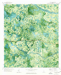 1971 Pineland1976 Print · USGSSouthern Georgia's wetland interior is captured in the early seventies, showing the remote landscape of Echols and Clinch Counties. Researchers can locate named crossings like Brown Ford, the path of an Old Railroad Grade, and the small settlement at Pineland.
 - 1971 Map of Haylow, 1976 Print
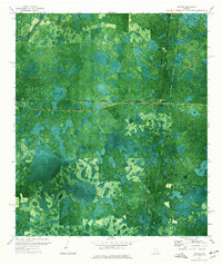 1971 Haylow1976 Print · USGSRailroad crossroads and extensive wetlands define this south Georgia landscape in the early 1970s. Genealogists and local historians can trace rail-side settlements like Haylow and Withers or locate family landmarks near Boggy Bay and Sasser Lake.
 - 1971 Map of Statenville, 1976 Print
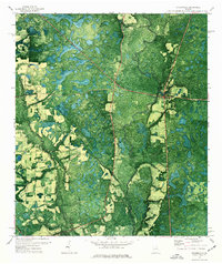 1971 Statenville1976 Print · USGSStatenville and the Lowndes-Echols county line are captured in the early seventies, showcasing a landscape defined by the winding Alapaha River. Researchers can trace rural church locations like Sardis Ch and family sites like Carter Cem.
 - 1980 Map of Okefenokee Swamp, 1981 Print
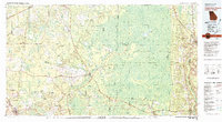 1980 Okefenokee Swamp1981 Print · USGSThe Georgia-Florida borderlands come to life in the early 1980s, centered on the immense wilderness of the Okefenokee Swamp. Genealogists and historians can trace rail-stop settlements like Fargo and Fruitland or explore the interior geography of Billys Island and Trail Ridge.
 - 1981 Map of Valdosta
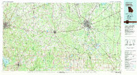 1981 Valdosta1981 Print · USGSCrossing the Georgia and Florida border in the early eighties, this survey captures the agricultural and military landscape of the coastal plain. Genealogists and historians can trace the rail-linked growth of Valdosta and Quitman or find rural landmarks like New Hope Church and Lake Miccosukee.
 - 1994 Map of Council, 1998 Print
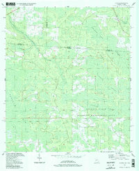 1994 Council1998 Print · USGSThe Georgia-Florida borderlands come into focus in the 1990s, revealing a landscape defined by the Osceola State Wildlife Management Area. Researchers can trace the historic Watson Line and the winding course of Little Suwannee Creek through the Pinhook Swamp.
 - 1994 Map of Lake Park, 1998 Print
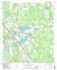 1994 Lake Park1998 Print · USGSThe Georgia-Florida border country near Lowndes County is captured here in the mid-nineties, showing a landscape defined by deep blue sinkhole lakes. Researchers can trace local history at Lake Park Cem, Strickland Ch, and the waters of Ocean Pond.
 - 2006 Map of Fargo SW, 2007 Print
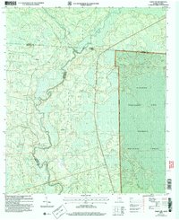 2006 Fargo SW2007 Print · USGSThe Georgia-Florida borderlands come into focus in the early 2000s, showing the dense wetlands where the Suwannee River meets the Osceola National Forest. Trace local history at Watson or locate the Hopewell Ch and its Cem near the riverbanks.
 - 2006 Map of Council, 2007 Print
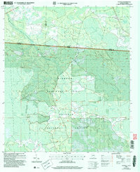 2006 Council2007 Print · USGSThe Georgia-Florida borderlands come to life in this mid-2000s study of the wetlands and forests south of Council. Researchers can trace the intersection of state lines through the Pinhook Swamp and follow landmarks like the Watson Line.
Showing maps 1-25 of 110
Frequently asked questions
- What are the different types of historical maps available for Echols County?
- What is the oldest map of Echols County?
- Where can I purchase historical maps of Echols County for my home or office?
- Where can I download high-res historical maps of Echols County?
- Are there historical topographic maps available for Echols County?
- Is there historical aerial imagery available for Echols County?
- Where are historical maps of Echols County sourced from?