1900s (20th Century) Maps of Fannin County, Georgia
Explore 61 historic maps of Fannin County from the 1900s (20th Century). These maps offer a rare glimpse into what life looked like during the 1900s — showing old roads, neighborhoods, homes, and landmarks that have changed or disappeared over time.
Whether you're researching your family's past, planning a metal detecting trip, or studying how Fannin County's landscape evolved across the 1900s, these high-resolution maps are a powerful tool for exploring the history of this region.
- Focus on a specific era: All maps on this page are from the 1900s, giving you a focused view of this time period.
- See what’s changed: Compare century-old streets, trails, and buildings to today's modern landscape using overlays and satellite layers.
- Research with precision: Use these maps for genealogy, historical research, land use analysis, or educational projects.
- View, download, or print: Maps are fully viewable online in high resolution, and can be downloaded or printed for your own records.
Start exploring Fannin County's history through authentic maps from the 1900s. This is your window into the past.
Fannin County, GA maps
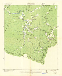
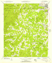
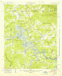
(61)- 1911 Map of Ellijay
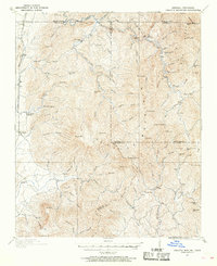
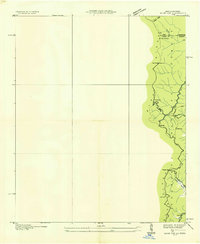
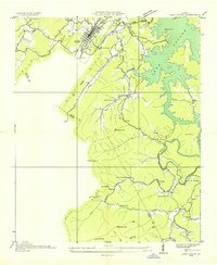
 1911 Ellijay1911 Print · USGSNorth Georgia and the Tennessee border are captured here at the turn of the century, showing a mountain landscape of river ferries and early rail. Genealogists can locate family landmarks like Higdons Store, the Pisgah church, or crossings at Bakers Ferry and Shallow Ford.4 unique versions available
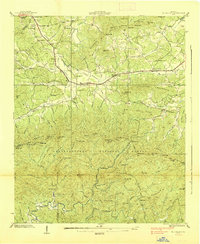
 - 1911 Map of Cohutta Mtn
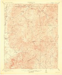
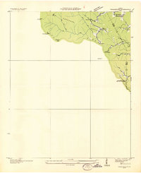
 1911 Cohutta Mtn1911 Print · USGSThe Georgia-Tennessee borderlands in the early twentieth century were defined by mountain rail and timber. Genealogists can trace family roots through settlements like Tennga and Crandall or locate historic operations like Hassler Mill along the rail line.2 unique versions available
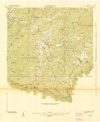
 - 1913 Map of Cohutta Mtn.
 1913 Cohutta Mtn.1913 Print · USGSThe Georgia and Tennessee borderlands appear here in the years before the Great Depression, centered on the high peaks of the Blue Ridge. Researchers can trace early railroad life along the Louisville & Nashville RR or locate old sites like Cohutta Springs and Hassler Mill.3 unique versions available
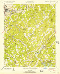
 - 1935 Map of Epworth
 1935 Epworth1935 Print · USGSNorth Georgia and the Tennessee borderlands are captured here in the mid-1930s, showing a landscape defined by copper mining and mountain farming. Researchers can locate vanished landmarks like Higdons Store, trace the Louisville and Nashville rail line, or find family roots at Madola Sch and Hipp Chapel.
 - 1935 Map of Ivylog
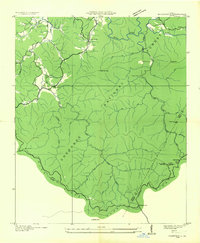
 1935 Ivylog1935 Print · USGSUnion County, Georgia, and the North Carolina borderlands are captured here in the mid-1930s before major dam projects reshaped the river valleys. Genealogists and local historians can trace family roots through numerous country landmarks like Ivylog Cem, Mt Zion Sch, and Davenport Mill.
 - 1935 Map of Mulky Gap
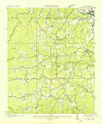
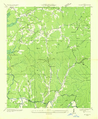
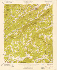
 1935 Mulky Gap1935 Print · USGSUnion and Fannin Counties were characterized by small mills and mountain gaps in the mid-1930s. Genealogists can trace family roots at Jones Cem or Harkins Cem, while historians can locate CCC Camp No F-12 and Clements Mills.
 - 1935 Map of Hemp Top
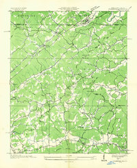
 1935 Hemp Top1935 Print · USGSHigh in the mountains along the Georgia-Tennessee border in the mid-1930s, this survey documents the ridge-line terrain of the Blue Ridge. Researchers can locate remote landmarks like the Fire Tower on Hemp Top, Ashe Mill, and Dally Gap.
 - 1935 Map of Noontootla
 1935 Noontootla1935 Print · USGSNorth Georgia's mountain ridges and valley settlements are captured here in the mid-1930s as the Tennessee Valley Authority and USGS surveyed the region. Researchers can trace the early APPALACHIAN TRAIL past the FIRE TOWER on Hawk Mtn and locate sites like Stock Hill Ch or the Rock Creek Cem.
 - 1935 Map of Mineral Bluff
 1935 Mineral Bluff1935 Print · USGSThe tri-state border region of Georgia, Tennessee, and North Carolina comes alive in the mid-1930s as industry and infrastructure reshape the mountain landscape. Genealogists can locate family landmarks like Paintertown Sch, Shady Grove Ch, and the homes near Mineral Bluff.
 - 1935 Map of Cashes Valley
 1935 Cashes Valley1935 Print · USGSCashes Valley and the North Georgia mountains come alive in this mid-1930s survey of the Fannin and Gilmer borderlands. Genealogists can trace family footprints near Cashes Valley Ch, Madola Sch, and the isolated homesteads along Fightingtown Creek.
 - 1935 Map of Lake Toccoa
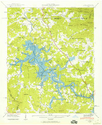
 1935 Lake Toccoa1935 Print · USGSNorth Georgia’s mountain and river life is preserved here during the mid-1930s transition into the hydroelectric era. Researchers can trace family roots through the numerous rural schools and churches, such as Stanley Creek Sch, Union Ch, and landmarks like Stanley Mill.
 - 1935 Map of Tickanetley
 1935 Tickanetley1935 Print · USGSHigh in the Blue Ridge mountains during the mid-1930s, this survey captures the rural crossroads of Gilmer and Fannin counties. Genealogists can trace early landmarks like Big Creek Ch, Stanley Mill, and the combined Mathis Chapel Sch.
 - 1935 Map of Wilscot
 1935 Wilscot1935 Print · USGSNorth Georgia mountain life is caught in a moment of transition in the mid-1930s as the TVA and CCC arrived in the Blue Ridge. Genealogists can trace old homesteads and landmarks like Star Creek Mill, Sugar Hill Ch, and CCC Camp F 8 along the Toccoa River.
 - 1935 Map of Culberson
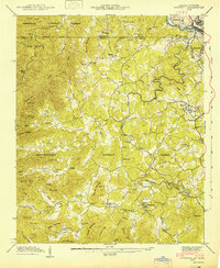
 1935 Culberson1935 Print · USGSThe borderlands of North Carolina and Georgia come alive in this mid-1930s study of the mountain gaps and rail corridors. Genealogists and historians can trace family-named sites like Hawkins Mill, Bell Sch, and New Liberty Ch along the winding Hemptown Creek.
 - 1935 Map of Suches
 1935 Suches1935 Print · USGSThe North Georgia mountains in the mid-1930s are captured here as federal forestry and New Deal projects began to reshape the Blue Ridge. Genealogists can trace early homesteads near Suches and Gaddistown or locate rural landmarks like Corinth Sch and Gilreath Mill.
 - 1938 Map of Mulky Gap
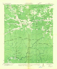
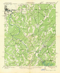
 1938 Mulky Gap1938 Print · USGSUnion County and Fannin County meet here in the late 1930s, showing a mountain landscape of rural post offices and federal conservation camps. Genealogists and historians can trace family locations through Jones Cem, Youngcane School, and Dillard Chapel.4 unique versions available
 - 1938 Map of Suches
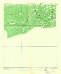
 1938 Suches1938 Print · USGSUpper Union County and the Toccoa River valley are captured in the late 1930s, showing a landscape of high mountain gaps and isolated rural communities. Researchers can locate the CCC Camp F1, the Appalachian Trail, and schools like Peggy Hale Sch.
 - 1941 Map of Mineral Bluff, 1956 Print
 1941 Mineral Bluff1956 Print · USGSThe tri-state borderlands of Georgia, Tennessee, and North Carolina come alive in the early 1940s as the river-and-rail economy hums near Mineral Bluff. Genealogists and researchers can locate the Galloway Cem, trace the Louisville and Nashville Railroad, and find the CCC Camp 3467 TVA 29 site.4 unique versions available
 - 1941 Map of Epworth, 1957 Print
 1941 Epworth1957 Print · USGSThe Tennessee-Georgia state line and the industrial copper basin are captured here in the early 1940s. Genealogists and historians can trace family landmarks like Hipp Chapel, Patterson Mill, and the small settlement of Madola along the Fightingtown Creek.3 unique versions available
 - 1941 Map of Culberson, 1958 Print
 1941 Culberson1958 Print · USGSThe borderlands of Georgia and North Carolina are captured here in the early 1940s, showing a landscape defined by mountain ridges and valley mills. Researchers can trace the Louisville and Nashville rail line through Culberson or locate family landmarks like Paris Cem and Loving Sch.4 unique versions available
 - 1941 Map of Ivylog, 1960 Print
 1941 Ivylog1960 Print · USGSThe Georgia and North Carolina borderlands appear here in the early 1940s as the Tennessee Valley Authority creates the new Nottely Lake. Genealogists can trace old homesteads and local institutions like the Ivylog Cem, Bethany Church, and Davenport Mill before the valley's landscape was forever changed.2 unique versions available
 - 1942 Map of Epworth
 1942 Epworth1942 Print · USGSThe Georgia-Tennessee border comes alive in the early 1940s, showing the rugged mountain corridor between McCaysville and Epworth. Researchers can trace old mountain homesteads, country schools like Payne Sch, and historic local landmarks such as Higdon Store and Patterson Mill.
 - 1942 Map of Ivylog
 1942 Ivylog1942 Print · USGSUnion County, Georgia, was undergoing a massive transformation in the early 1940s as the Tennessee Valley Authority reshaped the landscape. Researchers can trace the original river course and emerging shoreline of the Nottely Reservoir while locating family landmarks like Ivylog Cem and Lance Mill.
 - 1942 Map of Culberson
 1942 Culberson1942 Print · USGSThe Georgia and North Carolina borderlands come alive in the early 1940s, revealing a landscape of mountain ridges and family-run mills. Genealogists can trace rural roots at Paris Cem or locate the numerous schoolhouses and churches like Hemp Sch and Zion Hill Ch.2 unique versions available
 - 1943 Map of Mineral Bluff
 1943 Mineral Bluff1943 Print · USGSFannin County and the tri-state border region are shown here in the early 1940s, just after the completion of the Blue Ridge Dam. Researchers can trace family history through sites like Galloway Cem or follow the Louisville and Nashville tracks through Mineral Bluff.
Showing maps 1-25 of 61
Top cities of Fannin County
Frequently asked questions
- What are the different types of historical maps available for Fannin County?
- What is the oldest map of Fannin County?
- Where can I purchase historical maps of Fannin County for my home or office?
- Where can I download high-res historical maps of Fannin County?
- Are there historical topographic maps available for Fannin County?
- Is there historical aerial imagery available for Fannin County?
- Where are historical maps of Fannin County sourced from?