1900s (20th Century) Maps of Jefferson, Georgia
Explore 7 historic maps of Jefferson from the 1900s (20th Century). These maps offer a rare glimpse into what life looked like during the 1900s — showing old roads, neighborhoods, homes, and landmarks that have changed or disappeared over time.
Whether you're researching your family's past, planning a metal detecting trip, or studying how Jefferson's landscape evolved across the 1900s, these high-resolution maps are a powerful tool for exploring the history of this region.
- Focus on a specific era: All maps on this page are from the 1900s, giving you a focused view of this time period.
- See what’s changed: Compare century-old streets, trails, and buildings to today's modern landscape using overlays and satellite layers.
- Research with precision: Use these maps for genealogy, historical research, land use analysis, or educational projects.
- View, download, or print: Maps are fully viewable online in high resolution, and can be downloaded or printed for your own records.
Start exploring Jefferson's history through authentic maps from the 1900s. This is your window into the past.
Jefferson, GA maps
(7)- 1954 Map of Greenville, 1965 Print
 1954 Greenville1965 Print · USGSThe Upstate and Northeast Georgia are captured here during a decade of massive transformation as new reservoirs reshaped the Piedmont. Genealogists and hikers can trace the Appalachian Trail over Brasstown Bald or locate old community centers like Demorest, Westminster, and Royston.3 unique versions available
 - 1958 Map of Greenville
 1958 Greenville1958 Print · USGSThe Piedmont and Blue Ridge foothills come alive in this mid-century survey of the Upstate and Northeast Georgia. Trace the regional rail-and-river economy through the Southern Railway corridors and early reservoir developments like Lake Sidney Lanier.
 - 1964 Map of Winder North, 1965 Print
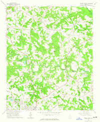 1964 Winder North1965 Print · USGSThe rural borderlands of Jackson and Barrow counties come into focus in the mid-sixties. Researchers can trace family sites like Rose Hill Cem, find the Holsenbeck Sch, and locate old landmarks like the Ebenezer Ch.4 unique versions available
 - 1964 Map of Pendergrass, 1965 Print
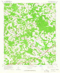 1964 Pendergrass1965 Print · USGSNortheast Georgia in the mid-1960s was a landscape of rail-linked towns and deep-rooted rural congregations. Genealogists and local historians can trace family locations through several landmark churches and cemeteries, including Harmony Hall Ch, Sugar Hill Ch, and Jarrett Cem.
 - 1964 Map of Jefferson, 1965 Print
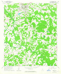 1964 Jefferson1965 Print · USGSJackson County in the mid-1960s reveals a landscape of established small-town centers and quiet rural crossroads connected by the SEABOARD AIR LINE. Researchers can trace old family landmarks and community anchors like Redstone Ch, Holiday Cem, and the Bryan Sch.
 - 1964 Map of Apple Valley, 1965 Print
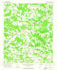 1964 Apple Valley1965 Print · USGSJackson County is shown in the mid-1960s as a landscape of river valleys and small crossroads communities. Researchers can trace family roots at Wheeler Cem or locate old community centers like Dry Pond, Thyatira, and Blackstock.2 unique versions available
 - 1979 Map of Commerce, 1980 Print
 1979 Commerce1980 Print · USGSThe Georgia and South Carolina Piedmont reached a period of significant regional growth in the late seventies. Genealogists and historians can trace family roots through locations like Blackberry Church, Old Pioneer Cem, and the Gillsville Sch.2 unique versions available
End of results
Showing maps 1-7 of 7
Top cities near Jefferson
- Athens historical maps
- Gainesville historical maps
- Winder historical maps
- Braselton historical maps
- Auburn historical maps
- Commerce historical maps
See more
Top neighborhoods of Jefferson
Frequently asked questions
- What are the different types of historical maps available for Jefferson?
- What is the oldest map of Jefferson?
- Where can I purchase historical maps of Jefferson for my home or office?
- Where can I download high-res historical maps of Jefferson?
- Are there historical topographic maps available for Jefferson?
- Is there historical aerial imagery available for Jefferson?
- Where are historical maps of Jefferson sourced from?