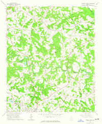
1964 Map of Winder North
USGS Topo · Published 1965About this map
Winder and Hoschton anchor this mid-1960s topographic survey, which documents the rural transition across the Jackson and Barrow county line. The landscape is defined by the winding paths of the Mulberry River and the Middle Oconee River, with the latter cutting through the northeastern corner. Significant local history is preserved in the numerous country churches and family-named cemeteries that dot the countryside, such as Gum Springs Cem and White Plains Ch.
Find a feature on this map
58 named features on this map. Tap any name to fly to it.
Don’t see what you’re looking for? This feature index may not catch every label — zoom into the map to look around manually.
Map Details
Editions of this 1964 Winder North Map
4 editions found
Other maps of this area

1891 · Gainesville
USGS Topo · 1:125,000

1896 · Monroe
USGS Topo · 1:125,000

1953 · Athens
USGS Topo · 1:250,000

1954 · Greenville
USGS Topo · 1:250,000

1958 · Greenville
USGS Topo · 1:250,000

1958 · Athens
USGS Topo · 1:250,000

1959 · Athens
USGS Topo · 1:250,000

1963 · Athens
USGS Topo · 1:250,000

1964 · Chestnut Mountain
USGS Topo · 1:24,000

1964 · Bold Springs
USGS Topo · 1:24,000