Old Maps of Screven County, Georgia for Metal Detecting
Plan your next treasure hunt with 149 historic maps of Screven County. Find old homesites, ghost towns, trails, and gathering spots that may be lost to time — perfect for identifying promising metal detecting locations.
- Locate forgotten sites: Uncover places like long-lost settlements, abandoned rail lines, or gathering spots.
- Plan better hunts: Use map overlays combined with LiDAR or satellite views to narrow in on historically rich areas.
- Made for detectorists: Thousands of hobbyists use these maps to discover relics, coins, and hidden history.
Use these historic maps to boost your research and find new opportunities beneath the surface of Screven County.
Screven County, GA maps
(149)- 1918 Map of Oliver, 1972 Print
 1918 Oliver1972 Print · USGSScreven County at the end of the Great War was a landscape defined by its river landings and intersecting railroads. Genealogists can trace family footprints at dozens of rural landmarks, from Lee Memorial Church and Jackson School to the depots in Oliver and Newington.
 - 1919 Map of Shirley
 1919 Shirley1919 Print · USGSThe Savannah River borderlands in the years following the Great War reveal a landscape of active river landings, logging railroads, and tight-knit rural communities. You can trace early 20th-century family roots at Heavenly Rest Ch, Cypressvale School, and the busy Hudsons Ferry Landing.3 unique versions available
 - 1919 Map of Allendale
 1919 Allendale1919 Print · USGSThe South Carolina Lowcountry is captured here in the years following the Great War, when rail lines and rural parishes defined the social landscape. Researchers can trace ancestral locations through numerous sites like Jordan Church, Hickory Hill School, and Haygoods Mill.4 unique versions available
 - 1920 Map of Ellenton
 1920 Ellenton1920 Print · USGSThe Savannah River valley in the years following the Great War reveals a landscape of river landings and small rail towns. Genealogists can trace family footprints through rural sites like Ellenton, St Marys Church, and the Burton and Myers Store.
 - 1920 Map of Hilltonia
 1920 Hilltonia1920 Print · USGSScreven County and the Savannah River valley are captured here at the end of the Great War, showing a landscape defined by ferries and rail. Genealogists can trace family footprints at Lovetts Cemetery, Bascom School, and the riverfront at Burtons Ferry.4 unique versions available
 - 1920 Map of Millen
 1920 Millen1920 Print · USGSJenkins County at the start of the twenties shows a landscape defined by the Ogeechee River and the busy rail junction at Millen. Genealogists can trace family footprints across dozens of rural landmarks like Old McCoy Church, Walker Academy, and Magnolia Spring.2 unique versions available
 - 1920 Map of Oliver
 1920 Oliver1920 Print · USGSScreven County agriculture and river commerce thrived in the years following the Great War. Genealogists can locate family landmarks across the Ogeechee basin, from Double Head Church and Middle Ground School to the bustling rail stops at Halcyondale and Oliver.2 unique versions available
 - 1920 Map of Peeples
 1920 Peeples1920 Print · USGSThe Savannah River lowcountry during the years following the Great War reveals a landscape of river landings and new highways. Genealogists can trace family roots through numerous sites like Virgin Mary Church, Buddenville School, and Solomons Crossroads.3 unique versions available
 - 1921 Map of Brooklet
 1921 Brooklet1921 Print · USGSBulloch County's rural heartland is captured here during the 1920s, showing a landscape defined by small-town rail junctions and river fords. Genealogists can trace family footprints at vanished landmarks like Slabville School, Corinth Church, and Ebenezer Ford.2 unique versions available
 - 1921 Map of Rocky Ford
 1921 Rocky Ford1921 Print · USGSSoutheast Georgia in the early twenties reveals a landscape of river-bottom swamps and decentralized farming communities. Genealogists can trace local roots through numerous family-named landmarks like Bradwell School, Akins Mill Creek, and Finchs Store.2 unique versions available
 - 1921 Map of Ellenton
 1921 Ellenton1921 Print · USGSThe Savannah River valley in the early 1920s reveals a lost network of riverside landings and agricultural rail stops. Genealogists can trace family footprints at Ellenton, Meyers Mill, and rural sites like Friendship Church or Bethesda School.2 unique versions available
 - 1943 Map of Brooklet
 1943 Brooklet1943 Print · USGSBulloch and Effingham Counties come alive in the early 1940s, showing a landscape of small farms and riverside landings. Genealogists can locate family landmarks like Knight Sch, Black Creek Ch, and the crossings along the Ogeechee River.
 - 1943 Map of Allendale
 1943 Allendale1943 Print · USGSCoastal plain settlements and timberlands thrive along the Salkehatchie River in the early 1940s as rail lines connect rural communities. Genealogists can trace family-named landmarks and institutions like Chaney Grove Mill, Hercules School, and Siloam Ch.
 - 1943 Map of Hilltonia
 1943 Hilltonia1943 Print · USGSScreven County settlements and Savannah River landings are meticulously documented in this mid-century survey. Genealogists can trace family landmarks like Lovetts Cemetery, Rock Hill Sch, and Antioch Ch across the rural landscape.
 - 1943 Map of Peeples
 1943 Peeples1943 Print · USGSAllendale County and the Georgia borderlands come alive in the early 1940s, showing a landscape defined by river landings and rural crossroads. Genealogists and researchers can trace family-named sites like Solomons Crossroads, Buddenville Sch, and Barton along the historic rail lines.
 - 1943 Map of Rocky Ford
 1943 Rocky Ford1943 Print · USGSBulloch, Jenkins, and Screven counties are shown here during the early 1940s as the railroad and river still drove local life. Genealogists can locate family landmarks like Williams Chapel, Mallards Mill, and the various schoolhouses including Alexander Sch and Daughtry Sch.
 - 1943 Map of Shirley
 1943 Shirley1943 Print · USGSThe Savannah River valley during the early 1940s reveals a landscape of river landings and rail-side settlements. Genealogists can trace family roots through sites like Heavenly Rest Ch, Mizpah Sch, and the riverside Hudson Ferry Landing.
 - 1943 Map of Millen
 1943 Millen1943 Print · USGSEastern Georgia during the Second World War remains a landscape of remote rail junctions and country schools. Genealogists can trace family roots through numerous sites like Walker Academy, Old Fort Lawton, and the settlements of Munnerlyn and Perkins.
 - 1943 Map of Augusta East
 1943 Augusta East1943 Print · USGSThe Savannah River valley along the Georgia and South Carolina border is shown here in the early 1940s, just before significant regional changes. Genealogists can trace hundreds of rural landmarks, including Ellenton, the Downer Institute, and several mills like Hatchers Mill.
 - 1943 Map of Millen
 1943 Millen1943 Print · USGSEastern Georgia during the early 1940s is shown here as a network of rail-side towns and river landings. Genealogists and local historians can locate many rural landmarks including Habersham Sch, Lovetts Cemetery, and the river crossing at Burtons Ferry.
 - 1943 Map of Oliver
 1943 Oliver1943 Print · USGSScreven County is depicted during the early 1940s, showing a landscape defined by the Ogeechee River and bustling rail lines. Genealogists can locate family landmarks such as Jackson Sch, Lee Memorial Ch, and the community of Halcyondale.
 - 1944 Map of Ellenton
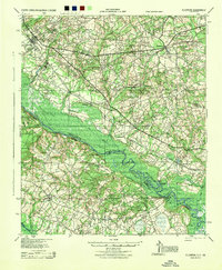 1944 Ellenton1944 Print · USGSIn the mid-1940s, this area of the Savannah River valley was a thriving agricultural landscape centered on Ellenton and Dunbarton. Genealogists can trace family footprints through sites like Bethesda Sch, Daisy May Ch, and the local Burton & Myers Store.
 - 1947 Map of Savannah
 1947 Savannah1947 Print · USGSCoastal Georgia and South Carolina are captured here in the mid-forties, showing the rail-and-river networks of the Lowcountry. Genealogists and researchers can trace old crossroads and river towns from Statesboro to Beaufort, alongside military sites like Camp Stewart and Parris Island.
 - 1948 Map of Savannah
 1948 Savannah1948 Print · USGSThe Georgia and South Carolina Lowcountry comes alive in this post-war survey of the coast and its river-fed hinterlands. Genealogists and historians can trace rail lines like the Central of Georgia RR and find established settlements such as Isle of Hope and Sylvania.
 - 1954 Map of Augusta
 1954 Augusta1954 Print · USGSThe Savannah River valley and South Carolina Midlands are captured here during a period of post-war growth. Researchers can trace the rail-and-river economy through the Southern RR corridor and locate historic settlements like Aiken, Orangeburg, and Sumter.
Showing maps 1-25 of 149
Top cities of Screven County
- Sylvania historical maps
- Hiltonia historical maps
- Newington historical maps
- Oliver historical maps
- Rocky Ford historical maps
Frequently asked questions
- What are the different types of historical maps available for Screven County?
- What is the oldest map of Screven County?
- Where can I purchase historical maps of Screven County for my home or office?
- Where can I download high-res historical maps of Screven County?
- Are there historical topographic maps available for Screven County?
- Is there historical aerial imagery available for Screven County?
- Where are historical maps of Screven County sourced from?