2020s Maps of Maui County, Hawaii
Explore 42 historic maps of Maui County from the 2020s. These maps offer a rare glimpse into what life looked like during the 2020s — showing old roads, neighborhoods, homes, and landmarks that have changed or disappeared over time.
Whether you're researching your family's past, planning a metal detecting trip, or studying how Maui County's landscape evolved across the 2020s, these high-resolution maps are a powerful tool for exploring the history of this region.
- Focus on a specific era: All maps on this page are from the 2020s, giving you a focused view of this time period.
- See what’s changed: Compare century-old streets, trails, and buildings to today's modern landscape using overlays and satellite layers.
- Research with precision: Use these maps for genealogy, historical research, land use analysis, or educational projects.
- View, download, or print: Maps are fully viewable online in high resolution, and can be downloaded or printed for your own records.
Start exploring Maui County's history through authentic maps from the 2020s. This is your window into the past.
Maui County, HI maps
(42)- 2024 Map of Kamalo, 2024 Print
 2024 Kamalo2024 Print · USGSThe northern coast of Molokai is documented in this modern survey, highlighting the remote peninsula and steep cliffs of the Kalaupapa National Historical Park. Genealogists and historians can locate the Siloama Congregational Church, Kalawao Cem, and the massive sea cliffs at Pelekunu Bay.
 - 2024 Map of Kilohana, 2024 Print
 2024 Kilohana2024 Print · USGSUpcountry Maui in the modern era reveals a landscape of high-elevation ranching and residential growth on the slopes of Haleakalā. Trace the local landmarks of Kula and Pūlehu, or locate the historic Holy Ghost Church Catholic and its Cem.
 - 2024 Map of Puu O Kali, 2024 Print
 2024 Puu O Kali2024 Print · USGSMaui's leeward coast and volcanic uplands are captured here in the early twenty-first century, showing the expansion of coastal communities. Genealogists and researchers can locate Lihue Cem, Puu Hele Cem, and the historic Trinity Episcopal Church By the Sea.
 - 2024 Map of Kaupo, 2024 Print
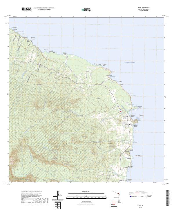
 2024 Kaupo2024 Print · USGSThe southern slopes of Maui come alive in this survey of the descent from the volcanic heights to the sea. Modern researchers can trace the historic Kaupo Trl through the Kaupo Gap or locate coastal settlements like Pōhakuloa and Mokulau.
 - 2024 Map of Makena, 2024 Print
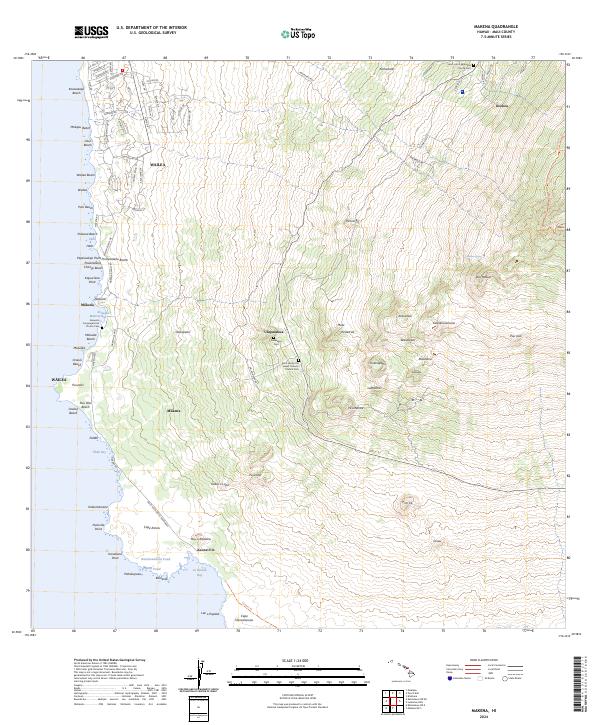 2024 Makena2024 Print · USGSCoastal Maui in the contemporary era reveals a mix of resort development and deep-rooted community history on the slopes of Haleakalā. Trace family sites at Keawala'i Congregational Church Cem or follow the coast to the lava fields of Cape Kina'u.
 - 2024 Map of Keanae, 2024 Print
 2024 Keanae2024 Print · USGSCoastal Maui's windward shore is shown in this modern survey, highlighting the historic taro-growing regions and remote coastal villages. Trace the locations of Keanae Congregational Church Cem, the Ke'anae Arboretum, and the dramatic cascades of Ha'ipua'ena Falls.
 - 2024 Map of Wailuku, 2024 Print
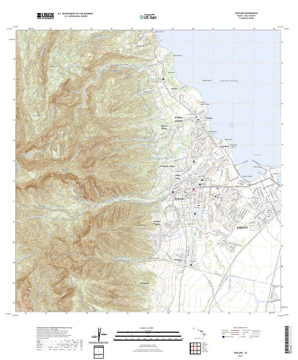 2024 Wailuku2024 Print · USGSCentral Maui comes into focus in the 2020s as the urban centers of Wailuku and Kahului expand toward the dramatic peaks of 'Īao Valley. Genealogists and historians can trace numerous local sites like the Kwong Fook Tong Chinese Cem and the Spreckels Ditch.
 - 2024 Map of Halawa, 2024 Print
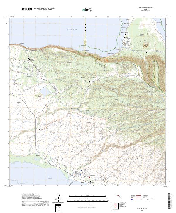
 2024 Halawa2024 Print · USGSThe eastern coast of Molokai is shown here in the 2020s, revealing a landscape of profound valleys and ancient settlement patterns. Genealogists and researchers can trace local family landmarks and coastal sites such as Pauwalu, Hānō, and the historic Halawa Valley.
 - 2024 Map of Kipahulu, 2024 Print
 2024 Kipahulu2024 Print · USGSThe windward Maui coast around Kipahulu is detailed here as it appears today, from the high wilderness to the sea. Researchers can locate significant sites like the Palapala Ho'omau Church Cem and landmarks such as the Pools of 'Ohe'o.
 - 2024 Map of Hana, 2024 Print
 2024 Hana2024 Print · USGSThis recent survey of Maui's eastern coast captures the remote settlement of Hana and its surrounding coastal landmarks. Researchers can trace local history through the Wanianalua Congregational Church Cem, Ka‘uiki Head, and the Hana District Courthouse.
 - 2024 Map of Molokai Airport OE S, 2024 Print
 2024 Molokai Airport OE S2024 Print · USGSCoastal waters south of Molokai are documented in this contemporary survey of the island's maritime surroundings. Researchers and maritime historians can trace the expanse of the Kalohi Channel as it meets the Pacific Ocean.
 - 2024 Map of Kaunakakai, 2024 Print
 2024 Kaunakakai2024 Print · USGSMolokai’s north and south shores are presented here, from the isolated Kalaupapa Peninsula to the coastal town of Kaunakakai. Genealogists can trace several burial grounds, including Homelani Cem and the Kalaupapa Settlement Cem.
 - 2024 Map of Molokai Airport, 2024 Print
 2024 Molokai Airport2024 Print · USGSThe central plains and coasts of Molokai are captured in this contemporary survey, showing the island's modern infrastructure and geography. Researchers can trace the layout of Kualapuu, locate Molokai Airport, and follow the deep ravines of Anahaki Gulch and Waiahewahewa Gulch.
 - 2024 Map of Ilio Point OE S, 2024 Print
 2024 Ilio Point OE S2024 Print · USGSCoastal waters north of Molokai are surveyed in this contemporary maritime study, capturing the open sea of Maui County. Genealogists and historians interested in modern offshore boundaries can trace the expanse of the Pacific Ocean in this offshore region.
 - 2024 Map of Molokai Airport OE N, 2024 Print
 2024 Molokai Airport OE N2024 Print · USGSThe coastal waters north of Molokai are captured in this modern maritime survey, highlighting the intersection of land and sea. Map collectors can trace the coastline at Ka'a as it meets the vast Pacific Ocean.
 - 2024 Map of Kaunakakai OE N, 2024 Print
 2024 Kaunakakai OE N2024 Print · USGSThe northern tip of Molokai meets the Pacific in the modern era, showing the protected lands of Kalaupapa National Historical Park. Researchers can locate specialized coastal infrastructure like the Kalaupapa Airport and landforms such as Kahi'u Point.
 - 2024 Map of Ilio Point OE N, 2024 Print
 2024 Ilio Point OE N2024 Print · USGSThe northwestern tip of Moloka'i is documented here at the edge of the Kaiwi Channel during the early twenty-first century. Researchers can trace coastal landmarks and traditional place names including 'Īlio Point, Kawākiu Gulch, and the remote Mokio Point.
 - 2024 Map of Ilio Point, 2024 Print
 2024 Ilio Point2024 Print · USGSThe western reaches of Moloka'i come into focus in the mid-2020s, showing the intersection of coastal ranching lands and residential outposts. Researchers can trace the layout of Maunaloa and find local landmarks such as Panda Airport and the Maunaloa Cem.
 - 2024 Map of Halawa OE S, 2024 Print
 2024 Halawa OE S2024 Print · USGSThe south-eastern coast of Maui is captured here during the twenty-first century, showcasing the island's unique aquaculture history. Researchers can trace the layout of traditional shoreline structures such as Ni'aupala Fishpond and find coastal landmarks like Puko'o Harbor.
 - 2024 Map of Lahaina, 2024 Print
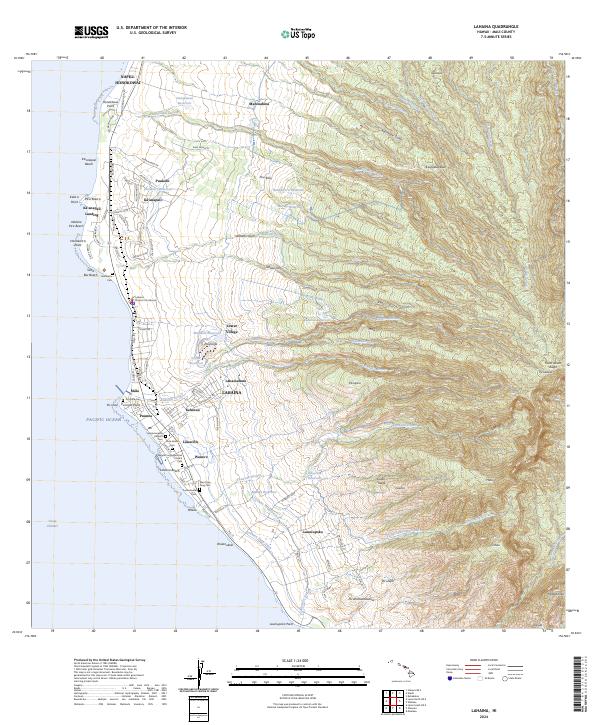 2024 Lahaina2024 Print · USGSThe West Maui coast comes into focus in this contemporary survey, showing the transition from the bustling streets of Lahaina to the high slopes of Puukukui. Genealogists can trace family heritage through local sites like Hale Aloha Cem and Lahainaluna.
 - 2024 Map of Kahoolawe OE E, 2024 Print
 2024 Kahoolawe OE E2024 Print · USGSThe eastern shores of Kaho'olawe are captured here in the early twenty-first century, showing a landscape defined by volcanic peaks and coastal points. Researchers can trace the rugged geography of Kanapou Bay and high points like Pu'u 'O Moa'ula Nui.
 - 2024 Map of Olowalu, 2024 Print
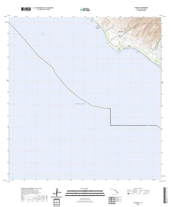 2024 Olowalu2024 Print · USGSCoastal West Maui is documented here in the early twenty-first century, showing the intersection of mountain watersheds and seaside settlements. Trace the vital water systems of the Olowalu Ditch or locate family-named coastal landmarks like Hekili Point and Kailiili.
 - 2024 Map of Lualailua Hills, 2024 Print
 2024 Lualailua Hills2024 Print · USGSThe leeward volcanic slopes of Maui are captured here in the mid-2020s, ranging from the high craters to the Pacific shore. Researchers can trace the rugged geography of Haleakalā National Park and remote coastal markers like Nakaohu Point and Kipapa.
 - 2024 Map of Haiku, 2024 Print
 2024 Haiku2024 Print · USGSMaui's northern coastline and Upcountry region are shown here in modern detail, highlighting the area's agricultural and maritime heritage. Researchers can trace historic family locations near Pauwela Hongwanji Cem, the Lowrie Ditch water system, and coastal settlements like Huelo and Kailua.
 - 2024 Map of Maalaea, 2024 Print
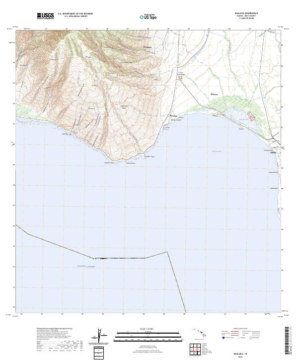 2024 Maalaea2024 Print · USGSModern Maui comes into focus in this recent survey of the island's central isthmus and southwestern slopes. Researchers can trace coastal development near Kihei and Mā‘alaea or explore the protected wetlands of the Keālia Pond National Wildlife Refuge.
Showing maps 1-25 of 42
Top cities of Maui County
- Kahului historical maps
- Wailuku historical maps
- Lahaina historical maps
- Pukalani historical maps
- Kaunakakai historical maps
- Lanai City historical maps
See more
Frequently asked questions
- What are the different types of historical maps available for Maui County?
- What is the oldest map of Maui County?
- Where can I purchase historical maps of Maui County for my home or office?
- Where can I download high-res historical maps of Maui County?
- Are there historical topographic maps available for Maui County?
- Is there historical aerial imagery available for Maui County?
- Where are historical maps of Maui County sourced from?